MyTopo
Cedar Bluff Mississippi US Topo Map
Couldn't load pickup availability
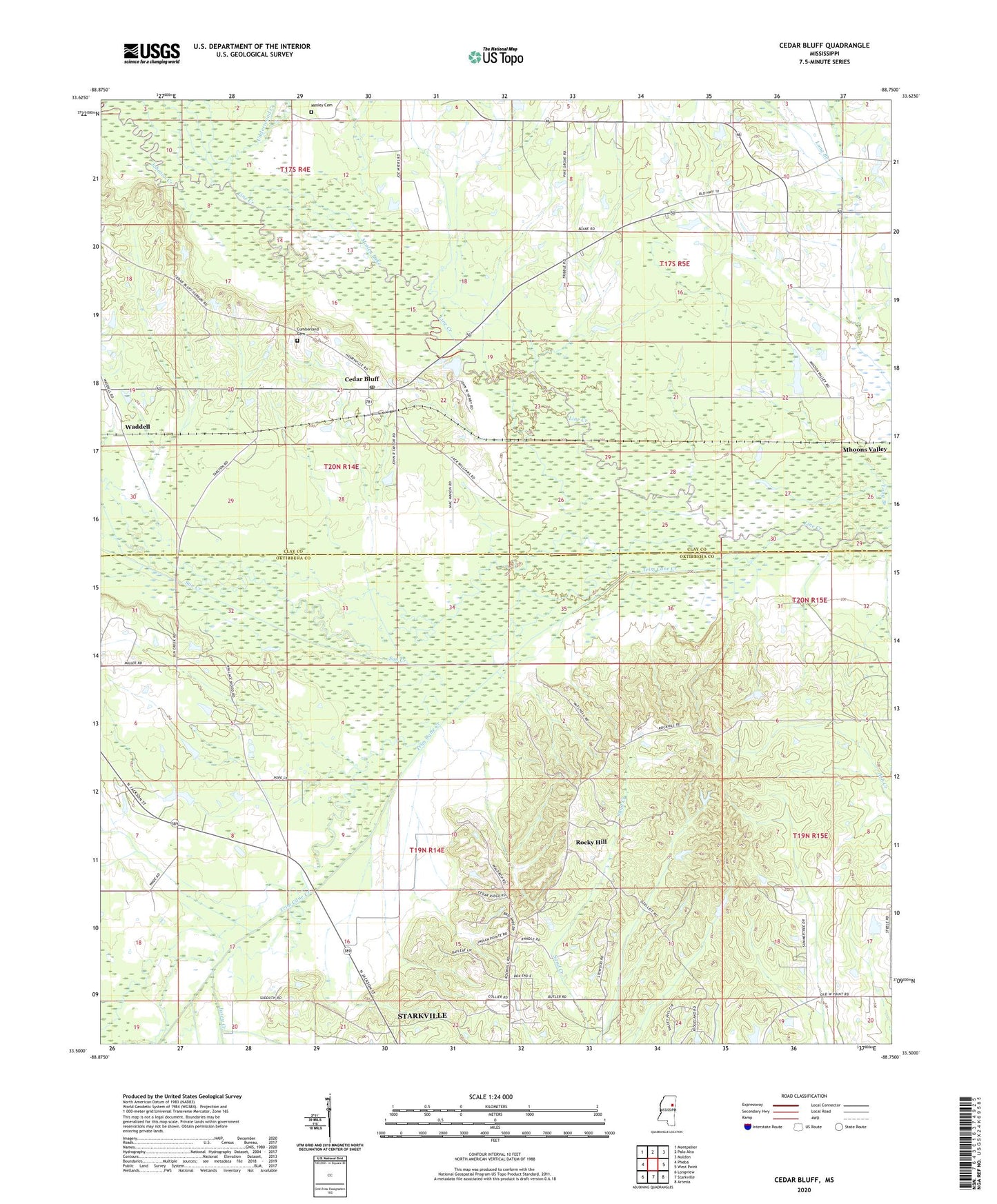
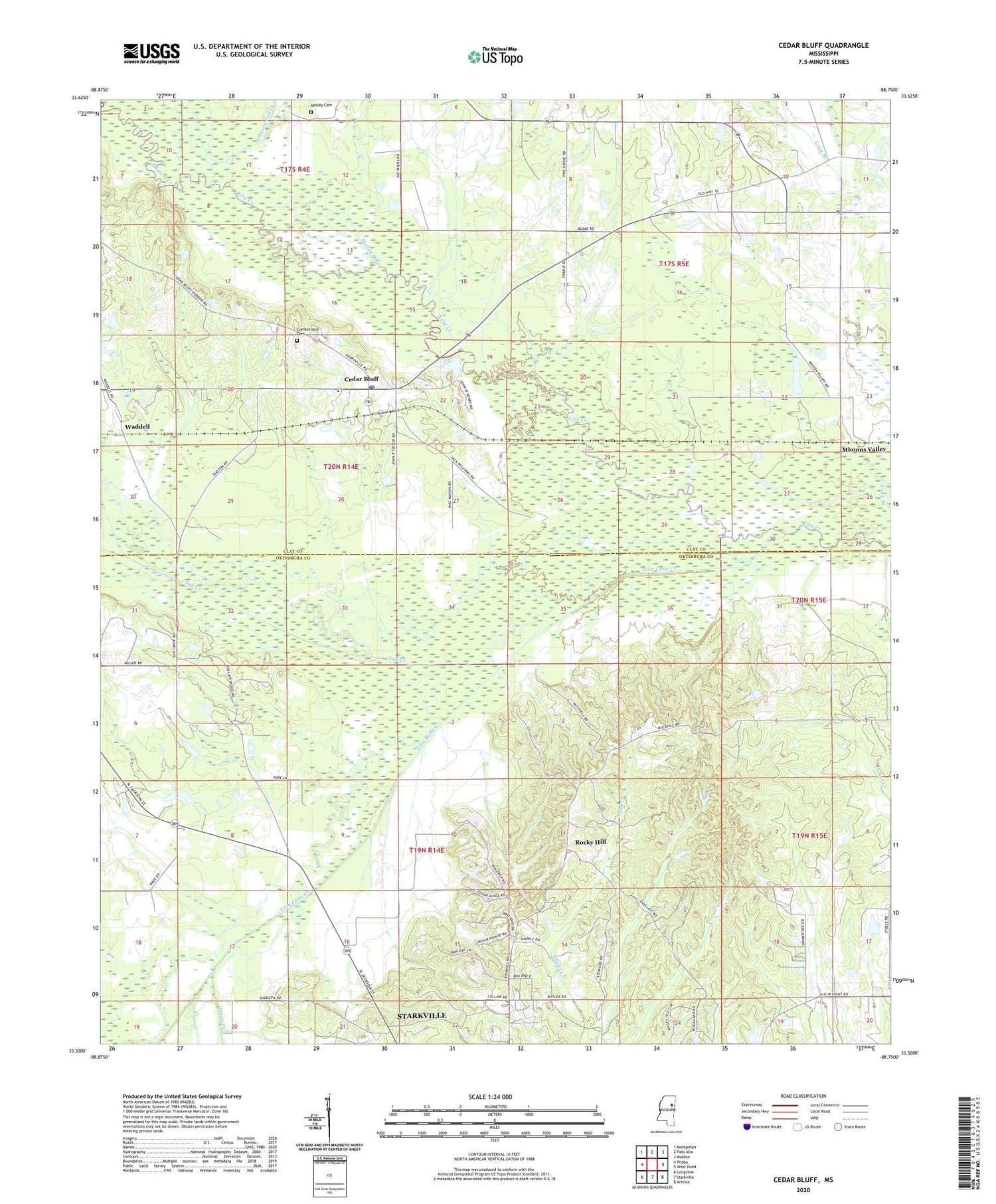
2024 topographic map quadrangle Cedar Bluff in the state of Mississippi. Scale: 1:24000. Based on the newly updated USGS 7.5' US Topo map series, this map is in the following counties: Oktibbeha, Clay. The map contains contour data, water features, and other items you are used to seeing on USGS maps, but also has updated roads and other features. This is the next generation of topographic maps. Printed on high-quality waterproof paper with UV fade-resistant inks.
Quads adjacent to this one:
West: Pheba
Northwest: Montpelier
North: Palo Alto
Northeast: Muldon
East: West Point
Southeast: Artesia
South: Starkville
Southwest: Longview
This map covers the same area as the classic USGS quad with code o33088e7.
Contains the following named places: Bock Lake Dam, Bridges Mill, Camp Seminole, Cedar Bluff, Cedar Bluff Baptist Church, Cedar Bluff Methodist Church, Cedarbluff Post Office, Cumberland Cemetery, Deans Lake, Hawkins Lake Dam, Henderson Lake Dam, Jennings Lake Dam, Josey Creek, Mhoons Farm School, Mhoons Valley, Mosley Cemetery, Mosley Lake, Plair United Methodist Church, Plairs, Portera Lake Dam, Rock Hill School, Rockhill United Methodist Church, Rocky Hill, Saint Paul Baptist Church, Sand Creek Chapel Missionary Baptist Church, Stacy Lake Dam, Sun Creek, Trim Cane Creek, Underwood Creek, Waddell