MyTopo
Moscow Mississippi US Topo Map
Couldn't load pickup availability
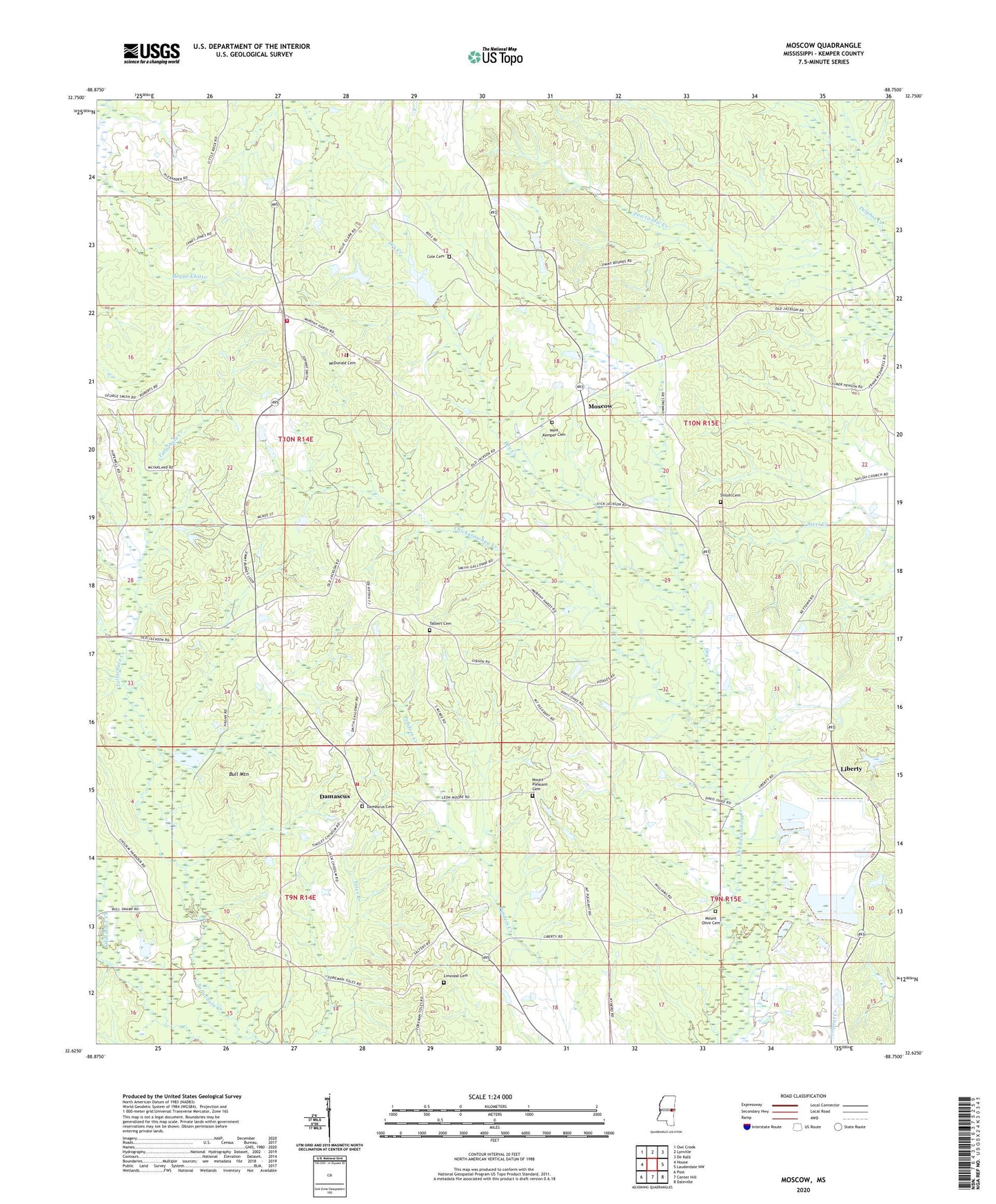
2020 topographic map quadrangle Moscow in the state of Mississippi. Scale: 1:24000. Based on the newly updated USGS 7.5' US Topo map series, this map is in the following counties: Kemper. The map contains contour data, water features, and other items you are used to seeing on USGS maps, but also has updated roads and other features. This is the next generation of topographic maps. Printed on high-quality waterproof paper with UV fade-resistant inks.
Quads adjacent to this one:
West: House
Northwest: Owl Creek
North: Lynville
Northeast: De Kalb
East: Lauderdale NW
Southeast: Daleville
South: Center Hill
Southwest: Post
Contains the following named places: A A Hopper Pond Dam, Big Oak Church, Bull Mountain, Cedar Grove Church, Cole Cemetery, Corinth Church, Damascus, Damascus Cemetery, Damascus Volunteer Fire Department, Darnall, Dry Creek, East Coongetto, Hugh Thomasson Lake Dam, Kemper County Volunteer Fire District 3 Station, Lester May Lake Dam, Liberty, Liberty Church, Linwood Cemetery, Little Rock School, McDonald Cemetery, Moscow, Moscow Recreational Vehicle Park, Mount Olive Cemetery, Mount Pleasant Cemetery, Mount Pleasant Church, Mount Zion Church, Persimmon Ridge Church, Shiloh Cemetery, Shiloh Church, Supervisor District 3, Talbert Cemetery, Unity Springs Church, West Kemper Baptist Church, West Kemper Cemetery