MyTopo
Lauderdale NW Mississippi US Topo Map
Couldn't load pickup availability
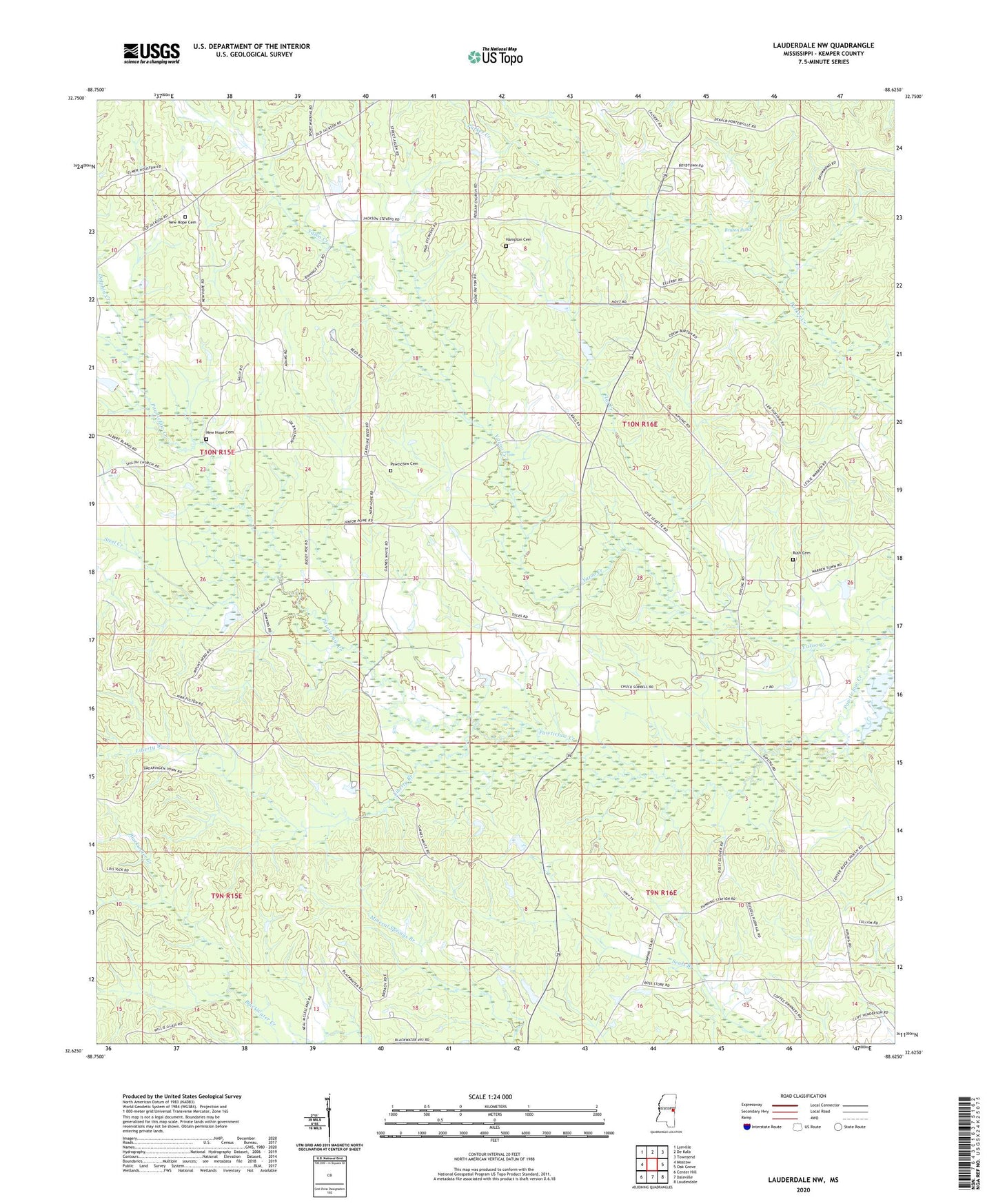
2024 topographic map quadrangle Lauderdale NW in the state of Mississippi. Scale: 1:24000. Based on the newly updated USGS 7.5' US Topo map series, this map is in the following counties: Kemper. The map contains contour data, water features, and other items you are used to seeing on USGS maps, but also has updated roads and other features. This is the next generation of topographic maps. Printed on high-quality waterproof paper with UV fade-resistant inks.
Quads adjacent to this one:
West: Moscow
Northwest: Lynville
North: De Kalb
Northeast: Townsend
East: Oak Grove
Southeast: Lauderdale
South: Daleville
Southwest: Center Hill
This map covers the same area as the classic USGS quad with code o32088f6.
Contains the following named places: Ayanabi, Beulah Church, Brown Ridge Church, Bruton Pond, Church of God, Delphia Creek, East Yazo Skatane, Flat Creek, H C Jenkins Pond Dam, Haanka Ullah, Hampton Cemetery, James Barnhanm Pond Dam, Kipling, Liberty Branch, Mount Nebo, New Hope Cemetery, New Hope Church, Pawticfaw Baptist Church, Pawticfaw Cemetery, Pleasant Ridge Church, Rush Cemetery, Steel Creek, Supervisor District 5, Yazoo Creek, ZIP Code: 39328