MyTopo
Daleville Mississippi US Topo Map
Couldn't load pickup availability
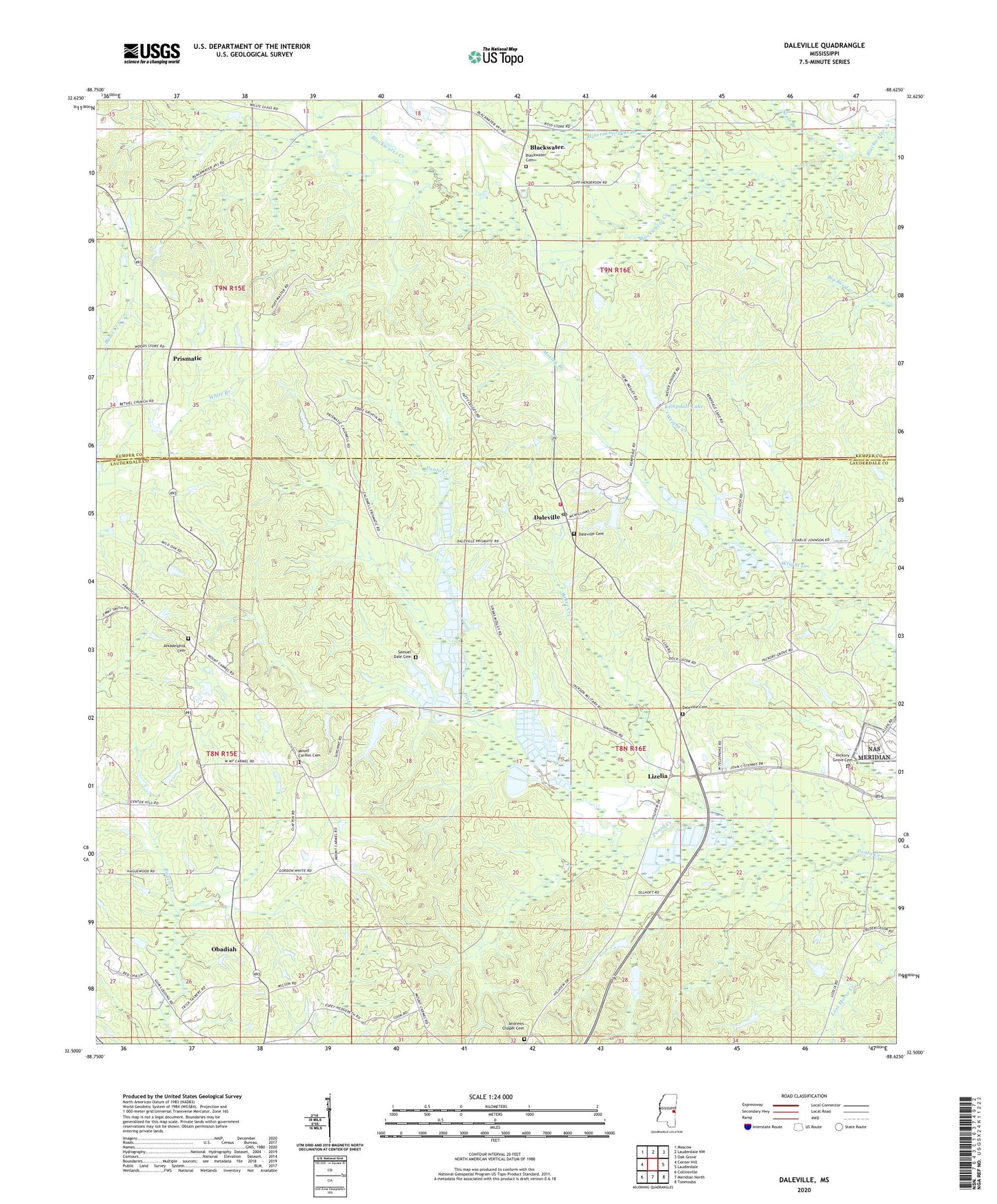
2024 topographic map quadrangle Daleville in the state of Mississippi. Scale: 1:24000. Based on the newly updated USGS 7.5' US Topo map series, this map is in the following counties: Lauderdale, Kemper. The map contains contour data, water features, and other items you are used to seeing on USGS maps, but also has updated roads and other features. This is the next generation of topographic maps. Printed on high-quality waterproof paper with UV fade-resistant inks.
Quads adjacent to this one:
West: Center Hill
Northwest: Moscow
North: Lauderdale NW
Northeast: Oak Grove
East: Lauderdale
Southeast: Toomsuba
South: Meridian North
Southwest: Collinsville
This map covers the same area as the classic USGS quad with code o32088e6.
Contains the following named places: A C Munn Pond Dam, Andrew Chapel United Methodist Church Cemetery, Andrews Chapel, Antioch Church, Arkadelphia Cemetery, Arkadelphia Church, Bailey Church, Baker Creek, Bethel Church, Bill Daniels Catfish Ponds Dam, Blackwater, Blackwater Baptist Church, Blackwater Cemetery, Chomontakali, Cliff Walker Pond Dam, Coosha, Cotes Mill, Covington Fish Ponds Dam, Daleville, Daleville Cemetery, Daleville Methodist Church, Daleville Post Office, Doctor Dawson Pond Dam, Doctor L Rush Lake Dam, E H Motley Junior Lake Dam, Ebenezer Church, Hickory Grove Baptist Church, Hickory Grove Baptist Church Cemetery, Kempdale Lake, Kempdale Lake Dam, Lizelia, Mineral Springs Branch, Mosley Branch, Mount Carmel Cemetery, Mount Carmel Church, Obadiah, Prismatic, R N McElroy Pond Dam, Sam Dale Volunteer Fire Department and Rescue, Samuel Dale Cemetery, Seals Branch, Tabernacle Church, Temple Pond Dam, White Oak Church, Whites Store, ZIP Codes: 39320, 39326