MyTopo
Woodville Mississippi US Topo Map
Couldn't load pickup availability
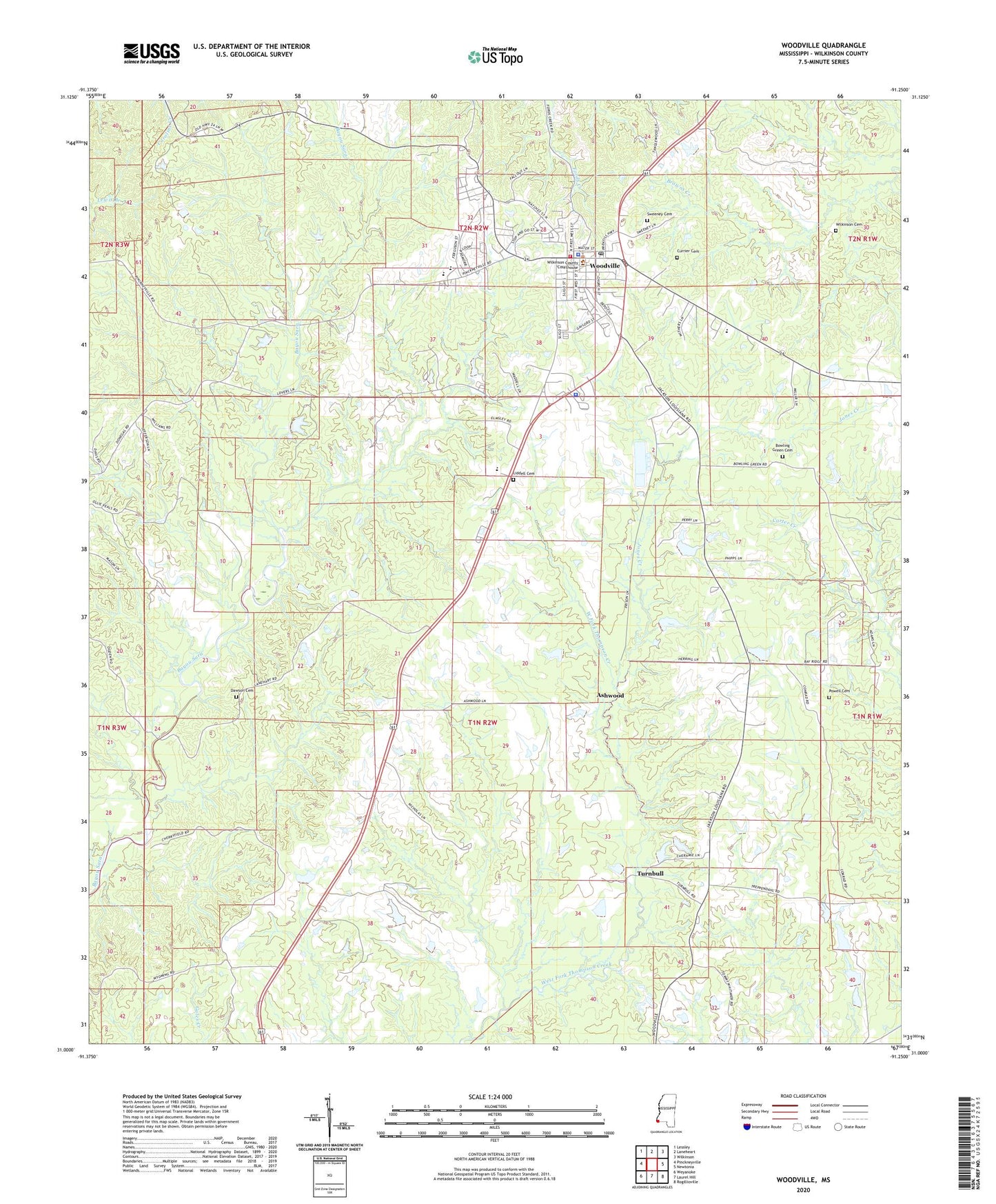
2024 topographic map quadrangle Woodville in the state of Mississippi. Scale: 1:24000. Based on the newly updated USGS 7.5' US Topo map series, this map is in the following counties: Wilkinson. The map contains contour data, water features, and other items you are used to seeing on USGS maps, but also has updated roads and other features. This is the next generation of topographic maps. Printed on high-quality waterproof paper with UV fade-resistant inks.
Quads adjacent to this one:
West: Pinckneyville
Northwest: Lessley
North: Laneheart
Northeast: Wilkinson
East: Newtonia
Southeast: Rogillioville
South: Laurel Hill
Southwest: Weyanoke
This map covers the same area as the classic USGS quad with code o31091a3.
Contains the following named places: Angola School, Ashwood, Ashwood Church, Bay Ridge School, Beach Grove Church, Bowling Green Cemetery, Currier Cemetery, Dawson Cemetery, Deer Park School, James A Ventress Lake Dam, John C Hughes Lake Dam, Jones Creek, Liddell Cemetery, Magnolia School, Powell Cemetery, Saint John Church, Saint Luke School Number 2, Saint Peters Church, Sweeney Cemetery, Town of Woodville, Turnbull, Wilkinson Cemetery, Wilkinson County Elementary School, Wilkinson County High School, Wilkinson County Sheriff's Office, Woodville, Woodville Attendance Center, Woodville Police Department, Woodville Post Office, Woodville Volunteer Fire Department