MyTopo
Aurora Missouri US Topo Map
Couldn't load pickup availability
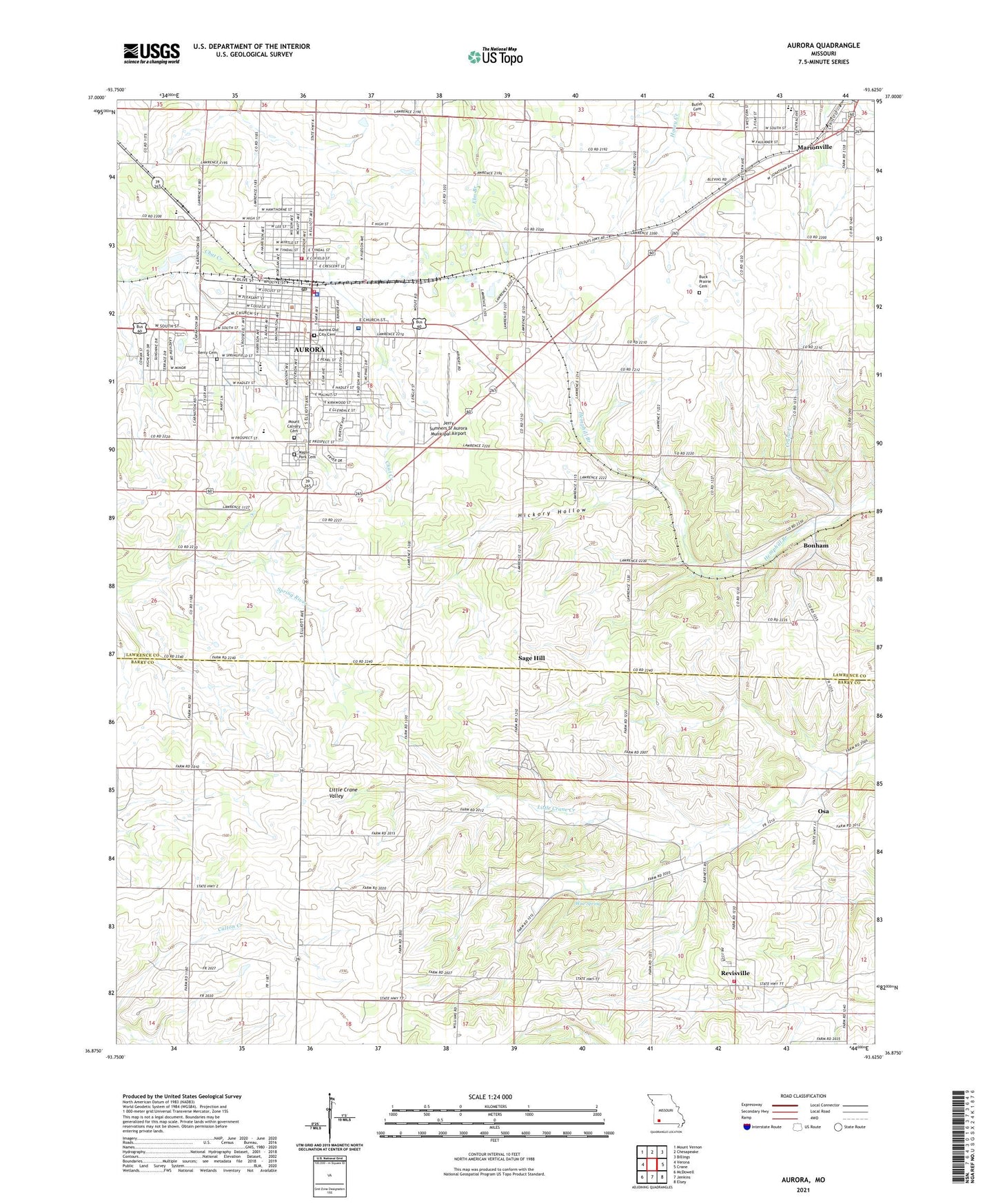
2021 topographic map quadrangle Aurora in the state of Missouri. Scale: 1:24000. Based on the newly updated USGS 7.5' US Topo map series, this map is in the following counties: Lawrence, Barry. The map contains contour data, water features, and other items you are used to seeing on USGS maps, but also has updated roads and other features. This is the next generation of topographic maps. Printed on high-quality waterproof paper with UV fade-resistant inks.
Quads adjacent to this one:
West: Verona
Northwest: Mount Vernon
North: Chesapeake
Northeast: Billings
East: Crane
Southeast: Elsey
South: Jenkins
Southwest: McDowell
Contains the following named places: Aurora, Aurora Fire Department Station 1, Aurora Fire Department Station 2, Aurora High School, Aurora Junior High School, Aurora Police Department, Aurora Post Office, Aurora Rural Fire Department Station 1, Baldwin Park, Bonham, Browns School, Buck Prairie Cemetery, Buck Prairie Church, City of Aurora, Clay Hill Church, Consolidated High School Number One, Crosby Park, East Fork Jenkins Creek, Eureka School, Hemphill Branch, Hickory Grove School, Hickory Hollow, Jerry Sumners Sr Aurora Municipal Airport, KELE-FM (Aurora), KSWM-AM (Aurora), Liberty School, Lone Star School, Lowell School, Maple Park Cemetery, Marionville Elementary School, Marionville Middle School, Mars Hill School, Mercy Hospital Aurora, Mineral Point School, Mount Calvary Cemetery, North Stone Northeast Barry County Fire District Station 24, Oak Park, Osa, Osa Church, Osa School, Pate Early Childhood Center, Revisville, Robinson Elementary School, Robinson Intermediate School, Sage Hill, Sunset Drive-In, Talmage Community Church, Township of Aurora, Township of Buck Prairie, Township of Ozark, Union Grove Church, White Oak Church, White Oak School, White Park, Wise Spring