MyTopo
Bayouville Missouri US Topo Map
Couldn't load pickup availability
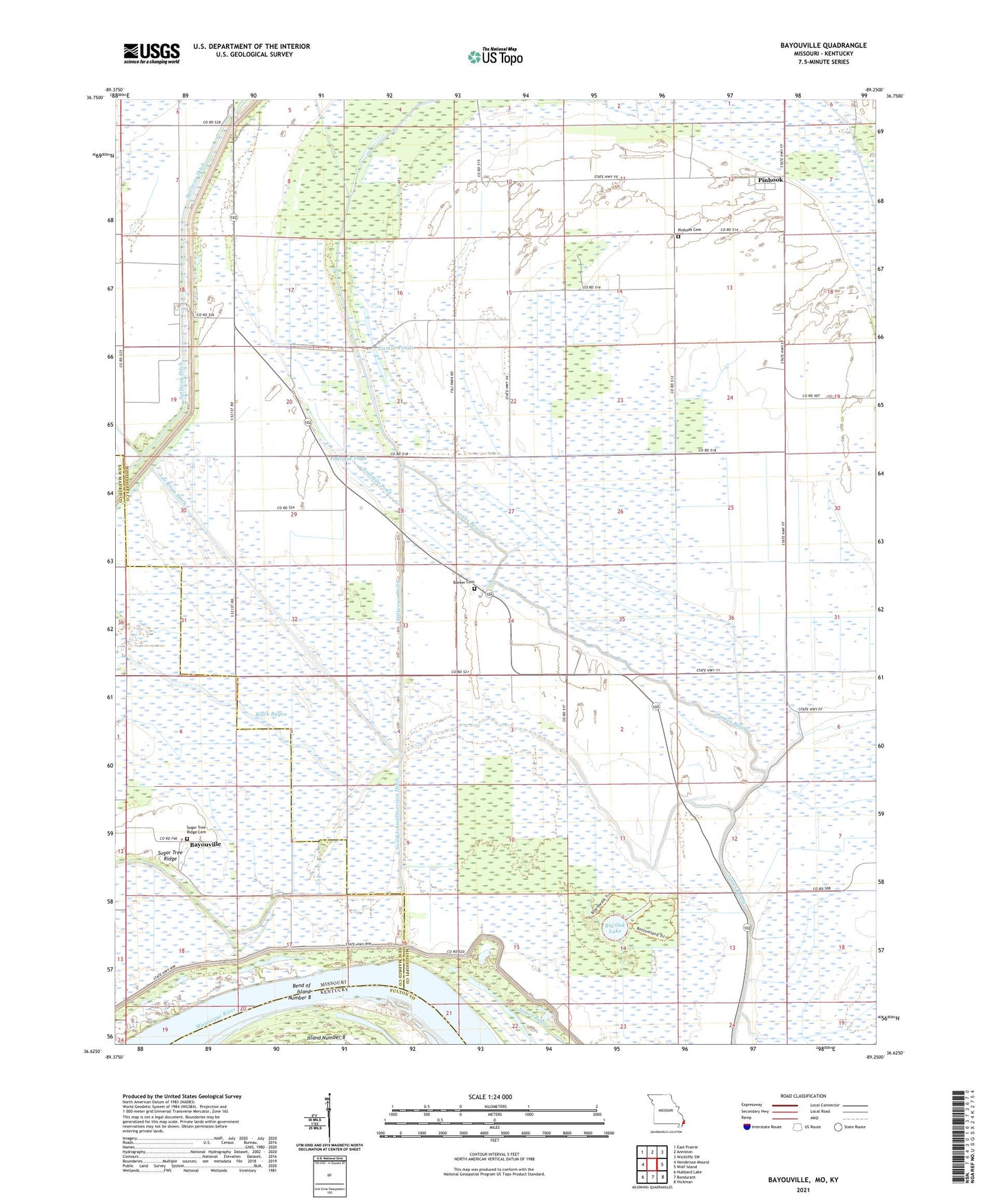
2021 topographic map quadrangle Bayouville in the state of Missouri. Scale: 1:24000. Based on the newly updated USGS 7.5' US Topo map series, this map is in the following counties: Mississippi, New Madrid, Fulton. The map contains contour data, water features, and other items you are used to seeing on USGS maps, but also has updated roads and other features. This is the next generation of topographic maps. Printed on high-quality waterproof paper with UV fade-resistant inks.
Quads adjacent to this one:
West: Henderson Mound
Northwest: East Prairie
North: Anniston
Northeast: Wickliffe SW
East: Wolf Island
Southeast: Hickman
South: Bondurant
Southwest: Hubbard Lake
This map covers the same area as the classic USGS quad with code o36089f3.
Contains the following named places: Barker Cemetery, Bayouville, Bend of Island Number Eight Revetment, Big Muskrat Pond, Big Oak Lake, Big Oak Lake Dam, Big Oak Tree State Park, Birds Point New Madrid Levee, Black Bayou, Boston Cemetery, Cooley Cemetery, Dry Bayou Landing, Eagle Lake, Fourmile Pond, Grassy Pond, James Bayou, Lee Rowe Ditch, Mound School, Mounds Church, Mount Eria Church, New Hope Church, Pinhook, Pinhook Church, Pinhook School, Saint Johns Diversion Ditch, Sixmile Ponds, Spillway Ditch, Sugar Tree Ridge, Sugar Tree Ridge Cemetery, Sugar Tree Ridge School, Tenmile Pond, Three States Landing, Township of James Bayou, Township of Wolf Island, Village of Pinhook, Wilkerson Ditch, Windyville School, ZIP Code: 63845