MyTopo
Hubbard Lake Missouri US Topo Map
Couldn't load pickup availability
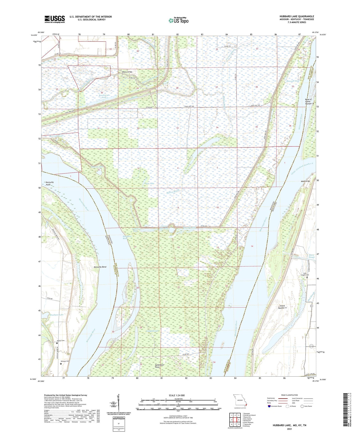
2021 topographic map quadrangle Hubbard Lake in the states of Missouri, Kentucky. Scale: 1:24000. Based on the newly updated USGS 7.5' US Topo map series, this map is in the following counties: New Madrid, Fulton, Lake. The map contains contour data, water features, and other items you are used to seeing on USGS maps, but also has updated roads and other features. This is the next generation of topographic maps. Printed on high-quality waterproof paper with UV fade-resistant inks.
Quads adjacent to this one:
West: New Madrid
Northwest: Kewanee
North: Henderson Mound
Northeast: Bayouville
East: Bondurant
Southeast: Samburg
South: Tiptonville
Southwest: Point Pleasant
Contains the following named places: Adams Cemetery, Ash Log, Bowman Hole, Chute of Island Number 8, Conran Dike, Conran Dike Hole, Cooper Landing, Cutoff Slough, Dawson Hole, Elbow Slough, Fish Lake, Hancock Hole, Harris Light, Henderson Landing, Higgerson School, Hotchkiss Bend, Hotchkiss Landing, Hubbard Lake, Island Number 9, Kelly Landing, Kentucky Bend, Kentucky Point, Knotts Bridge, La Forge Landing, La Forge Revetment, Lake Number 9, Lester Landing, Mable Landing, Madrid Bar, Madrid Bend Church, Morrison Hole, Morrison Landing, Mud Ditch, New Madrid Farrenburg Levee, Newsom Landing, Ransburgh Hole, Riley Lake, Round Hole, Spies Landing, Stonewall Lake, Stump Hole, T Louis Bayou, Township of Saint John, Tressle Hole, Washpan Lake, Whitson Cemetery, Wilson Bayou, ZIP Code: 63869