MyTopo
Beach Missouri US Topo Map
Couldn't load pickup availability
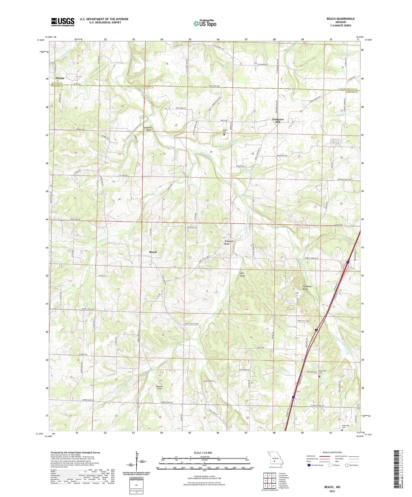
2021 topographic map quadrangle Beach in the state of Missouri. Scale: 1:24000. Based on the newly updated USGS 7.5' US Topo map series, this map is in the following counties: Webster, Dallas. The map contains contour data, water features, and other items you are used to seeing on USGS maps, but also has updated roads and other features. This is the next generation of topographic maps. Printed on high-quality waterproof paper with UV fade-resistant inks.
Quads adjacent to this one:
West: Elkland
Northwest: Charity
North: Long Lane
Northeast: Phillipsburg
East: Niangua
Southeast: High Prairie
South: Marshfield
Southwest: Strafford
Contains the following named places: Antioch Church, Beach, Beckner Field, Bethel Church, Callaway Bluff, Dermott, East Fork Niangua River, Forkners Hill, Full Gospel Church, Givins Branch, Goose Creek, Graves School, Greer Creek, Hagan Branch, Hawk Pond Branch, Haymes Chapel, Hollis Branch, Independence School, Jameson Bluff, Jameson School, Marlin Branch, Marlin Cemetery, Marlin School, McElwain Cemetery, Mill Bluff, Miller School, Mission Home Church, Pack School, Plank School, Saint Luke, Saint Luke Church, Saint Luke School, Saint Paul Lutheran Cemetery, Sand Spring School, Sarah Branch, Shady Grove Church, Shady Grove School, Sparkle Brook School, Thompson Bluff, Thorpe, Township of Washington, Warden Chapel, West Fork Niangua River