MyTopo
Charity Missouri US Topo Map
Couldn't load pickup availability
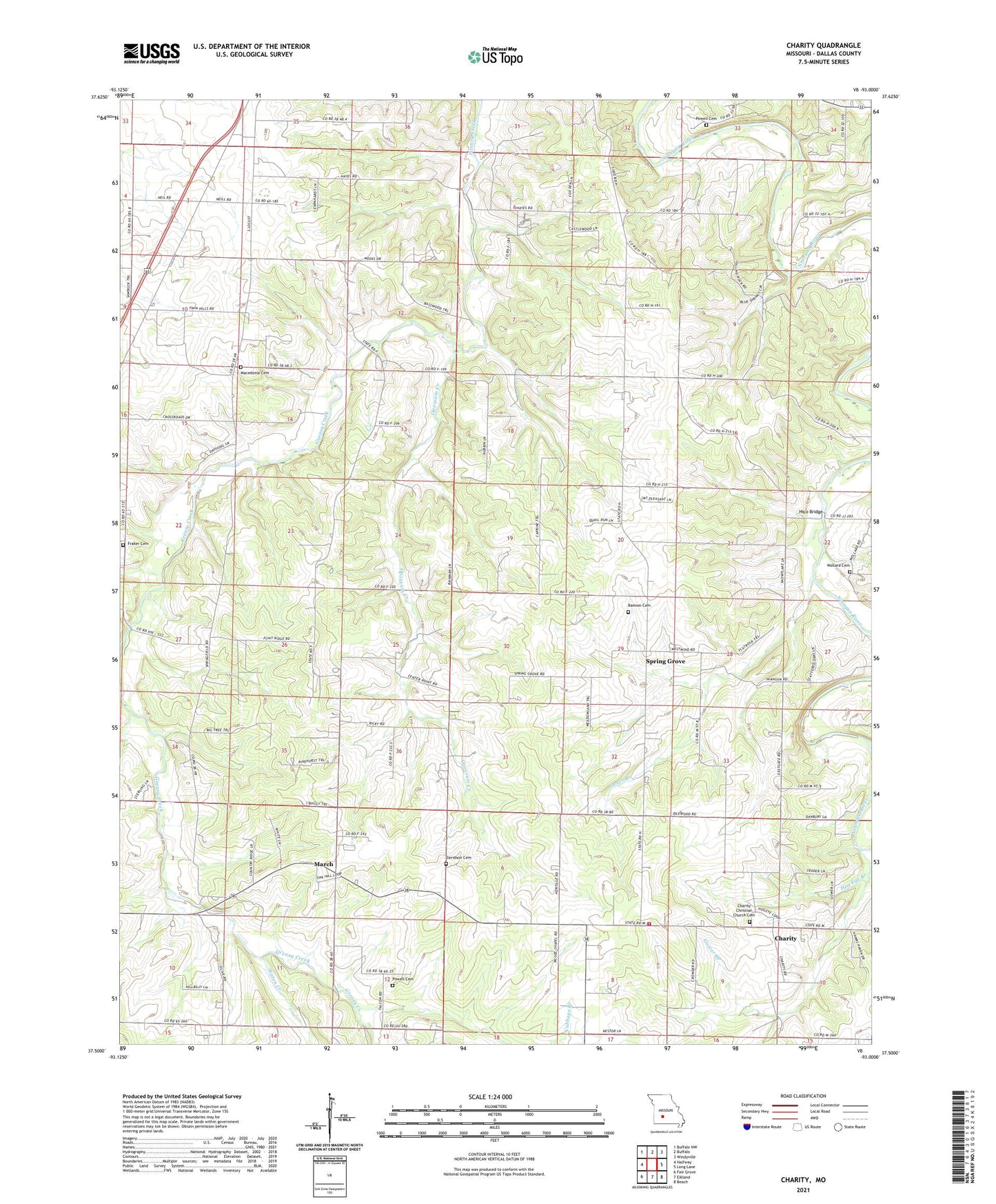
2021 topographic map quadrangle Charity in the state of Missouri. Scale: 1:24000. Based on the newly updated USGS 7.5' US Topo map series, this map is in the following counties: Dallas. The map contains contour data, water features, and other items you are used to seeing on USGS maps, but also has updated roads and other features. This is the next generation of topographic maps. Printed on high-quality waterproof paper with UV fade-resistant inks.
Quads adjacent to this one:
West: Halfway
Northwest: Buffalo NW
North: Buffalo
Northeast: Windyville
East: Long Lane
Southeast: Beach
South: Elkland
Southwest: Fair Grove
This map covers the same area as the classic USGS quad with code o37093e1.
Contains the following named places: Bannon Cemetery, Boyd, Buffalo Branch, Buffalo Rural Fire Department Station 2, Cabbage Branch, Center Point Church, Charity, Charity Christian Church Cemetery, Charity School, Davidson Cemetery, Flint Ridge School, Fraker Cemetery, Gower Branch, Hankens Branch, Hico, Hico Bridge, Hog Eye Branch, Jones Branch, Lauries Landing Airport, Macedonia Cemetery, Macedonia Church, Macedonia School, March, March School, McGee Chapel, Mount Harmon School, Mount Pleasant Church Number 1, Mount Pleasant Church Number 2, Olive Leaf School, Opossum Creek, Powell Cemetery, Spring Grove, Staten Creek, Township of Jackson, Township of South Benton, Wollard Cemetery, ZIP Code: 65644