MyTopo
Strafford Missouri US Topo Map
Couldn't load pickup availability
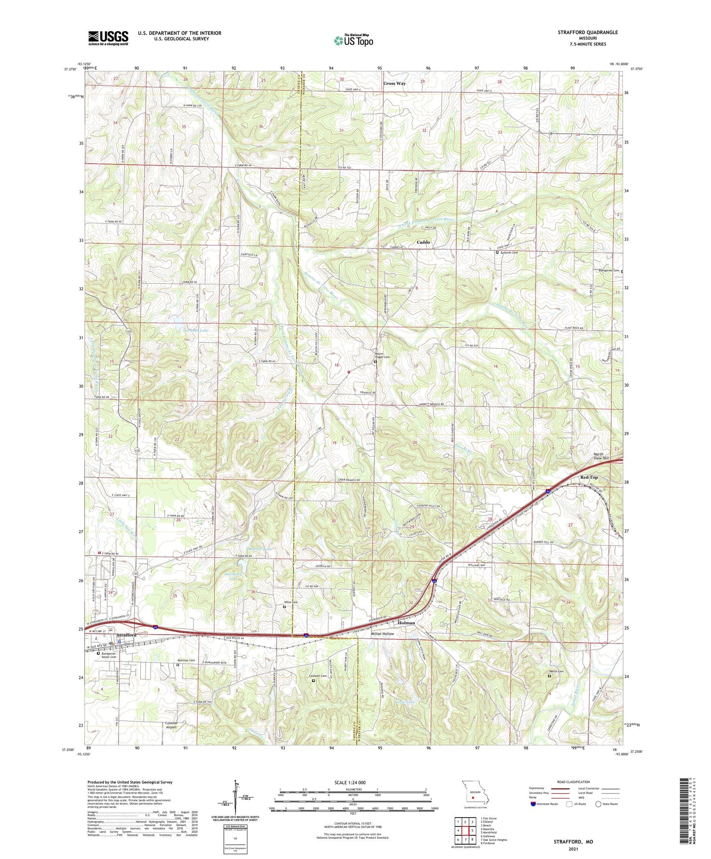
2021 topographic map quadrangle Strafford in the state of Missouri. Scale: 1:24000. Based on the newly updated USGS 7.5' US Topo map series, this map is in the following counties: Webster, Greene. The map contains contour data, water features, and other items you are used to seeing on USGS maps, but also has updated roads and other features. This is the next generation of topographic maps. Printed on high-quality waterproof paper with UV fade-resistant inks.
Quads adjacent to this one:
West: Bassville
Northwest: Fair Grove
North: Elkland
Northeast: Beach
East: Marshfield
Southeast: Fordland
South: Oak Grove Heights
Southwest: Galloway
This map covers the same area as the classic USGS quad with code o37093c1.
Contains the following named places: Bodenhammer School, Bumgarner Cemetery, Caddo, Caldwell Cemetery, Circle Lake Dam, City of Strafford, Cross Way, Elk Lake Dam, Epworth Church, Fellowship Church, Goss School, Great Bear Lake Dam, Grier Branch, Happy Hollow Camp, Hardeke Lake, Hardeke Lake Dam, Hilliard Estates Lake, Hilliard Estates Lake Dam, Holman, Holman School, Jarrett Branch, Jones Lake, KTOZ-FM (Marshfield), Lake Ralph Foster Dam, Locust Prairie Community Center, Locust Prairie School, Lost Lake Dam, Mount Calvary Church, Mount Pisgah Church, Mueller Lake, Mueller Lake Dam, Mullinax Cemetery, North Carolina Creek, North Fork Pomme de Terre River, North View Hill, Polk Spring Branch, Red Top, Salisbury Lake, Salisbury Lake Dam, South Fork Pomme de Terre River, Strafford, Strafford Fire Protection District Station 1, Strafford Fire Protection District Station 3, Strafford Fire Protection District Station 4, Strafford Police Department, Strafford Post Office, Township of Grant, Township of Jackson Number 2, Welch Cemetery, Willis Cemetery, ZIP Code: 65757