MyTopo
Elkland Missouri US Topo Map
Couldn't load pickup availability
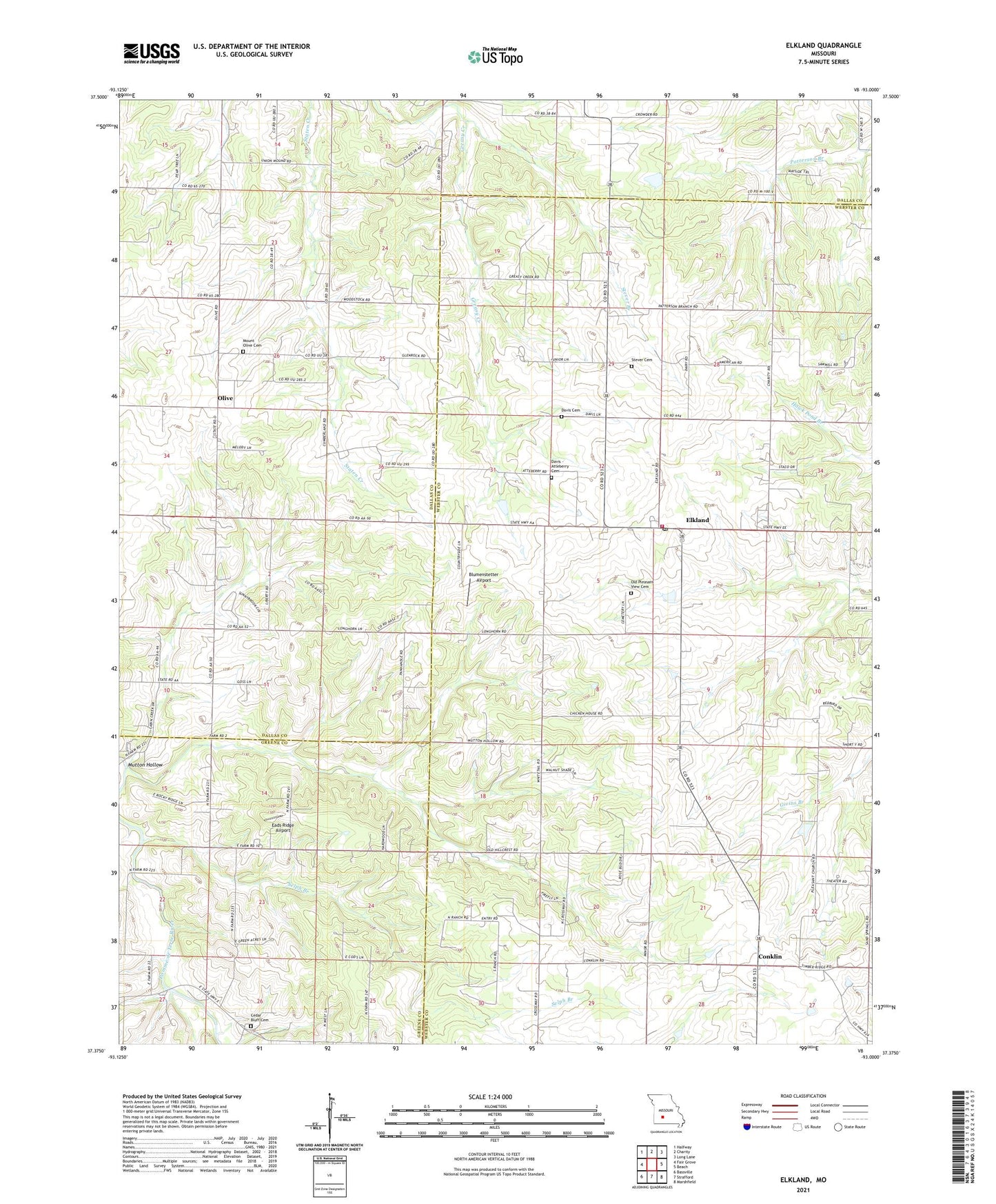
2021 topographic map quadrangle Elkland in the state of Missouri. Scale: 1:24000. Based on the newly updated USGS 7.5' US Topo map series, this map is in the following counties: Webster, Dallas, Greene. The map contains contour data, water features, and other items you are used to seeing on USGS maps, but also has updated roads and other features. This is the next generation of topographic maps. Printed on high-quality waterproof paper with UV fade-resistant inks.
Quads adjacent to this one:
West: Fair Grove
Northwest: Halfway
North: Charity
Northeast: Long Lane
East: Beach
Southeast: Marshfield
South: Strafford
Southwest: Bassville
This map covers the same area as the classic USGS quad with code o37093d1.
Contains the following named places: Blumenstetter Airport, Cedar Bluff Church, Conklin, Davis - Atteberry Cemetery, Davis Cemetery, Dugan Dam, Eads Ridge Airport, Elkland, Elkland Fire Protection District, Elkland Post Office, Elkland School, Free Will Chapel, Hannon Lake Dam, Minor School, Mission Chapel, Mount Olive Cemetery, Mount Olive Church, Mutton Hollow, Old Goss School, Old Pleasant View Cemetery, Olive, Olive School, Pleasant Ridge Church, Pleasant View Church, Selph Branch, Stever Branch, Stever Cemetery, Timber Ridge Church, Township of Jackson, Union Mound Church