MyTopo
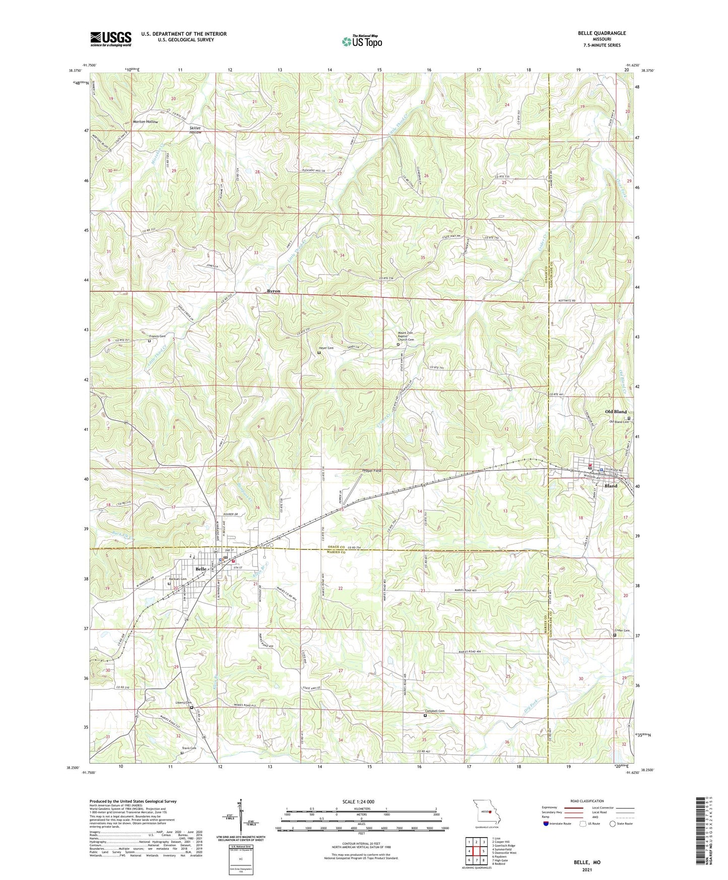
Belle Missouri US Topo Map
Couldn't load pickup availability
2021 topographic map quadrangle Belle in the state of Missouri. Scale: 1:24000. Based on the newly updated USGS 7.5' US Topo map series, this map is in the following counties: Osage, Maries, Gasconade. The map contains contour data, water features, and other items you are used to seeing on USGS maps, but also has updated roads and other features. This is the next generation of topographic maps. Printed on high-quality waterproof paper with UV fade-resistant inks.
Quads adjacent to this one:
West: Summerfield
Northwest: Linn
North: Cooper Hill
Northeast: Goerlisch Ridge
East: Owensville West
Southeast: Redbird
South: High Gate
Southwest: Paydown
Contains the following named places: Adkins School, Belle, Belle Police Department, Belle Volunteer Fire Department, Beulah Church, Bland, Bland Police Department, Bland Post Office, Bland Volunteer Fire Department Station 1, Bumpass Creek, Byron, Campbell Cemetery, City of Belle, City of Bland, Clear Fork, Crider Cemetery, Crossroads School, Dingley, Dingley School, Francis Cemetery, Gallaway Station, Garfield School, Hedenkamp Lake Dam, Heyer Cemetery, Klein Branch, Liberty Cemetery, Liberty Church, McKinley School, Mount Zion Baptist Church, Mount Zion School, Old Bland Cemetery, Pepper Field, Skillet Hollow, Township of Jefferson, Travis Cemetery, Weller School, ZIP Code: 65014