
MyTopo
Bloomsdale Missouri US Topo Map
Couldn't load pickup availability
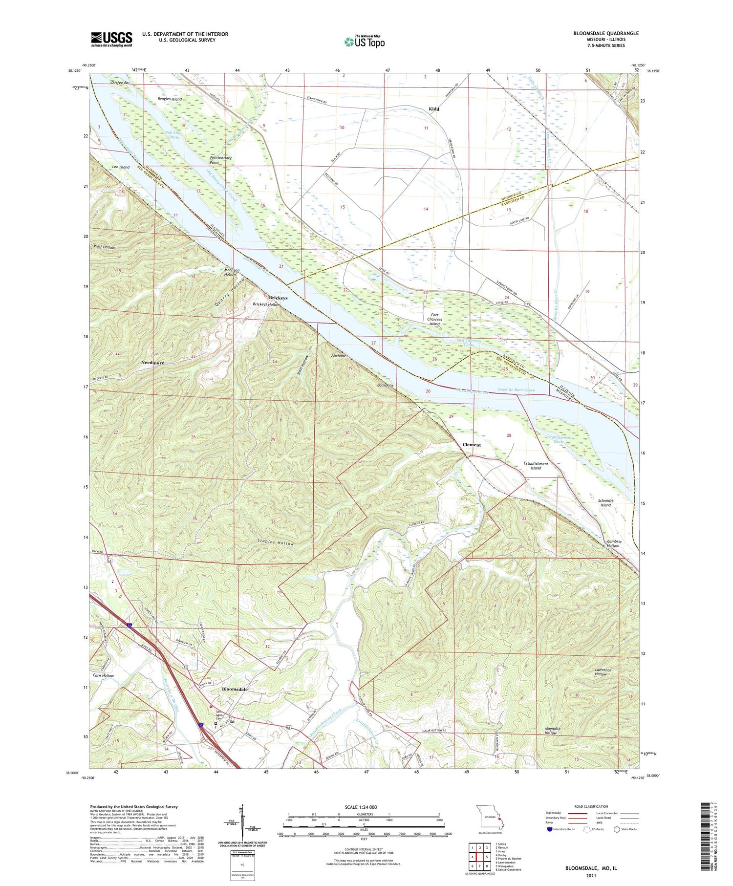
2021 topographic map quadrangle Bloomsdale in the states of Missouri, Illinois. Scale: 1:24000. Based on the newly updated USGS 7.5' US Topo map series, this map is in the following counties: Ste. Genevieve, Monroe, Randolph, Jefferson. The map contains contour data, water features, and other items you are used to seeing on USGS maps, but also has updated roads and other features. This is the next generation of topographic maps. Printed on high-quality waterproof paper with UV fade-resistant inks.
Quads adjacent to this one:
West: Danby
Northwest: Selma
North: Renault
Northeast: Ames
East: Prairie du Rocher
Southeast: Sainte Genevieve
South: Weingarten
Southwest: Lawrenceton
Contains the following named places: Ames Towhead, Backbone, Bellville School, Bloomsdale, Bloomsdale Elementary School, Bloomsdale Village Post Office, Bloomsdale Volunteer Fire Department, Boxtown School, Brickey School, Brickeys, Brickeys Hollow, Cambria Hollow, Carpenter Branch, City of Bloomsdale, Clement, Corn Hollow, Durfee Bar, Establishment Chute, Establishment Island, Fort Cavendish, Fort Chartres Chute, Fort Chartres Island, Fort Chartres State Park, Fourche a Du Clos, Hoeff School, Isle du Bois Creek, Jawbone, Kidd, Kinsey Creek, Lee Island, Morrison Hollow, Mud Branch, Needmore, Old Maeystown Creek, Onemile Race Creek, Penitentiary Point, Quarry Hollow, Saint Philip, Saint Philomenas Catholic Church, Salt Lake Chute, Schmidts Island, Snell Hollow, Staples Hollow, Stringtown School, Wolf Hollow


