MyTopo
Lawrenceton Missouri US Topo Map
Couldn't load pickup availability
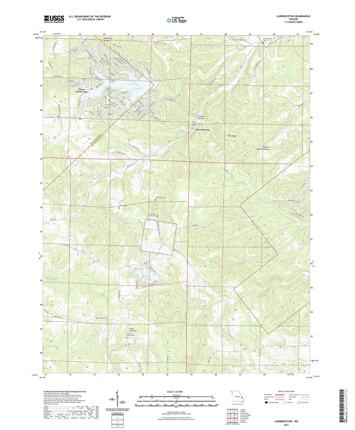
2021 topographic map quadrangle Lawrenceton in the state of Missouri. Scale: 1:24000. Based on the newly updated USGS 7.5' US Topo map series, this map is in the following counties: Ste. Genevieve, St. Francois. The map contains contour data, water features, and other items you are used to seeing on USGS maps, but also has updated roads and other features. This is the next generation of topographic maps. Printed on high-quality waterproof paper with UV fade-resistant inks.
Quads adjacent to this one:
West: French Village
Northwest: Halifax
North: Danby
Northeast: Bloomsdale
East: Weingarten
Southeast: Coffman
South: Sprott
Southwest: Farmington
This map covers the same area as the classic USGS quad with code o37090h3.
Contains the following named places: Beckemeyer Cemetery, Bequette Cemetery, Cunningham Branch, Erb Lake, Goose Creek, Goose Creek Lake, Goose Creek Lake Census Designated Place, Goose Creek Lake Dam, Goose Creek Lake Fire Department Station 1, Goose Creek Lake Fire Department Station 2, Herman School, Jenning Cemetery, Lake Seven Falls Dam Number 2, Lake Seven Falls Dam Number 3, Lawrenceton, Lawrenceton School, Little Vine Church, Little Vine Church Cemetery, Little Vine Hill, Little Vine School, Mackley Cemetery, Mill, Number 615 Dam, Patterson Family Cemetery, Pin Hook Branch, Pine Ridge, Pinhook Hollow, Pinkston Dam, Pinkston Lake, Saint Lawrences Catholic Church, Thurman School, Township of Union, ZIP Code: 63036