MyTopo
Bollinger Creek Missouri US Topo Map
Couldn't load pickup availability
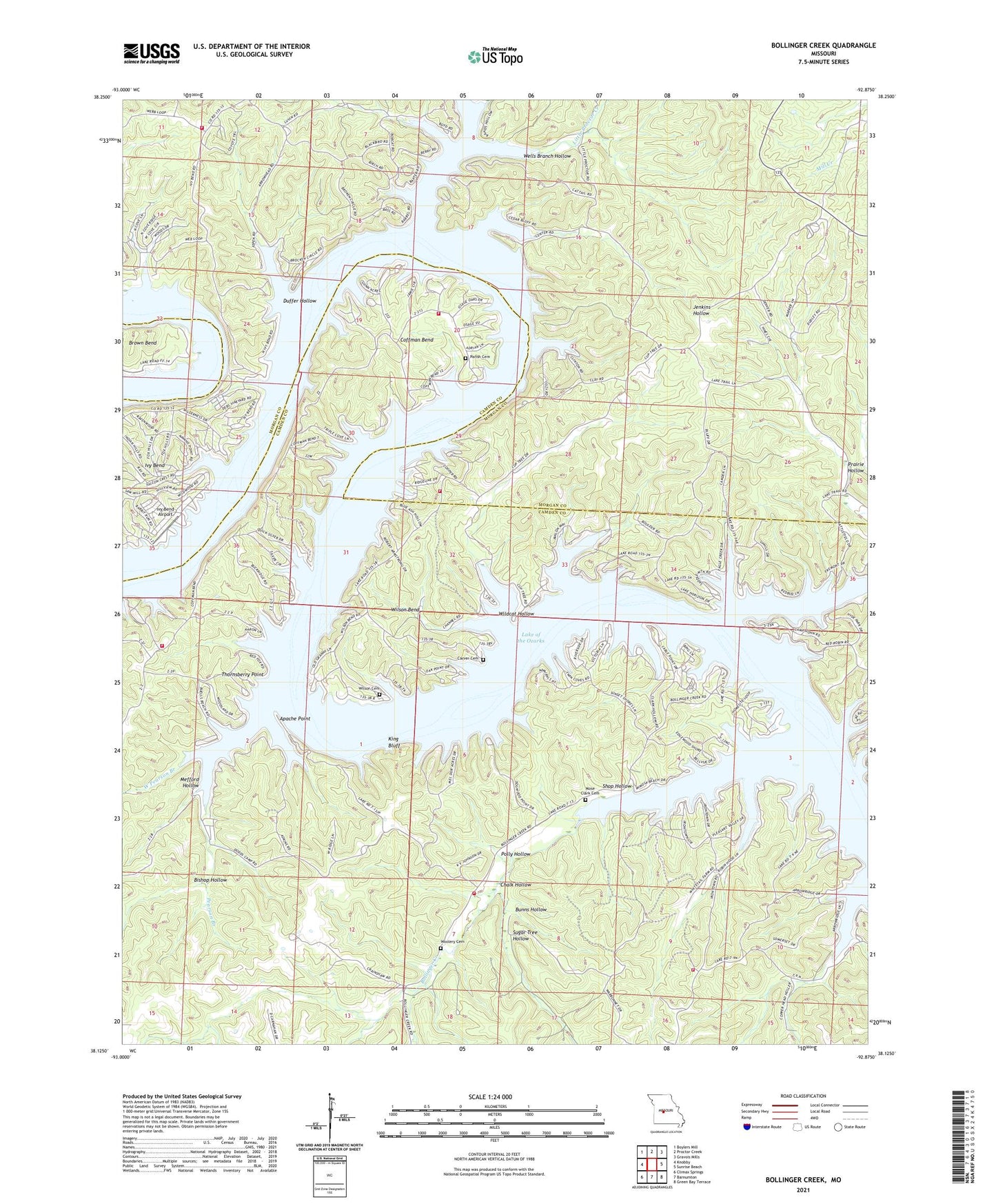
2021 topographic map quadrangle Bollinger Creek in the state of Missouri. Scale: 1:24000. Based on the newly updated USGS 7.5' US Topo map series, this map is in the following counties: Camden, Morgan. The map contains contour data, water features, and other items you are used to seeing on USGS maps, but also has updated roads and other features. This is the next generation of topographic maps. Printed on high-quality waterproof paper with UV fade-resistant inks.
Quads adjacent to this one:
West: Knobby
Northwest: Boylers Mill
North: Proctor Creek
Northeast: Gravois Mills
East: Sunrise Beach
Southeast: Green Bay Terrace
South: Barnumton
Southwest: Climax Springs
This map covers the same area as the classic USGS quad with code o38092b8.
Contains the following named places: Apache Point, Bishop Hollow, Bollinger Creek, Brown Bend, Bunns Hollow, Camp Horn, Carver, Carver Cemetery, Chalk Hollow, Christian Church of the Ozarks, Clarks School, Coffman Bend, Coffman Bend Fire Department Association Station 2, Coffman Bend Fire Protection Association Station 1 Headquarters, Corum, Dodds, Duffer Hollow, Gravois Fire Protection District Station 3, Ivy Bend, Ivy Bend Airport, Ivy Bend Fire Department Station 2, Ivy Bend Mission, Jenkins School, King Bluff, Lake of the Ozarks, Little Niangua Arm, Little Proctor Creek, Mefford Hollow, Mose Clark Cemetery, Northwest Fire Protection District Station 2, Northwest Fire Protection District Station 4, Osage Iron Works, Parish Cemetery, Parmley Hollow, Pearson Branch, Pearson Branch School, Polly Hollow, Prairie Hollow, Shop Hollow, Sugar Tree Hollow, Thornsberry Point, Township of Adair, Wells Branch Hollow, West Pearson Branch, Wildcat Hollow, Wilson Bend, Wilson Bend School, Wilson Cemetery, Woolery Cemetery