MyTopo
Boylers Mill Missouri US Topo Map
Couldn't load pickup availability
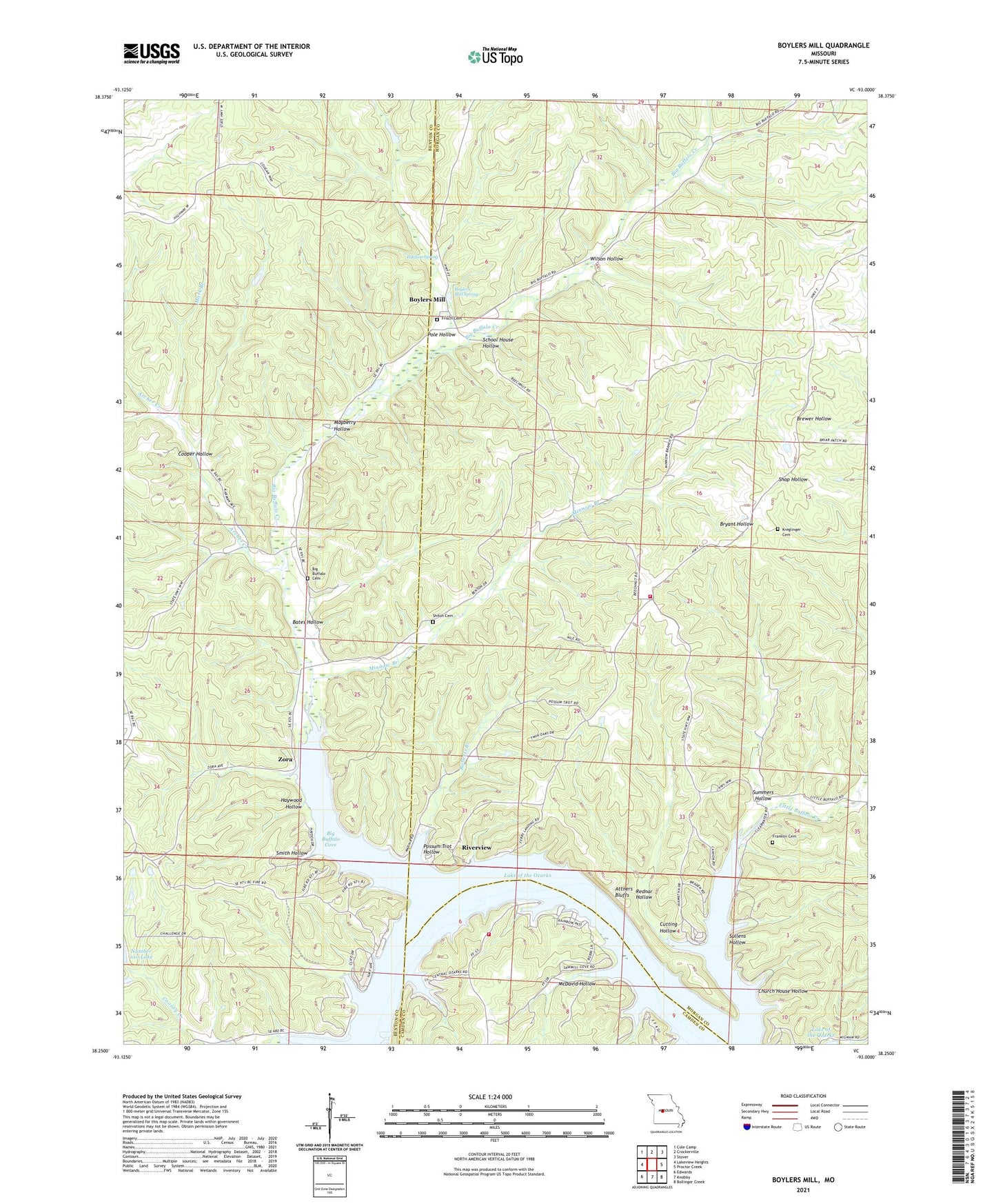
2021 topographic map quadrangle Boylers Mill in the state of Missouri. Scale: 1:24000. Based on the newly updated USGS 7.5' US Topo map series, this map is in the following counties: Morgan, Benton, Camden. The map contains contour data, water features, and other items you are used to seeing on USGS maps, but also has updated roads and other features. This is the next generation of topographic maps. Printed on high-quality waterproof paper with UV fade-resistant inks.
Quads adjacent to this one:
West: Lakeview Heights
Northwest: Cole Camp
North: Crockerville
Northeast: Stover
East: Proctor Creek
Southeast: Bollinger Creek
South: Knobby
Southwest: Edwards
This map covers the same area as the classic USGS quad with code o38093c1.
Contains the following named places: Archer Creek, Attners Bluffs, Bates Hollow, Big Bend Acres, Big Buffalo Cemetery, Big Buffalo Cove, Big Buffalo Creek, Big Buffalo Creek State Wildlife Area, Big Buffalo School, Big Buffaloe School, Bockelman Lake Dam, Boylers Mill, Boylers Mill Spring, Carpenter Memorial State Wildlife Area, Central Ozarks, Church House Hollow, Cooper Hollow, Cutting Hollow, Franklin Cemetery, Frisch Cemetery, Haywood Hollow, Hudson Spring, Jackson and Keller Trust Lake South Dam, Jackson Keller Trust Lake North Dam, Kreglinger Cemetery, Little Buffalo Church, Little Buffalo Creek, Mark Branch, Mayberry Hollow, McDavid Hollow, Minnow Branch, Mount Calvary Church, Mount Hulda Lookout Tower, Mount Hulda State Wildfile Area, Northwest Fire Protection District Station 3, Pole Hollow, Possum Trot Hollow, Rednar Hollow, Riverview, Riverview School, Roberts Branch, Rock Ridge School, School House Hollow, Shiloh Cemetery, Smith Hollow, Stover Rural Fire Protection District Station 2, Sullens Hollow, Summers Hollow, Trinity Chapel, Wilson Hollow, Zora