MyTopo
Climax Springs Missouri US Topo Map
Couldn't load pickup availability
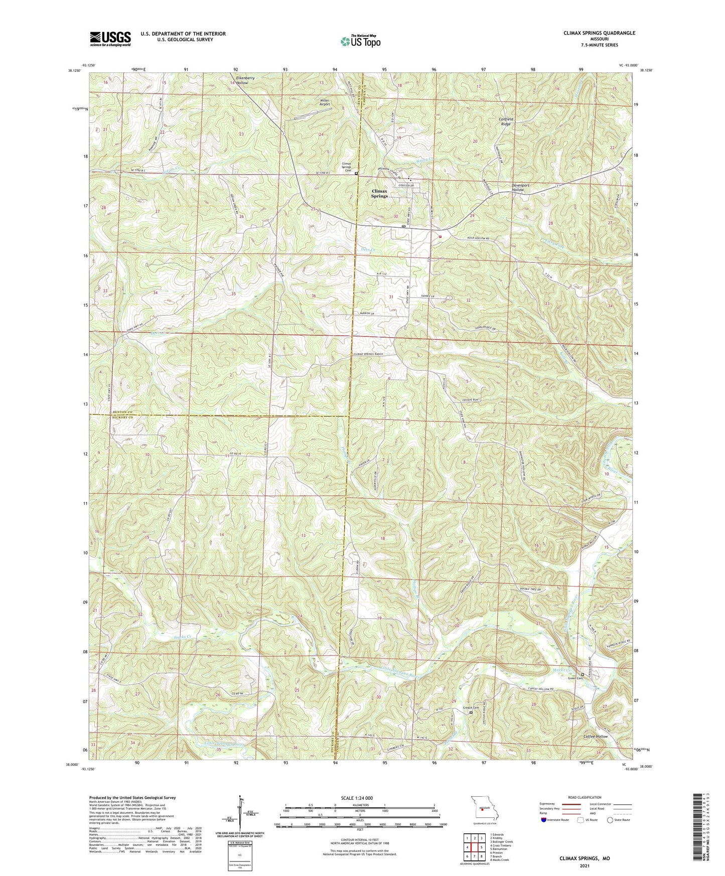
2021 topographic map quadrangle Climax Springs in the state of Missouri. Scale: 1:24000. Based on the newly updated USGS 7.5' US Topo map series, this map is in the following counties: Camden, Benton, Hickory. The map contains contour data, water features, and other items you are used to seeing on USGS maps, but also has updated roads and other features. This is the next generation of topographic maps. Printed on high-quality waterproof paper with UV fade-resistant inks.
Quads adjacent to this one:
West: Cross Timbers
Northwest: Edwards
North: Knobby
Northeast: Bollinger Creek
East: Barnumton
Southeast: Macks Creek
South: Branch
Southwest: Preston
This map covers the same area as the classic USGS quad with code o38093a1.
Contains the following named places: Carlson Lake Dam, Childers, Climax Springs, Climax Springs Cemetery, Climax Springs Census Designated Place, Climax Springs Lookout Tower, Climax Springs Post Office, Coffee Hollow, Creach Cemetery, Flint Springs School, Green Cemetery, Green Ridge Church, Harmony Church, High Point School, Macks Creek, Miller Airport, Mulberry School, Northwest Fire Protection District Station 1 Headquarters, Pennel Branch, Phillips Branch, Starks Creek, Township of Jordan, Village of Climax Springs, Wiseman Church