MyTopo
Knobby Missouri US Topo Map
Couldn't load pickup availability
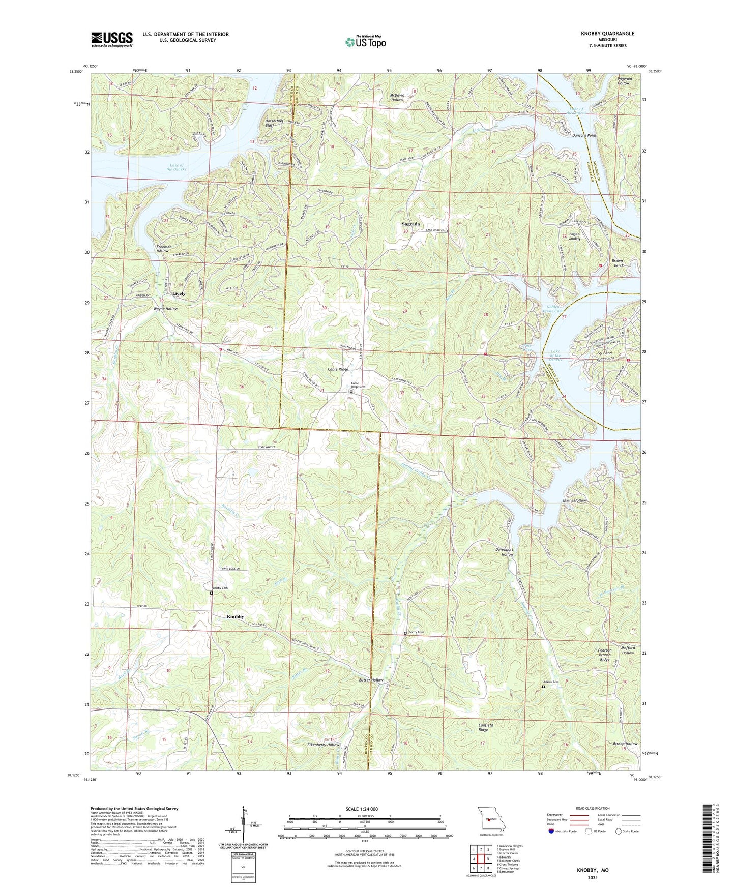
2021 topographic map quadrangle Knobby in the state of Missouri. Scale: 1:24000. Based on the newly updated USGS 7.5' US Topo map series, this map is in the following counties: Camden, Benton, Morgan. The map contains contour data, water features, and other items you are used to seeing on USGS maps, but also has updated roads and other features. This is the next generation of topographic maps. Printed on high-quality waterproof paper with UV fade-resistant inks.
Quads adjacent to this one:
West: Edwards
Northwest: Lakeview Heights
North: Boylers Mill
Northeast: Proctor Creek
East: Bollinger Creek
Southeast: Barnumton
South: Climax Springs
Southwest: Cross Timbers
This map covers the same area as the classic USGS quad with code o38093b1.
Contains the following named places: Adkins Cemetery, Butter Hollow, Cable Ridge, Cable Ridge Cemetery, Cable Ridge Church of Christ, Cable Ridge School, Canfield Ridge, Cooney Creek, Crittenden, Davenport Hollow, Deer Creek Fire Protection District Station 5, Dority Cemetery, Dry Branch, Duncans Point, Eagle's Landing, Elkenberry Hollow, Elkins Hollow, Freeman Hollow, Golden Goose Cove, Horsethief Bluff, Ivy Bend Fire Department Station 1, Jack Branch, Knobby, Knobby Cemetery, Knobby Creek, Lake Road Volunteer Fire Department, Lick Creek, Lick Creek Church, Lick Creek School, Lively, Moles Cave State Wildlife Area, Morriss Creek, New Hope Church, Nichol Hill School, Northwest Fire Protection District Station 5, Number 741 Dam, Olive Branch School, Pearson Branch Church, Pearson Branch Ridge, Pine Cove, Rainy Creek, Rise Branch, Ritter Branch, Sagrada, Shady Grove Church, Spring Valley, Spring Valley Creek, Sweet Water School, Walkers Corner, Wayne Hollow, White School, Wigwam Hollow, ZIP Code: 65324