MyTopo
Clearmont Missouri US Topo Map
Couldn't load pickup availability
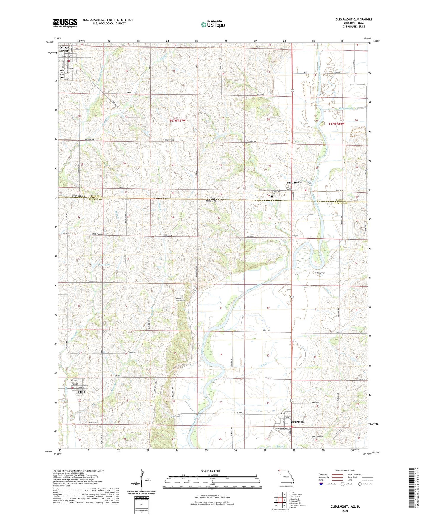
2021 topographic map quadrangle Clearmont in the states of Missouri, Iowa. Scale: 1:24000. Based on the newly updated USGS 7.5' US Topo map series, this map is in the following counties: Nodaway, Page. The map contains contour data, water features, and other items you are used to seeing on USGS maps, but also has updated roads and other features. This is the next generation of topographic maps. Printed on high-quality waterproof paper with UV fade-resistant inks.
Quads adjacent to this one:
West: Blanchard
Northwest: Coin
North: Clarinda South
Northeast: New Market
East: Hopkins SW
Southeast: Wilcox
South: Burlington Junction
Southwest: Skidmore NW
This map covers the same area as the classic USGS quad with code o40095e1.
Contains the following named places: Braddy Park, Braddyville, Braddyville Access, Braddyville Cemetery, Braddyville City Hall, Braddyville Fire Department, Braddyville Post Office, Buchanan Creek, City of Braddyville, City of Clearmont, City of College Springs, City of Elmo, Clearmont, Clearmont Fire Protection District, Clearmont Post Office, College Springs, College Springs City Hall, College Springs Post Office, College Springs Volunteer Fire Department, Cottonwood School, East Mill Creek, Elmo, Elmo Area Fire Protection District, Elmo Post Office, Jerry Creek, Maple Hill Cemetery, Maple Lawn School, Middle Mill Creek, Moss Branch, Mount Tabor School, Oak Hill Cemetery - North, Presbyterian Church, Pruitt Lake, Pruitt Lake Dam, Shambaugh Quarry, Sink Creek, South Page Community School, Township of Amity, Union Grove Cemetery, Union Grove School, White Chapel School, White Lily School, Wolf Creek, ZIP Codes: 51631, 51637