MyTopo
Blanchard Iowa US Topo Map
Couldn't load pickup availability
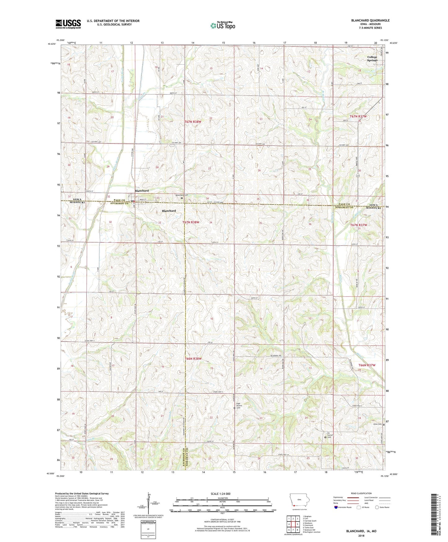
2022 topographic map quadrangle Blanchard in the states of Missouri, Iowa. Scale: 1:24000. Based on the newly updated USGS 7.5' US Topo map series, this map is in the following counties: Page, Nodaway, Atchison. The map contains contour data, water features, and other items you are used to seeing on USGS maps, but also has updated roads and other features. This is the next generation of topographic maps. Printed on high-quality waterproof paper with UV fade-resistant inks.
Quads adjacent to this one:
West: Westboro
Northwest: Bingham
North: Coin
Northeast: Clarinda South
East: Clearmont
Southeast: Burlington Junction
South: Skidmore NW
Southwest: Tarkio East
Contains the following named places: Blanchard, Blanchard Cemetery, Blanchard Census Designated Place, Blanchard Elevator, Blanchard Post Office, Blanchard United Methodist Church, Blanchard Volunteer Fire Department, City of Blanchard, East Mill Creek, Elmo Cemetery, Eureka School, Hazel Grove School, High Prairie Cemetery, High Prairie School, KYFR-AM (Shenandoah), Long Branch, North Grove School, North Prairie School, Six Corners Cemetery, South Blanchard, Township of Colfax, Township of Lincoln, West Mill Creek, ZIP Codes: 51630, 64445