MyTopo
Cabool SE Missouri US Topo Map
Couldn't load pickup availability
Also explore the Cabool SE Forest Service Topo of this same quad for updated USFS data
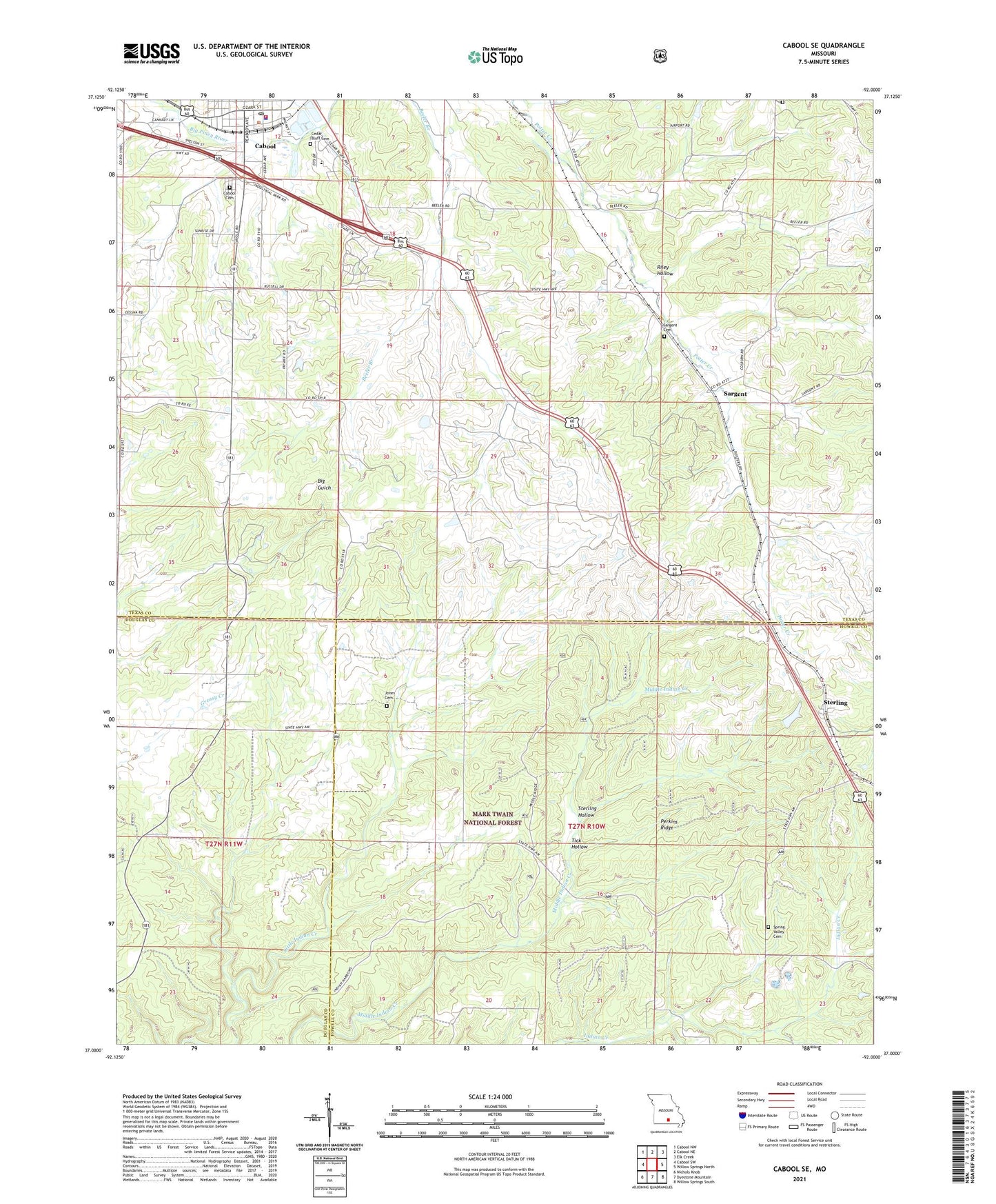
2021 topographic map quadrangle Cabool SE in the state of Missouri. Scale: 1:24000. Based on the newly updated USGS 7.5' US Topo map series, this map is in the following counties: Texas, Howell, Douglas. The map contains contour data, water features, and other items you are used to seeing on USGS maps, but also has updated roads and other features. This is the next generation of topographic maps. Printed on high-quality waterproof paper with UV fade-resistant inks.
Quads adjacent to this one:
West: Cabool SW
Northwest: Cabool NW
North: Cabool NE
Northeast: Elk Creek
East: Willow Springs North
Southeast: Willow Springs South
South: Dyestone Mountain
Southwest: Nichols Knob
This map covers the same area as the classic USGS quad with code o37092a1.
Contains the following named places: Cabool, Cabool Cemetery, Cabool Fire Department, Cabool Police Department, Cabool Post Office, Cedar Bluff, Cedar Bluff Baptist Church, Cedar Bluff Cemetery, Forest Flower School, John Foster Dam, Jones Cemetery, KUKU-FM (Willow Springs), Mount Pisgah Church, New Hope School, Ozark School, Pea Ridge Church, Pea Ridge School, Perkins Ridge, Pine Flat Church, Pine Flat Community Building, Riley Hollow, Sargent, Sargent Cemetery, Sargent School, Spring Valley Cemetery, Sterling, Sterling Hollow, Sterling Lookout Tower, Sterling School, Tick Hollow, Township of Burdine, Union School