MyTopo
Charleston Missouri US Topo Map
Couldn't load pickup availability
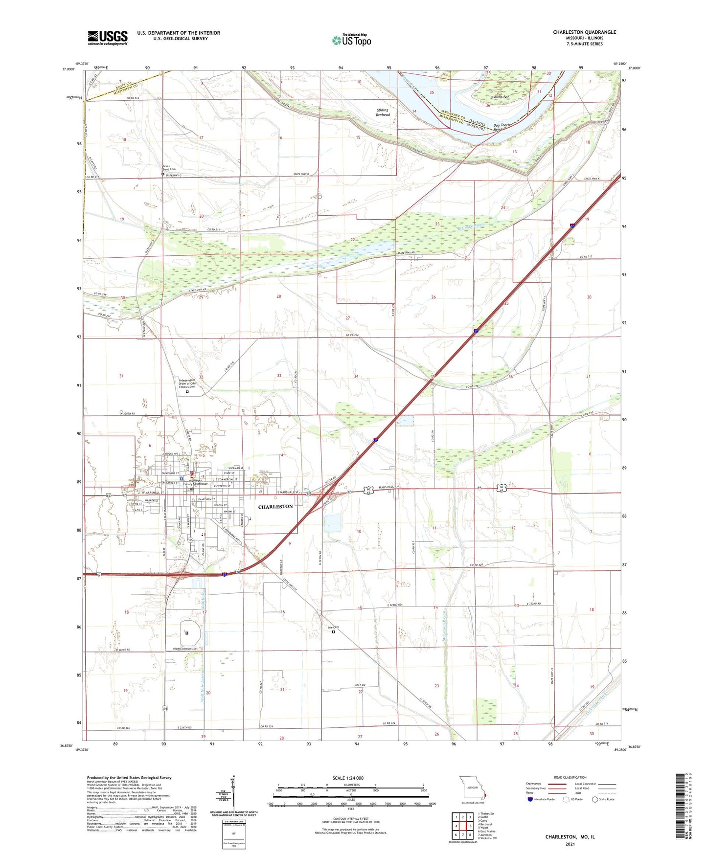
2021 topographic map quadrangle Charleston in the states of Missouri, Illinois. Scale: 1:24000. Based on the newly updated USGS 7.5' US Topo map series, this map is in the following counties: Mississippi, Alexander, Scott. The map contains contour data, water features, and other items you are used to seeing on USGS maps, but also has updated roads and other features. This is the next generation of topographic maps. Printed on high-quality waterproof paper with UV fade-resistant inks.
Quads adjacent to this one:
West: Bertrand
Northwest: Thebes SW
North: Cache
Northeast: Cairo
East: Wyatt
Southeast: Wickliffe SW
South: Anniston
Southwest: East Prairie
This map covers the same area as the classic USGS quad with code o36089h3.
Contains the following named places: Bethlehem Church, Big Lake, Big Lake Ditch, Big Lake School, Browns Bar, Catalpa, Charleston, Charleston Plaza, Charleston Police Department, Charleston Post Office, City of Charleston, Concord School, Coulter, Crenshaw, Dog Tooth Bend, Eugene Field School, Fish Lake, Fish Lake School, Grigsby School, Hallett, Hough, Independent Order of Odd Fellows Cemetery, James Bayou, KCHR-AM (Charleston), Lee Cemetery, Lincoln School, Mark Twan School, McDowell-Schmid Airport, Mississippi County Sheriff's Office, O'Rourkes Blue Hole, Rumsey Spur, Saint Francis de Dales Church, Saint Henrys School, Saint Mattews Church, Sliding Towhead, Southeast Correctional Center, Sweet Home Church, Texas Bend, Texas Bend Cemetery, Texas Bend School, Township of Tywappity, Upper Big Lake Dam, Warren E Hearnes School, Wolf Hole, ZIP Code: 63834