MyTopo
Trask Missouri US Topo Map
Couldn't load pickup availability
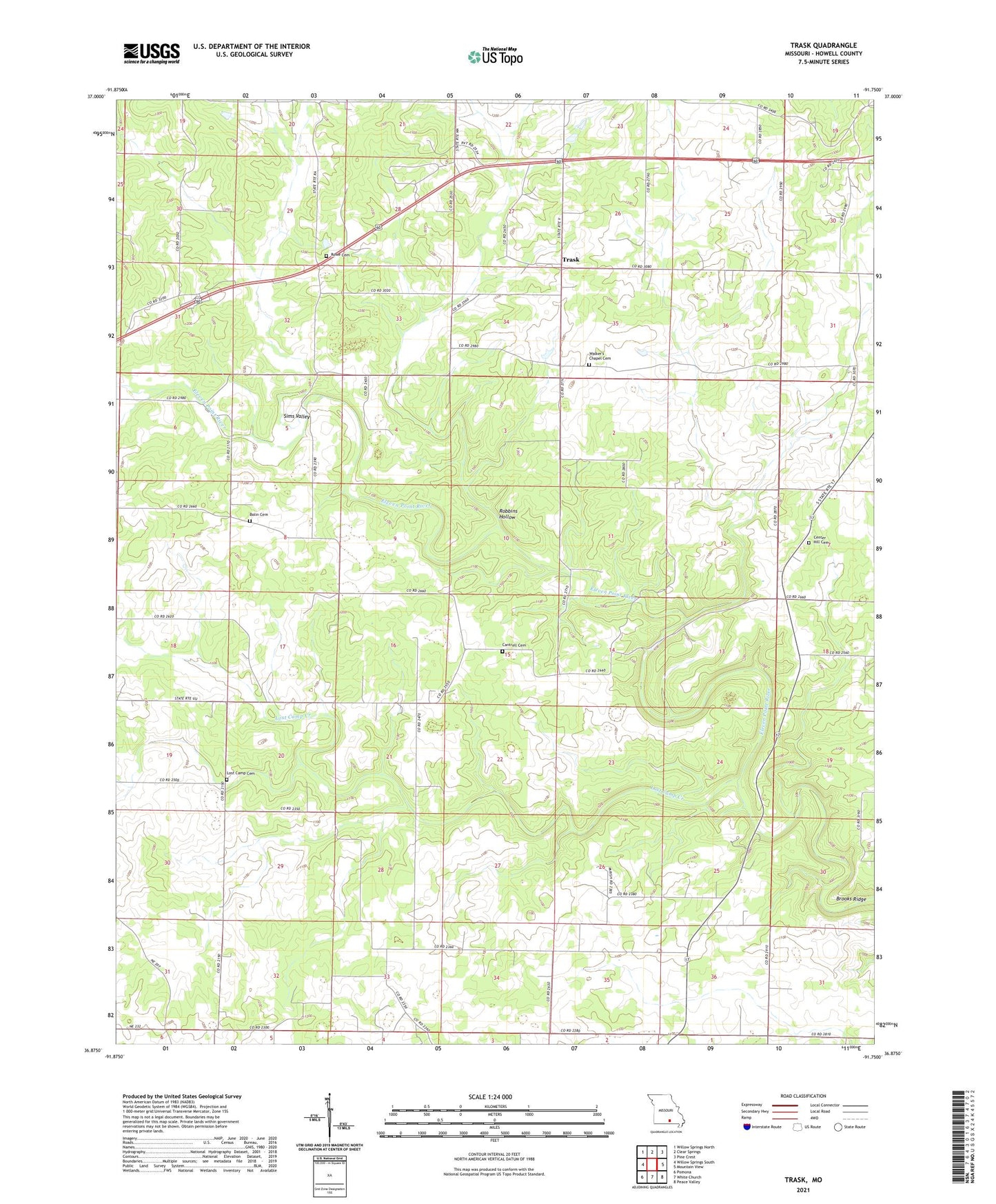
2021 topographic map quadrangle Trask in the state of Missouri. Scale: 1:24000. Based on the newly updated USGS 7.5' US Topo map series, this map is in the following counties: Howell. The map contains contour data, water features, and other items you are used to seeing on USGS maps, but also has updated roads and other features. This is the next generation of topographic maps. Printed on high-quality waterproof paper with UV fade-resistant inks.
Quads adjacent to this one:
West: Willow Springs South
Northwest: Willow Springs North
North: Clear Springs
Northeast: Pine Crest
East: Mountain View
Southeast: Peace Valley
South: White Church
Southwest: Pomona
This map covers the same area as the classic USGS quad with code o36091h7.
Contains the following named places: Boatman School, Butts School, Cantrell School, Center Hill Church, Center Hill School, Cooper Dam, Dowling School, Lost Camp Cemetery, Lost Camp Church, Lost Camp Creek, Lost Camp School, Modrall School, Mount Zion Church, Robbins Hollow, Rowe Cemetery, Simms Valley School, Sims Valley, Township of Hutton Valley, Trask, Trask School, Walkers Chapel