MyTopo
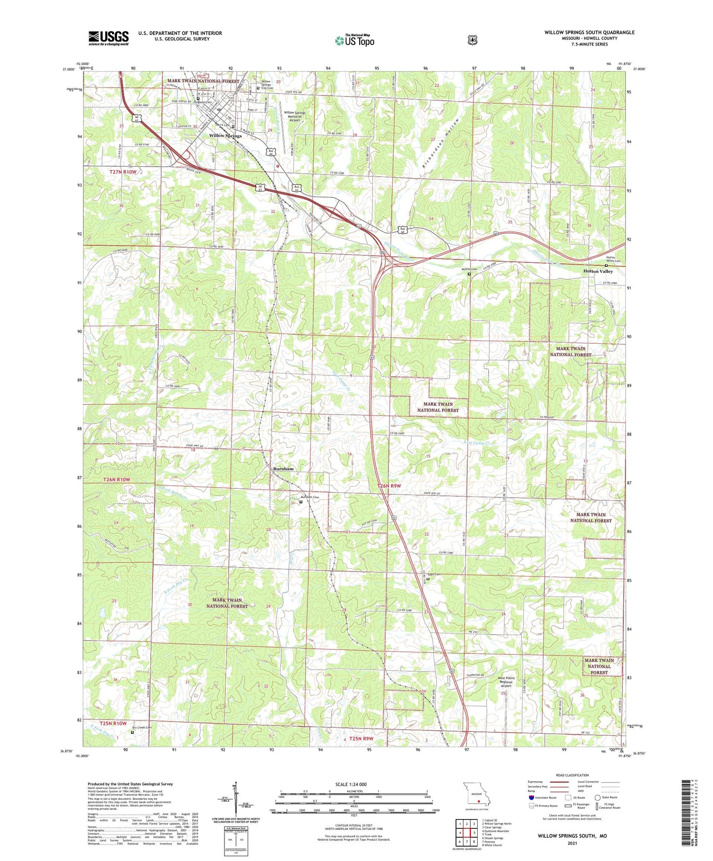
Willow Springs South Missouri US Topo Map
Couldn't load pickup availability
Also explore the Willow Springs South Forest Service Topo of this same quad for updated USFS data
2021 topographic map quadrangle Willow Springs South in the state of Missouri. Scale: 1:24000. Based on the newly updated USGS 7.5' US Topo map series, this map is in the following counties: Howell. The map contains contour data, water features, and other items you are used to seeing on USGS maps, but also has updated roads and other features. This is the next generation of topographic maps. Printed on high-quality waterproof paper with UV fade-resistant inks.
Quads adjacent to this one:
West: Dyestone Mountain
Northwest: Cabool SE
North: Willow Springs North
Northeast: Clear Springs
East: Trask
Southeast: White Church
South: Pomona
Southwest: Siloam Springs
This map covers the same area as the classic USGS quad with code o36091h8.
Contains the following named places: Burnham, Burnham Cemetery, Burnham School, City of Willow Springs, College Hill School, Davis School, Dean Davis State Wildlife Area, Dry Creek School, Eleven Point Rural Fire Department Station 1, Eleven Point Rural Fire Department Station 2 Headquarters, Eleven Point Rural Fire Department Station 3, Epps Cemetery, Full Gospel Church, Halfway School, Hutton Valley, KUKU-AM (Willow Springs), Latter Day Saints Church, Moffitt Cemetery, Pleasant Valley School, Pomona Lake Dam, Richardson Hollow, Township of Willow Springs, West Plains Regional Airport, Willow Springs, Willow Springs City Cemetery, Willow Springs Memorial Airport, Willow Springs Post Office, ZIP Code: 65793