MyTopo
Mountain View Missouri US Topo Map
Couldn't load pickup availability
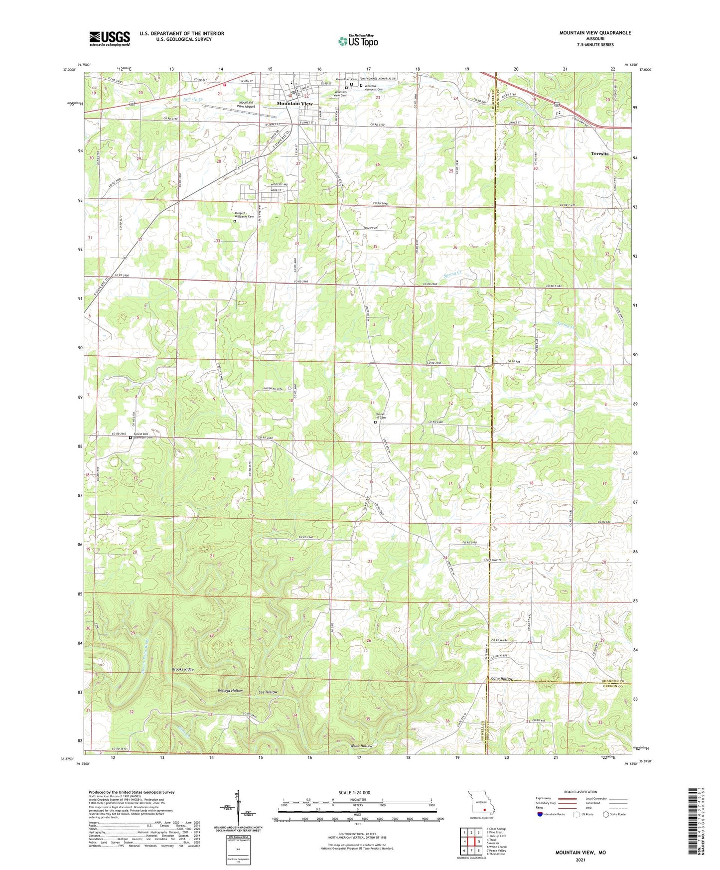
2021 topographic map quadrangle Mountain View in the state of Missouri. Scale: 1:24000. Based on the newly updated USGS 7.5' US Topo map series, this map is in the following counties: Howell, Shannon, Oregon. The map contains contour data, water features, and other items you are used to seeing on USGS maps, but also has updated roads and other features. This is the next generation of topographic maps. Printed on high-quality waterproof paper with UV fade-resistant inks.
Quads adjacent to this one:
West: Trask
Northwest: Clear Springs
North: Pine Crest
Northeast: Jam Up Cave
East: Montier
Southeast: Thomasville
South: Peace Valley
Southwest: White Church
This map covers the same area as the classic USGS quad with code o36091h6.
Contains the following named places: Brooks Ridge, Bunkers Spur, Chapel, Chapel Hill Church, Chapel Hill School, City of Mountain View, Deep Water School, Forest Dell Church, Forest Dell School, Gravel Ridge School, Greenlawn Cemetery, Kenaga Hollow, Lee Hollow, Liberty High School, Mountain View, Mountain View Airport, Mountain View Cemetery, Mountain View Police Department, Mountain View Post Office, Mountain View Volunteer Fire Department, Oak Ridge School, Pleasant Grove School, Shady Grove School, Teresita, Township of Chapel, Webb Hollow