MyTopo
Clinton North Missouri US Topo Map
Couldn't load pickup availability
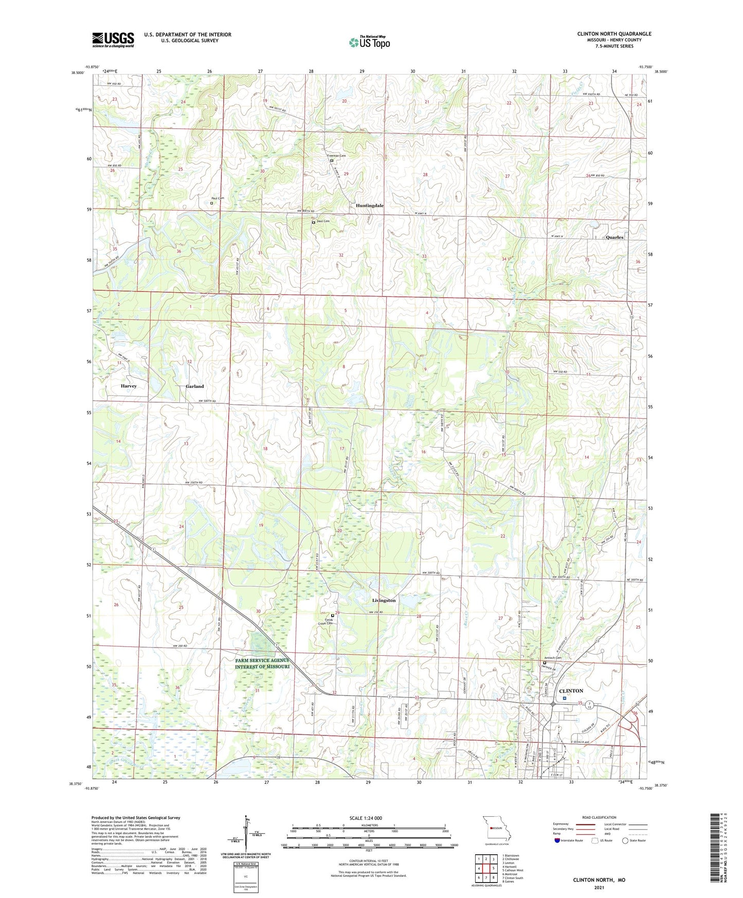
2021 topographic map quadrangle Clinton North in the state of Missouri. Scale: 1:24000. Based on the newly updated USGS 7.5' US Topo map series, this map is in the following counties: Henry. The map contains contour data, water features, and other items you are used to seeing on USGS maps, but also has updated roads and other features. This is the next generation of topographic maps. Printed on high-quality waterproof paper with UV fade-resistant inks.
Quads adjacent to this one:
West: Hartwell
Northwest: Blairstown
North: Chilhowee
Northeast: Leeton
East: Calhoun West
Southeast: Gaines
South: Clinton South
Southwest: Montrose
Contains the following named places: Antioch Cemetery, Beaty Lake, Beaty Ranch Lake Dam, Collins School, Comer School, Cottonwood Branch, Curtis School, East Fork Honey Creek, Eastgate Shopping Center, Ferros Ranch-Aero, Fields Creek Cemetery, Fields Creek School, Freeman Cemetery, Garland, Garland School, George Bud Church Memorial Hospital Heliport, Golden Valley Memorial Hospital, Harvey, Henry County, Huntingdale, Huntingdale School, KDKD-AM (Clinton), Land School, Lincoln School, Livingston, North Clinton, Paul Cemetery, Poague State Wildlife Area, Quarles, Rives County, Russell School, Township of Fields Creek, White School