MyTopo
Sentinel Missouri US Topo Map
Couldn't load pickup availability
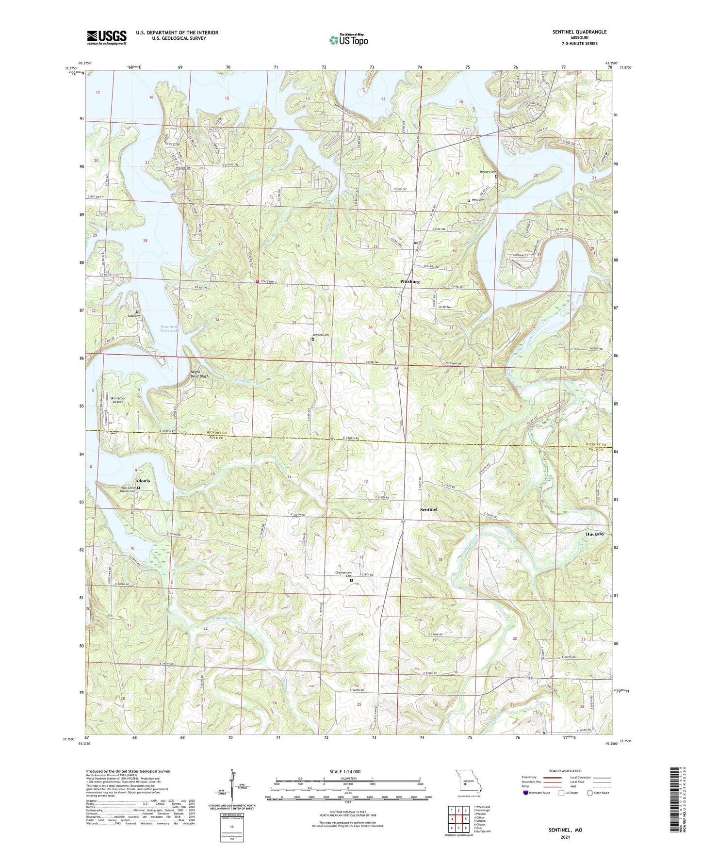
2021 topographic map quadrangle Sentinel in the state of Missouri. Scale: 1:24000. Based on the newly updated USGS 7.5' US Topo map series, this map is in the following counties: Hickory, Polk. The map contains contour data, water features, and other items you are used to seeing on USGS maps, but also has updated roads and other features. This is the next generation of topographic maps. Printed on high-quality waterproof paper with UV fade-resistant inks.
Quads adjacent to this one:
West: Elkton
Northwest: Wheatland
North: Hermitage
Northeast: Preston
East: Urbana
Southeast: Buffalo NW
South: Polk
Southwest: Cliquot
This map covers the same area as the classic USGS quad with code o37093g3.
Contains the following named places: Adonis, Antioch Cemetery, Antioch School, Bethel Southers Baptist Church, Big Hollow Branch, Carter Cemetery, Chamberlain Cemetery, Christian Church, Church of Jesus Christ, Claude Branch, Decker Branch, Eagle Hill School, Fox Ridge School, Hartman Grove School, Ingalls Creek, Inglis School, Lightfoot Public Use Area, Little Decker Branch, Mill Branch, Mohawk Corner, Negro Bend Bluff, Nemo Landing Public Use Area, Oak Grove Baptist Cemetery, Oak Grove Baptist Church, Oak Grove School, Pitt Cemetery, Pitts Cemetery, Pittsburg, Pittsburg Church, Pittsburg Landing Public Use Area, Pittsburg Public Use Area, Pittsburg Volunteer Fire Department, Pomme de Terre Lake, Pomme de Terre Southern Baptist Church, Pomme de Terre State Wildlife Management Area, Possum Creek, Rose Hill School, Saap Cemetery, Sentinel, Ski Harbor Airport, Star Ridge Church, Stewart Cemetery, Stick Branch, Stinking Creek, The House of the Lord, Township of Green, Twin Cedars Chapel, ZIP Codes: 65724, 65727