MyTopo
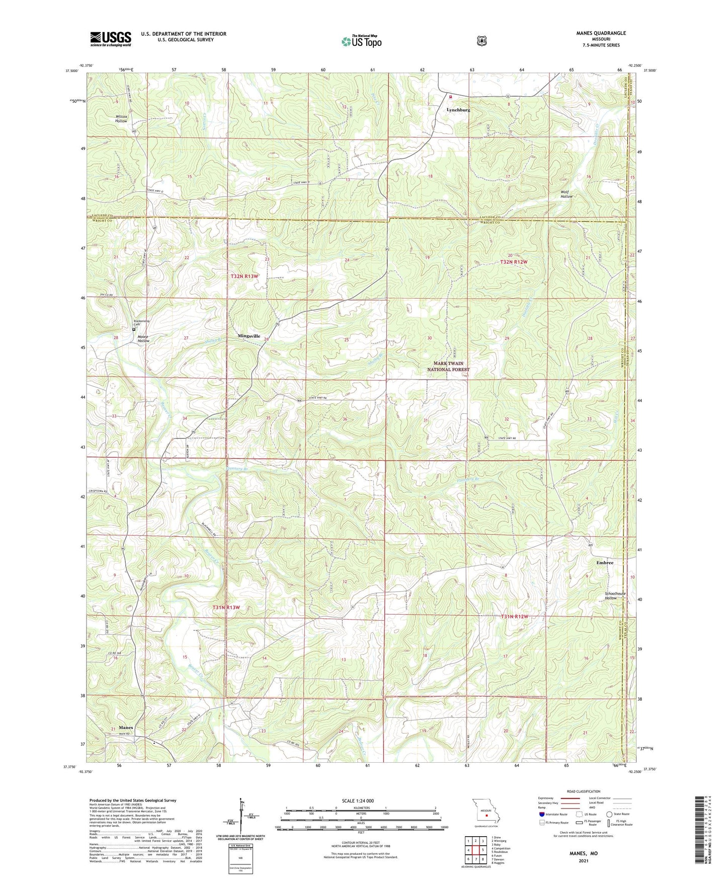
Manes Missouri US Topo Map
Couldn't load pickup availability
Also explore the Manes Forest Service Topo of this same quad for updated USFS data
2021 topographic map quadrangle Manes in the state of Missouri. Scale: 1:24000. Based on the newly updated USGS 7.5' US Topo map series, this map is in the following counties: Wright, Laclede, Texas. The map contains contour data, water features, and other items you are used to seeing on USGS maps, but also has updated roads and other features. This is the next generation of topographic maps. Printed on high-quality waterproof paper with UV fade-resistant inks.
Quads adjacent to this one:
West: Competition
Northwest: Drew
North: Winnipeg
Northeast: Roby
East: Roubidoux
Southeast: Huggins
South: Dawson
Southwest: Fuson
This map covers the same area as the classic USGS quad with code o37092d3.
Contains the following named places: Astoria, Blankenship Cemetery, Embree, Evening Shade Church, Flannery Branch, Jarres Ford, Lone Star School, Lynchburg, Maines, Manes, Mingsville, Montgomery School, Moore Hollow, Nebo Falcon Rural Volunteer Fire Department Station 3, Postoak School, Rose School, Shelby Branch, Sunny Side, Sunnyside Post Office, Sycamore School, Township of Montgomery, Union Star Church, Victory School, Wolf Hollow, ZIP Code: 65543