MyTopo
Cooper Hill Missouri US Topo Map
Couldn't load pickup availability
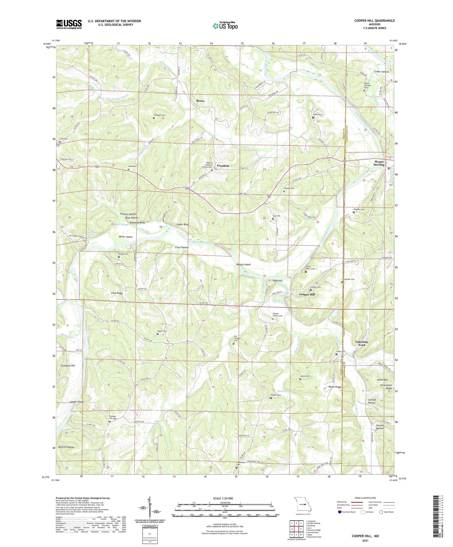
2021 topographic map quadrangle Cooper Hill in the state of Missouri. Scale: 1:24000. Based on the newly updated USGS 7.5' US Topo map series, this map is in the following counties: Osage, Gasconade. The map contains contour data, water features, and other items you are used to seeing on USGS maps, but also has updated roads and other features. This is the next generation of topographic maps. Printed on high-quality waterproof paper with UV fade-resistant inks.
Quads adjacent to this one:
West: Linn
Northwest: Luystown
North: Fredericksburg
Northeast: Pershing
East: Goerlisch Ridge
Southeast: Owensville West
South: Belle
Southwest: Summerfield
Contains the following named places: Bacon Spring, Baker Cemetery, Bend School, Blue Hollow, Bueker Cemetery, Bumper Cemetery, Butte Cemetery, Cedar Bluff, Cisco Hollow, Clod Ridge, College Hill Cemetery, College Hill Church, College Hill Dam, College Hill Lake, Contrary Creek, Cooper Family Cemetery, Cooper Hill, Cox - Cooper Cemetery, Cox Cemetery, Crider Creek, Crider Hollow, Deer Slough, Drewel Ford, Edwards Bluff, Evangel Saint Paul Church, Ferguson Branch, Feuersville, Feuersville Church, Feuersville Post Office, Freedom, Fuersville Cemetery, Garfield School, Gerloff Hollow, Glenco Lake, Haynes Cemetery, Heckman School, Hickorynut Ridge, Hollenback Spring, Hood Hill, Judy Branch, Kidd Cemetery, Lake Ford, Lambeth Cemetery, Lane, Lane Community Church, Lang Cemetery, Leach Baker Cemetery, Little Third Creek, Lovett Island, Massie Island, Miller Grove School, Miller Island, Mistaken Creek, Morton Hollow, Mount Sterling, Mount Sterling Cemetery, Nixon Cemetery, Nixon Ridge, Owens Creek, Owensville Volunteer Fire Department Station 2, Patterson Dam, Peggy Branch, Phelps Cemetery, Pin Oak Church, Pin Oak Creek, Pointers Creek, Pointers Creek Public Access, Possum Hollow, Possumtown School, Postoak School, Ryors, Ryors Church, Ryors School, Schneider Cemetery, Sherrill Hollow, Smith Hill, South Fork Contrary Creek, Success School, Third Creek, Triumph, Useful, Valentine Ford, Wildcat School