MyTopo
Crockerville Missouri US Topo Map
Couldn't load pickup availability
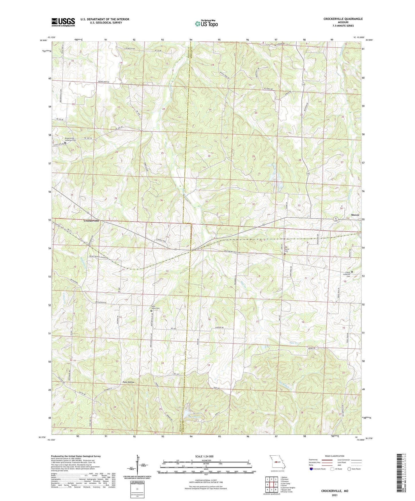
2021 topographic map quadrangle Crockerville in the state of Missouri. Scale: 1:24000. Based on the newly updated USGS 7.5' US Topo map series, this map is in the following counties: Morgan, Benton. The map contains contour data, water features, and other items you are used to seeing on USGS maps, but also has updated roads and other features. This is the next generation of topographic maps. Printed on high-quality waterproof paper with UV fade-resistant inks.
Quads adjacent to this one:
West: Cole Camp
Northwest: Bahner
North: Pyrmont
Northeast: Florence
East: Stover
Southeast: Proctor Creek
South: Boylers Mill
Southwest: Lakeview Heights
Contains the following named places: Balke Prairie School, Bethlehem Church, Brauersville Lutheran Cemetery, Brauersville School, Christ Lutheran Cemetery, Crockerville, Haw Creek School, Lake Placid, Lake Placid Dam, Number 779 Dam, Old Stover Cemetery, Pleasant Union Church, Pleasant Union School, Saint Johns Cemetery, ZIP Code: 65078