MyTopo
Deerfield Missouri US Topo Map
Couldn't load pickup availability
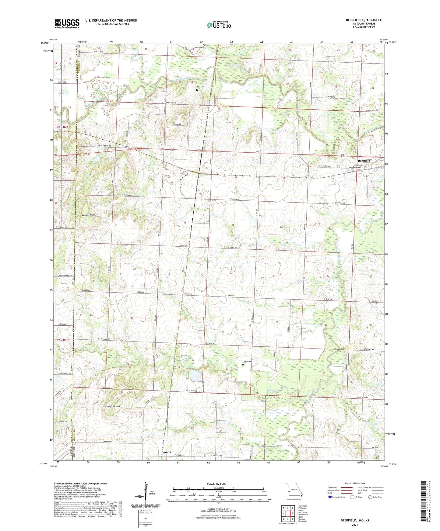
2021 topographic map quadrangle Deerfield in the state of Missouri. Scale: 1:24000. Based on the newly updated USGS 7.5' US Topo map series, this map is in the following counties: Vernon, Bourbon. The map contains contour data, water features, and other items you are used to seeing on USGS maps, but also has updated roads and other features. This is the next generation of topographic maps. Printed on high-quality waterproof paper with UV fade-resistant inks.
Quads adjacent to this one:
West: Fort Scott
Northwest: Hammond
North: Richards
Northeast: Metz
East: Moundville
Southeast: Bronaugh
South: Garland
Southwest: Cato
Contains the following named places: Bunnville, Cheney Branch, Clayton Christian Church, Cottonwood Creek, Cox Cemetery, Deerfield, Deerfield Cemetery, Deerfield Community Fire Association, Deerfield Post Office, Deerfield School, Doctor R F Searl Dam, Doctor R F Searl Lake, Eve, Grassy Run, Green Branch, Katy, Katy Post Office, Logan Cemetery, Logan School, Lone Elm School, Lone Star School, McHugh School, Moores Branch, Pleasant Valley School, Pleasant View School, Seitz Lake Dam, Shiloh Creek, Shiloh School, Sunny Slope School, Swart, Township of Coal, Vergil Mound, Vetters Hill, Village of Deerfield, White Cemetery, ZIP Code: 64741