MyTopo
Bronaugh Missouri US Topo Map
Couldn't load pickup availability
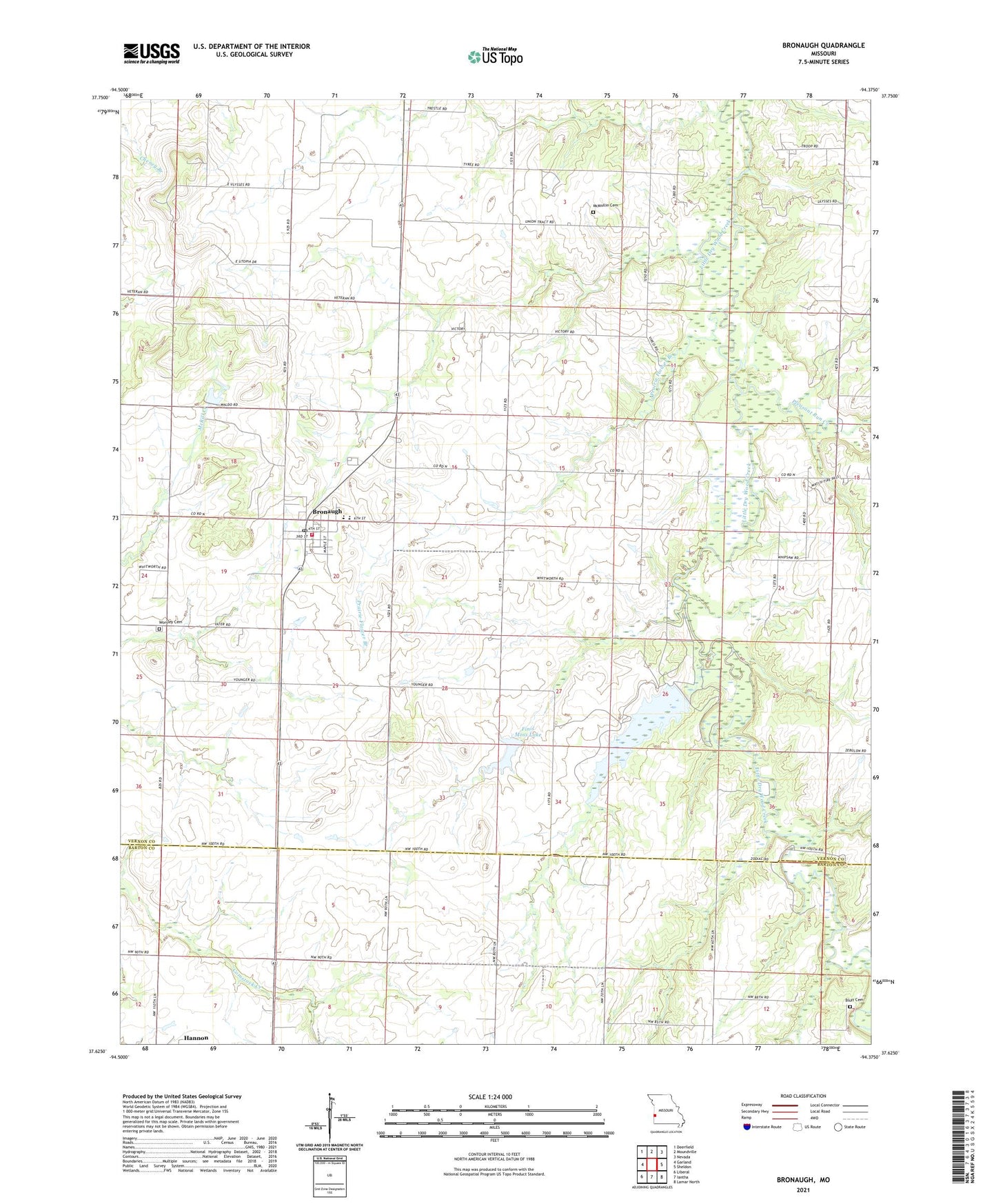
2021 topographic map quadrangle Bronaugh in the state of Missouri. Scale: 1:24000. Based on the newly updated USGS 7.5' US Topo map series, this map is in the following counties: Vernon, Barton. The map contains contour data, water features, and other items you are used to seeing on USGS maps, but also has updated roads and other features. This is the next generation of topographic maps. Printed on high-quality waterproof paper with UV fade-resistant inks.
Quads adjacent to this one:
West: Garland
Northwest: Deerfield
North: Moundville
Northeast: Nevada
East: Sheldon
Southeast: Lamar North
South: Iantha
Southwest: Liberal
This map covers the same area as the classic USGS quad with code o37094f4.
Contains the following named places: Bluff Church, Bronaugh, Bronaugh Community Fire Protection Association, Bronaugh Elementary School, Bronaugh High School, Bronaugh Post Office, City of Bronaugh, Fairview Church, Finis Moss Lake, Francis Lake Dam, McMullin Cemetery, Number 671 Dam, Pleasant Run Creek, Prairie Flower Branch, Railroad Pond, Township of Moundville, Victory School, Worsley Cemetery, Worsley Church