MyTopo
Metz Missouri US Topo Map
Couldn't load pickup availability
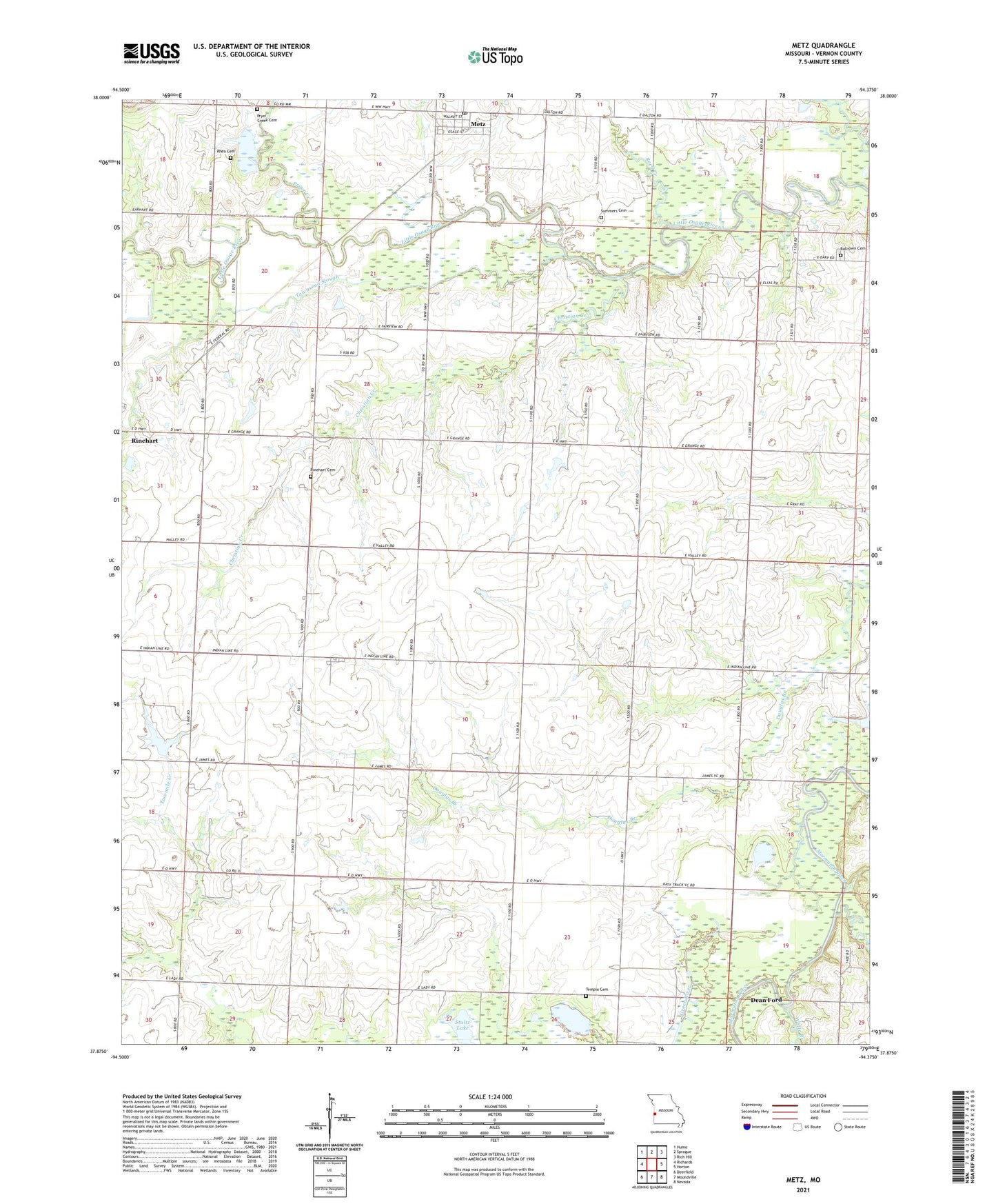
2021 topographic map quadrangle Metz in the state of Missouri. Scale: 1:24000. Based on the newly updated USGS 7.5' US Topo map series, this map is in the following counties: Vernon. The map contains contour data, water features, and other items you are used to seeing on USGS maps, but also has updated roads and other features. This is the next generation of topographic maps. Printed on high-quality waterproof paper with UV fade-resistant inks.
Quads adjacent to this one:
West: Richards
Northwest: Hume
North: Sprague
Northeast: Rich Hill
East: Horton
Southeast: Nevada
South: Moundville
Southwest: Deerfield
This map covers the same area as the classic USGS quad with code o37094h4.
Contains the following named places: Backbone Lake, Balltown Cemetery, Blaine, Charles Lake Dam, Christian Creek, Dean Ford, Dean Lake, Durham School, Flight Lake Natural Historic Area, Hong, Johnson School, Lake School, Metz, Metz Post Office, Metz School, Old Metz School, Otterbein Chapel, Prairie Dell Church, Pryor Creek, Pryor Creek Cemetery, Reed Creek, Rhea Cemetery, Rinehart, Rinehart Cemetery, Rinehart School, Roundtop School, Stultz Lake, Sulphur Spring Branch, Summers Cemetery, Temple, Temple Cemetery, Temple Post Office, Town of Metz, Townsend Slough, Township of Lake, Township of Metz, W S Charles Lake, West Washington School, White Branch, Whittfield School, ZIP Codes: 64765, 64778