MyTopo
Emden Missouri US Topo Map
Couldn't load pickup availability
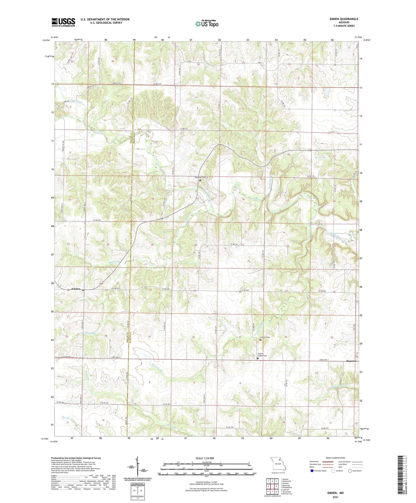
2021 topographic map quadrangle Emden in the state of Missouri. Scale: 1:24000. Based on the newly updated USGS 7.5' US Topo map series, this map is in the following counties: Marion, Shelby. The map contains contour data, water features, and other items you are used to seeing on USGS maps, but also has updated roads and other features. This is the next generation of topographic maps. Printed on high-quality waterproof paper with UV fade-resistant inks.
Quads adjacent to this one:
West: Burksville
Northwest: Newark
North: Nelsonville
Northeast: Durham
East: Philadelphia
Southeast: Monroe City
South: Hunnewell
Southwest: Lakenan
Contains the following named places: Andrew Chapel, Andrew Chapel Cemetery, Bellville, Bevill Lake, Calvert Cemetery, Davis School, Day School, Dickson Lake Dam, Ebenezer Cemetery, Ebenezer Church, Ebenezer School, Emden, Emden Garage Park, Emden Post Office, Emden School, Ewing School, Hawkins Branch, Heather, Kincaid School, Merrills Branch, Moreland Branch, Parsons School, Pee Dee School, Spence School, Tiger Fork, Township of North River, Warren, Warren School, ZIP Codes: 63439, 63463