MyTopo
Charter Oak Missouri US Topo Map
Couldn't load pickup availability
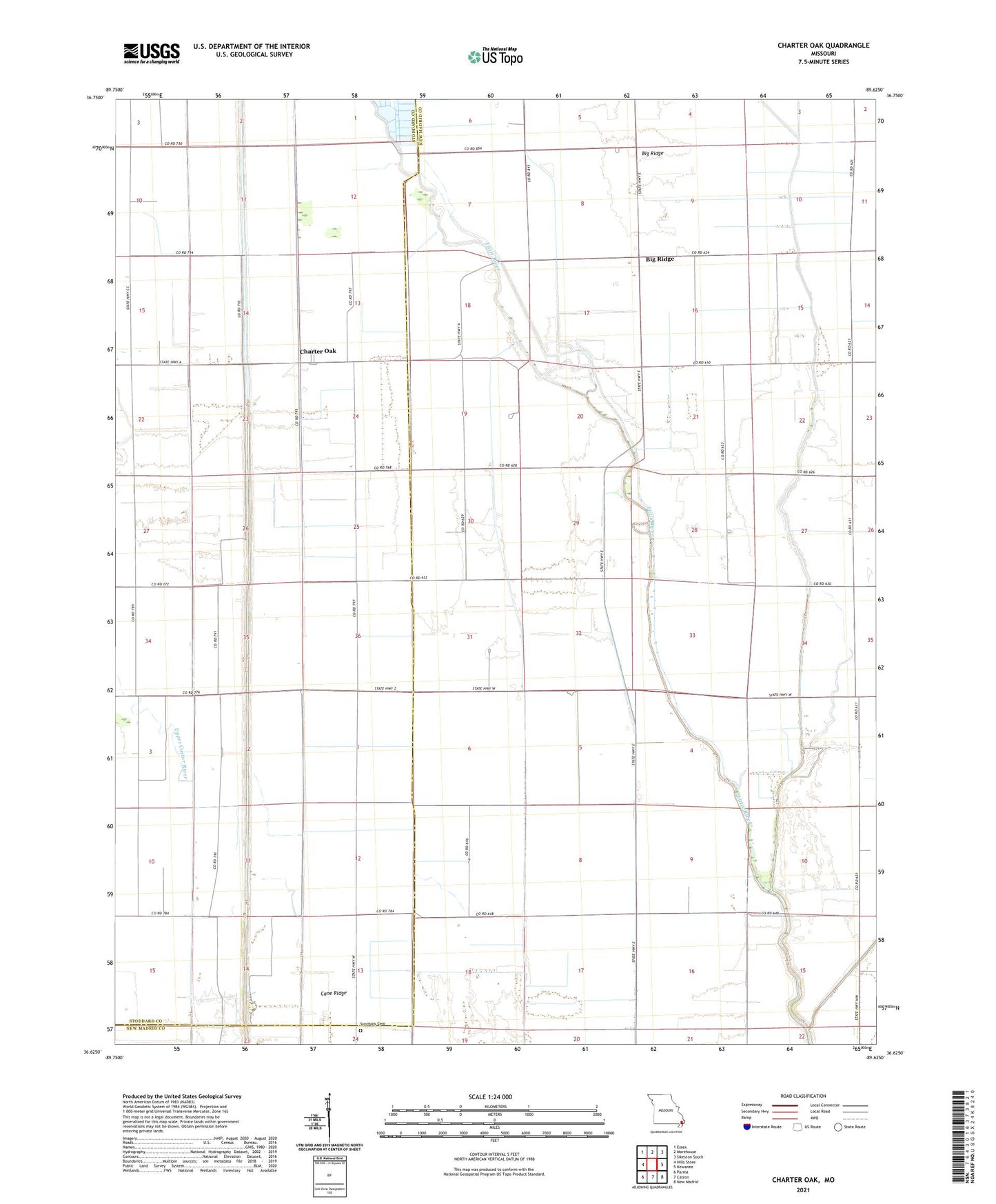
2021 topographic map quadrangle Charter Oak in the state of Missouri. Scale: 1:24000. Based on the newly updated USGS 7.5' US Topo map series, this map is in the following counties: New Madrid, Stoddard. The map contains contour data, water features, and other items you are used to seeing on USGS maps, but also has updated roads and other features. This is the next generation of topographic maps. Printed on high-quality waterproof paper with UV fade-resistant inks.
Quads adjacent to this one:
West: Hills Store
Northwest: Essex
North: Morehouse
Northeast: Sikeston South
East: Kewanee
Southeast: New Madrid
South: Catron
Southwest: Parma
This map covers the same area as the classic USGS quad with code o36089f6.
Contains the following named places: Big Ridge, Big Ridge Church, Big Ridge School, Cane Ridge, Charter Oak, Claud, Hurricane Ridge, Hurricane Ridge Church, Kavanaugh School, Kendal School, Lower Castor River, Medal, New Mount Zion Church, Otter Slough Ditch, Otto Spur, Pilgrim Rest Church, Simmons Cemetery, Tinsley School, West Charter Oak School, ZIP Code: 63833