MyTopo
Morehouse Missouri US Topo Map
Couldn't load pickup availability
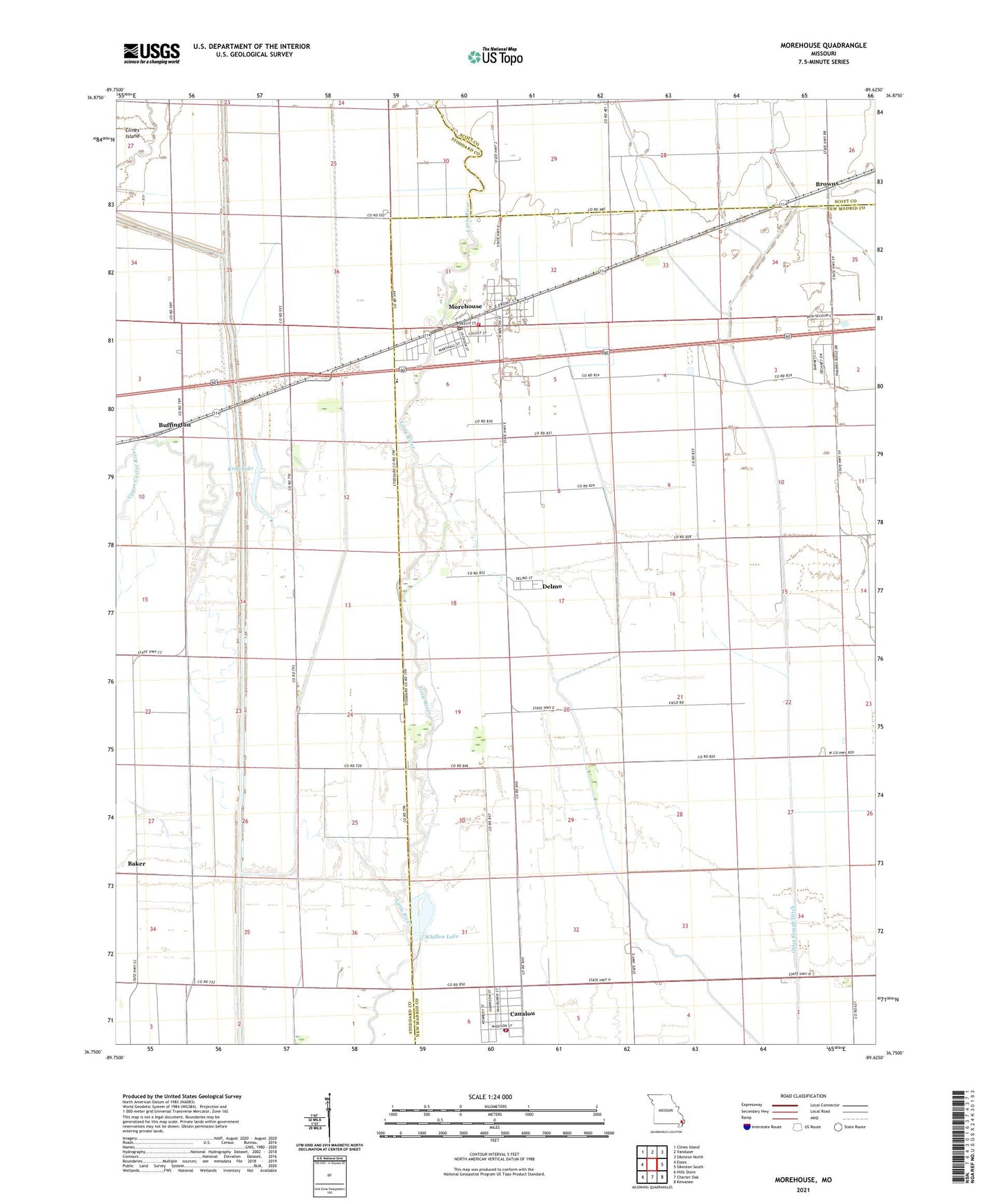
2021 topographic map quadrangle Morehouse in the state of Missouri. Scale: 1:24000. Based on the newly updated USGS 7.5' US Topo map series, this map is in the following counties: New Madrid, Stoddard, Scott. The map contains contour data, water features, and other items you are used to seeing on USGS maps, but also has updated roads and other features. This is the next generation of topographic maps. Printed on high-quality waterproof paper with UV fade-resistant inks.
Quads adjacent to this one:
West: Essex
Northwest: Clines Island
North: Vanduser
Northeast: Sikeston North
East: Sikeston South
Southeast: Kewanee
South: Charter Oak
Southwest: Hills Store
This map covers the same area as the classic USGS quad with code o36089g6.
Contains the following named places: Browns, Buffington, Canalou, Canalou Volunteer Fire Department, City of Canalou, City of Morehouse, Cline School, Crossroad School, Delmo, Greer School, Hale School, King Lake, Landers Ridge School, Little River, Longs Dam, Longs Pond, Macedonia Church, Morehouse, Morehouse Fire and Rescue Department, Morehouse Post Office, New Bethel Church, Township of West, Tram Switch, Warner School, Whitten Lake, Whitten Lake Dam, ZIP Codes: 63828, 63868