MyTopo
Vanduser Missouri US Topo Map
Couldn't load pickup availability
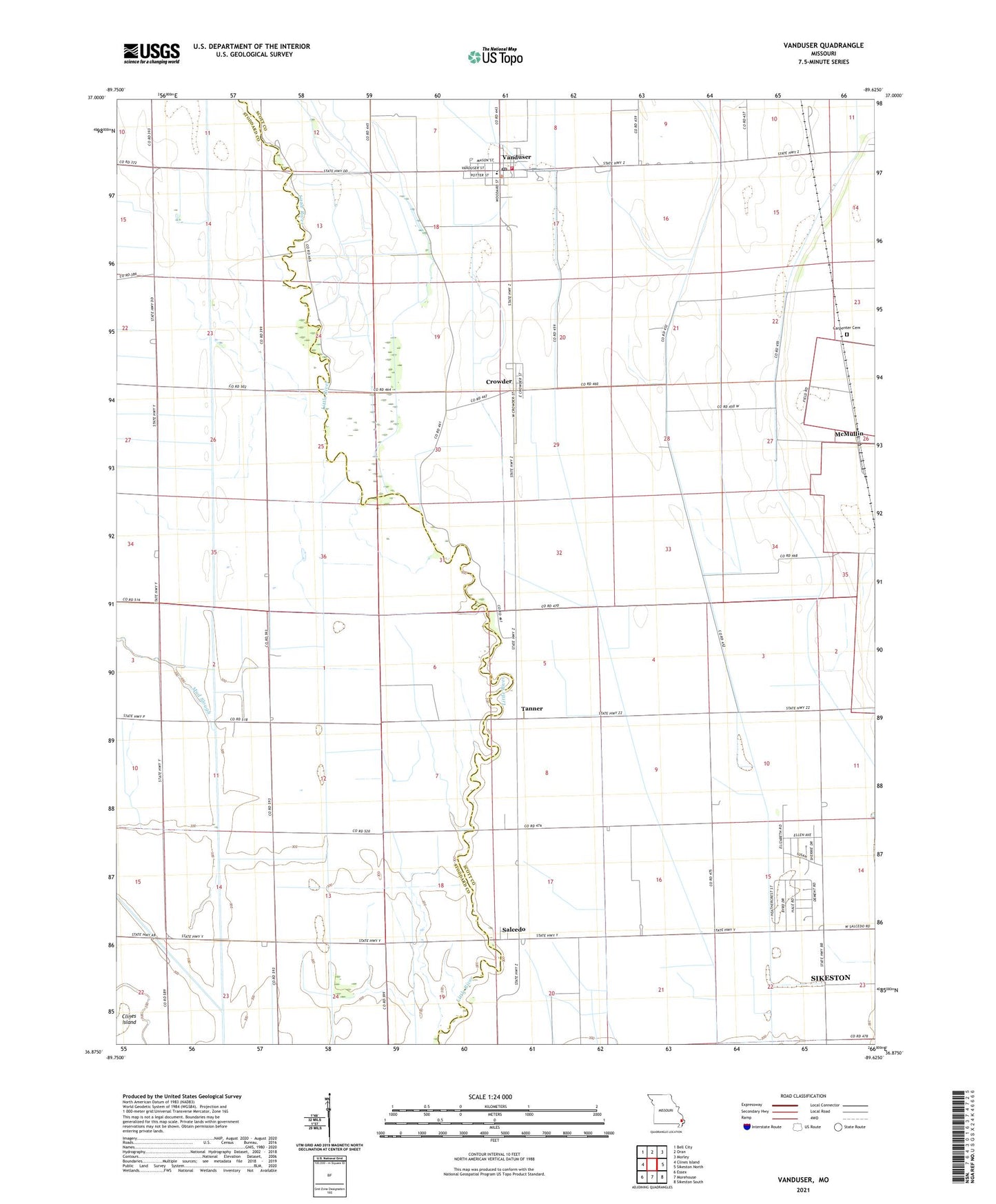
2021 topographic map quadrangle Vanduser in the state of Missouri. Scale: 1:24000. Based on the newly updated USGS 7.5' US Topo map series, this map is in the following counties: Scott, Stoddard. The map contains contour data, water features, and other items you are used to seeing on USGS maps, but also has updated roads and other features. This is the next generation of topographic maps. Printed on high-quality waterproof paper with UV fade-resistant inks.
Quads adjacent to this one:
West: Clines Island
Northwest: Bell City
North: Oran
Northeast: Morley
East: Sikeston North
Southeast: Sikeston South
South: Morehouse
Southwest: Essex
This map covers the same area as the classic USGS quad with code o36089h6.
Contains the following named places: Baker School, Bridwell, Carpenter Cemetery, Crooked Slough, Crowder, Crowder School, Ditch Number 37, Friendship Church, Harbinson, Hunter School, Lorimer School, Mud Slough, Pilgrim Rest Church, Salcedo, Scott County Rural Fire Protection District Station 3, Stringer School, Tanner, Tanner School, Township of Rootwad, Vanduser, Vanduser Post Office, Village of Vanduser, ZIP Code: 63784