MyTopo
Yancy Mills Missouri US Topo Map
Couldn't load pickup availability
Also explore the Yancy Mills Forest Service Topo of this same quad for updated USFS data
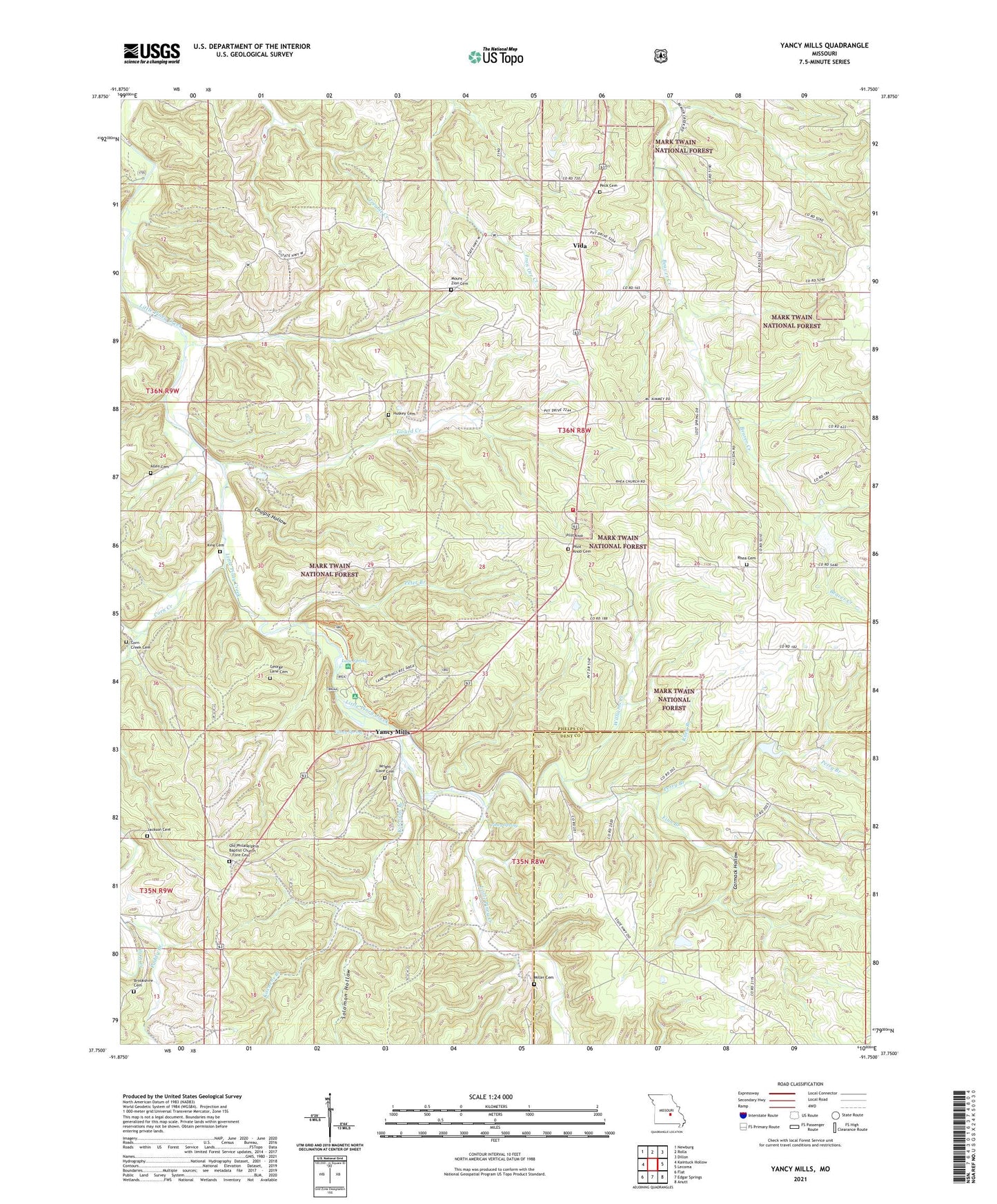
2021 topographic map quadrangle Yancy Mills in the state of Missouri. Scale: 1:24000. Based on the newly updated USGS 7.5' US Topo map series, this map is in the following counties: Phelps, Dent. The map contains contour data, water features, and other items you are used to seeing on USGS maps, but also has updated roads and other features. This is the next generation of topographic maps. Printed on high-quality waterproof paper with UV fade-resistant inks.
Quads adjacent to this one:
West: Kaintuck Hollow
Northwest: Newburg
North: Rolla
Northeast: Dillon
East: Lecoma
Southeast: Anutt
South: Edgar Springs
Southwest: Flat
This map covers the same area as the classic USGS quad with code o37091g7.
Contains the following named places: Allen Cemetery, Allison and Haas Lake Dam, Ben Fore School, Blossom Rock Trail, Brookshire Cemetery, Carmack Hollow, Cedar Bluff Trail, Church of God, Coalpit Hollow, Corn Creek, Corn Creek Cemetery, Cross School, Finn Branch, George Lane Cemetery, Gourd Creek, Grayson School, Green Bush School, Hines Branch, Huskey Cemetery, Jackson Cemetery, King Cemetery, Kitchens Branch, Lane Spring, Lane Spring Campground, Miller Cemetery, Moselle Mine, Mount Zion Baptist Church, Mount Zion Cemetery, Old Philadelphia Baptist Church / Fore Cemetery, Paddy Branch, Peck Cemetery, Perry Branch, Peter Branch, Philadelphia Church, Pilot Knob, Pilot Knob Cemetery, Pilot Knob Church, Pilot Knob Lookout Tower, Piney Spring, Rhea Cemetery, Rhea Church, Rhea School, Riley Branch, Rolla Rural Fire Protection Association South, Silver Fox Farm, Solomon Hollow, Teeters Lake Dam, Vida, Williams Creek, Wright Slave Cemetery, Yancy Mills, Yancy Mills Post Office, Yancy School, Yancy Spring