MyTopo
Flatwoods Missouri US Topo Map
Couldn't load pickup availability
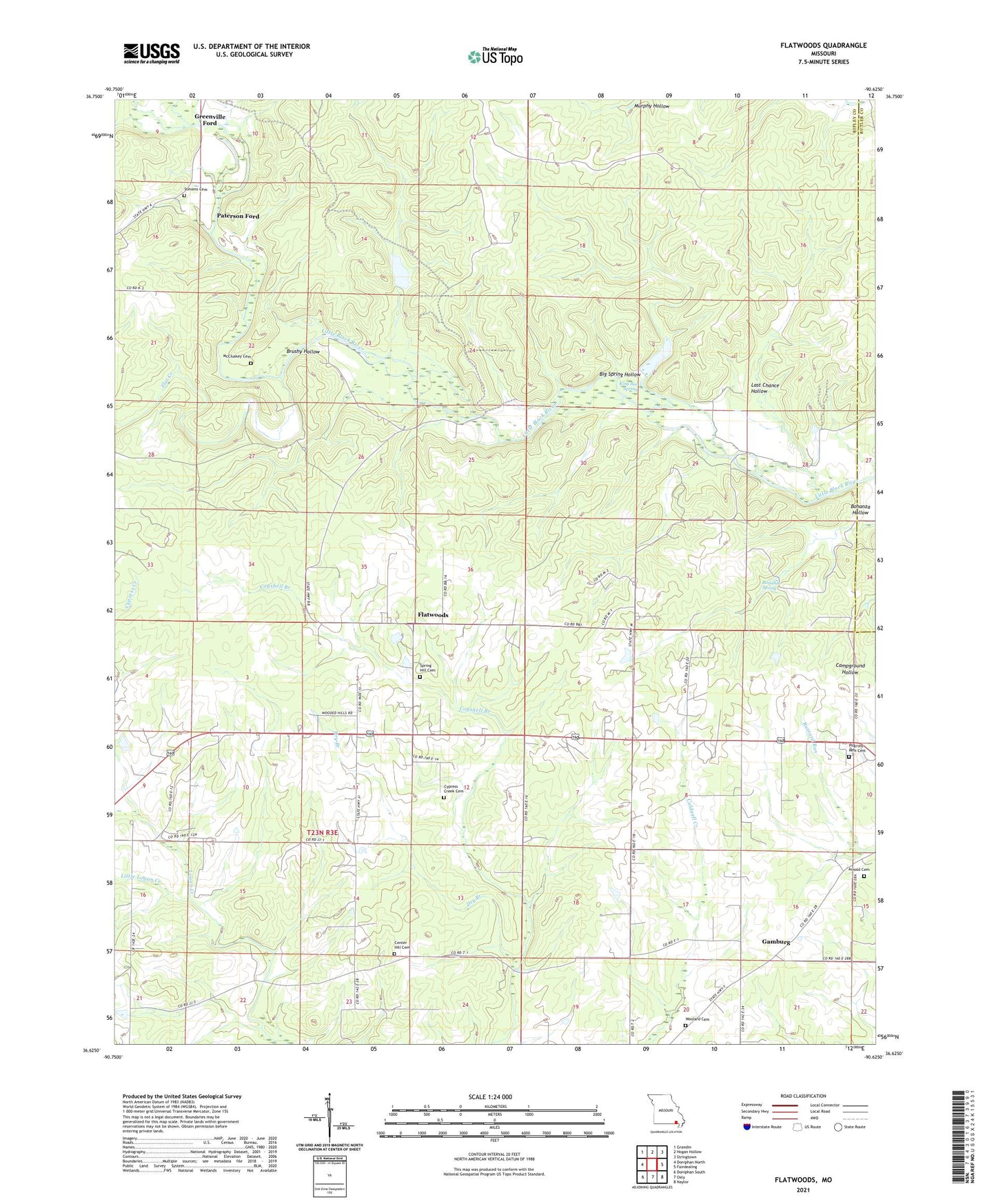
2021 topographic map quadrangle Flatwoods in the state of Missouri. Scale: 1:24000. Based on the newly updated USGS 7.5' US Topo map series, this map is in the following counties: Ripley, Butler. The map contains contour data, water features, and other items you are used to seeing on USGS maps, but also has updated roads and other features. This is the next generation of topographic maps. Printed on high-quality waterproof paper with UV fade-resistant inks.
Quads adjacent to this one:
West: Doniphan North
Northwest: Grandin
North: Hogan Hollow
Northeast: Stringtown
East: Fairdealing
Southeast: Naylor
South: Oxly
Southwest: Doniphan South
Contains the following named places: Arnold Cemetery, Big Spring Hollow, Bonanza Hollow, Bonanza Spring, Brushy Hollow, Center Hill Cemetery, Center Hill Church, Cogshell Branch, Cypress Creek Cemetery, Cypress Creek School, Dry Branch, Dryden, Dryden Post Office, Ernest Post Office, Flat Creek, Flatwoods, Flatwoods School, Gamburg, Green School, Greenville Ford, Greenville Ford Public Access, King Bee Spring, Kingbee, Last Chance Hollow, Little Bethel Church, Little Logan Creek, Logan Creek Fire Protection Association, Logan Creek School, McCluskey Cemetery, North Prong Little Black River, Ormsby School, Paterson Ford, Pennington Ford, Pennington Mill, Pine Bluff School, Rock Hill School, Slayton Ford, Slayton School, South Prong Little Black River, Spring Hill Cemetery, Spring Hill Church, Stevens Cemetery, Sycamore Hole, Township of Flatwoods, Township of Johnson, Township of Washington, Waldemer Flying W Ranch Airport, Woolard Cemetery, ZIP Code: 63939