MyTopo
Versailles Missouri US Topo Map
Couldn't load pickup availability
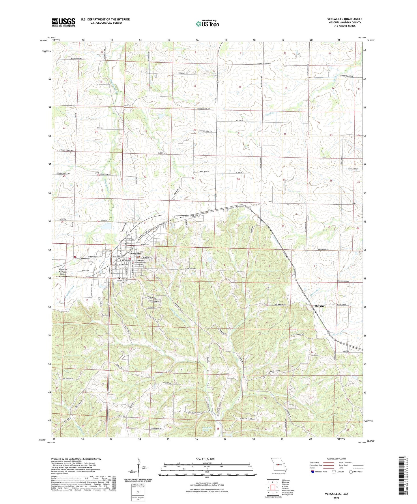
2021 topographic map quadrangle Versailles in the state of Missouri. Scale: 1:24000. Based on the newly updated USGS 7.5' US Topo map series, this map is in the following counties: Morgan. The map contains contour data, water features, and other items you are used to seeing on USGS maps, but also has updated roads and other features. This is the next generation of topographic maps. Printed on high-quality waterproof paper with UV fade-resistant inks.
Quads adjacent to this one:
West: Stover
Northwest: Florence
North: Fortuna
Northeast: Latham
East: Barnett
Southeast: Rocky Mount
South: Gravois Mills
Southwest: Proctor Creek
This map covers the same area as the classic USGS quad with code o38092d7.
Contains the following named places: Ball School, Calcina, City of Versailles, Freedom Church, Gravois Camp, James Mill Spring, Marvin, Morgan County Sheriff's Office, Mount Zion Church, Oak Grove Church, Oak Grove School, Prairie Dale School, Prairie Valley School, Rolling Hills Country Club, Roy Otten Memorial Airfield, Sunny Side School, Township of Moreau, Versailles, Versailles City Cemetery, Versailles City Fire Department, Versailles Municipal Airport, Versailles Post Office, Versailles Rural Fire Protection District, Walnut Grove School, West Union Church, ZIP Code: 65084