MyTopo
Gentryville Missouri US Topo Map
Couldn't load pickup availability
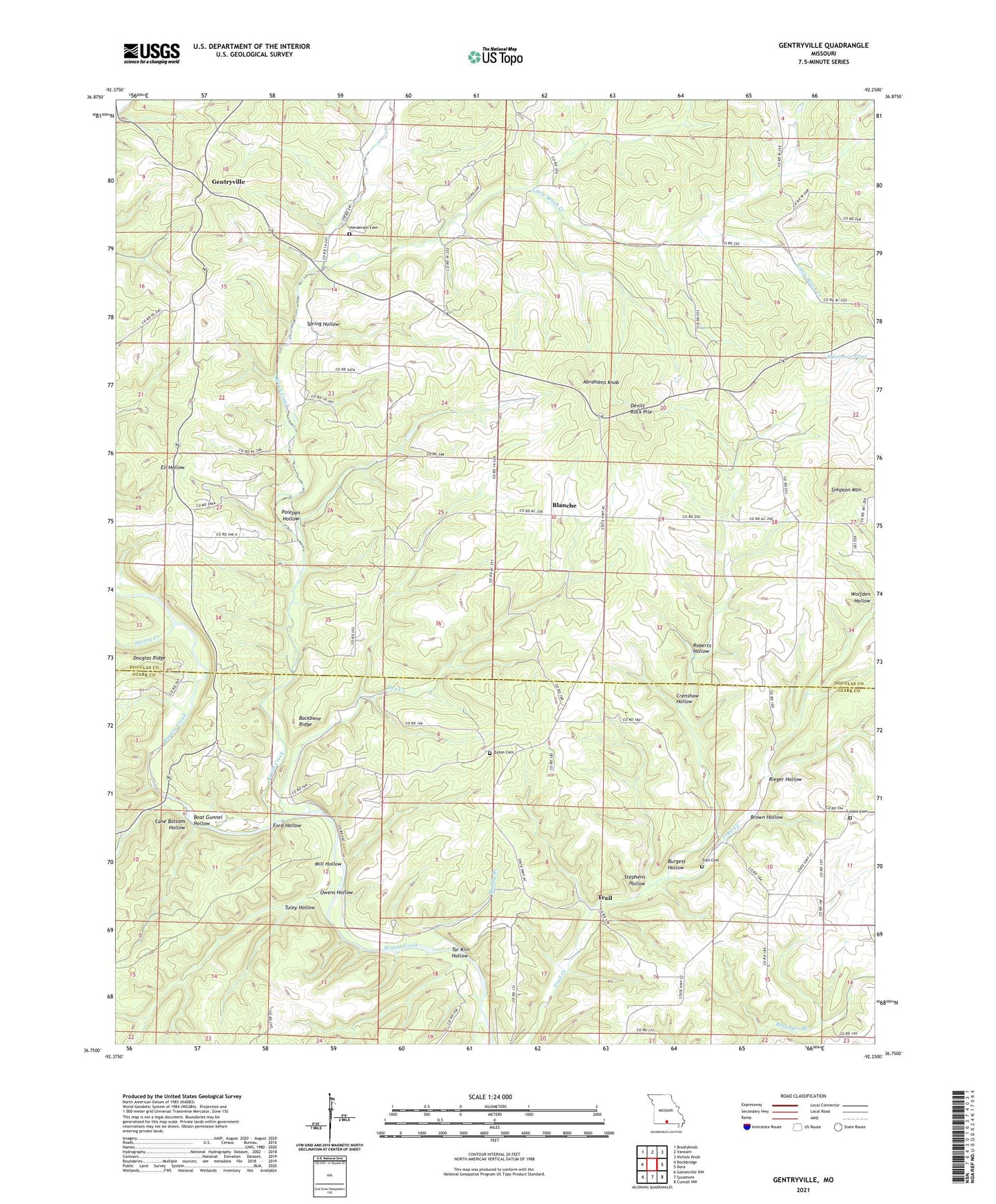
2021 topographic map quadrangle Gentryville in the state of Missouri. Scale: 1:24000. Based on the newly updated USGS 7.5' US Topo map series, this map is in the following counties: Douglas, Ozark. The map contains contour data, water features, and other items you are used to seeing on USGS maps, but also has updated roads and other features. This is the next generation of topographic maps. Printed on high-quality waterproof paper with UV fade-resistant inks.
Quads adjacent to this one:
West: Rockbridge
Northwest: Brushyknob
North: Vanzant
Northeast: Nichols Knob
East: Dora
Southeast: Cureall NW
South: Sycamore
Southwest: Gainesville NW
This map covers the same area as the classic USGS quad with code o36092g3.
Contains the following named places: Abrahams Knob, Backbone Ridge, Blackjack Church, Blackjack School, Blanche, Boat Gunnel Hollow, Brown Hollow, Brush Creek, Burgess Hollow, Cane Bottom Hollow, Cedar Tree School, Crenshaw Hollow, Devils Rock Pile, Douglas Ridge, Dry Creek, Eaton Cemetery, Ford Hollow, Gentryville, Hale Cemetery, Henderson Cemetery, Hickory Flat School, Little Brush Creek, Mill Hollow, Muddy Branch, Owens Hollow, Polepan Hollow, Polepen School, Rieger Hollow, Roberts Hollow, Saint Johns Church, Sedan, Silver Shade School, Simpson Mountain, Spring Creek, Spring Hollow, Stephens Hollow, Sycamore Pond, Tar Kiln Hollow, Township of Brush Creek, Township of Jackson, Trail, Trail Cemetery, Trail Church, Tuley Hollow, Upper Brixey School, Whiteoak Grove School, Wolfden Hollow, ZIP Code: 65638