MyTopo
Bassville Missouri US Topo Map
Couldn't load pickup availability
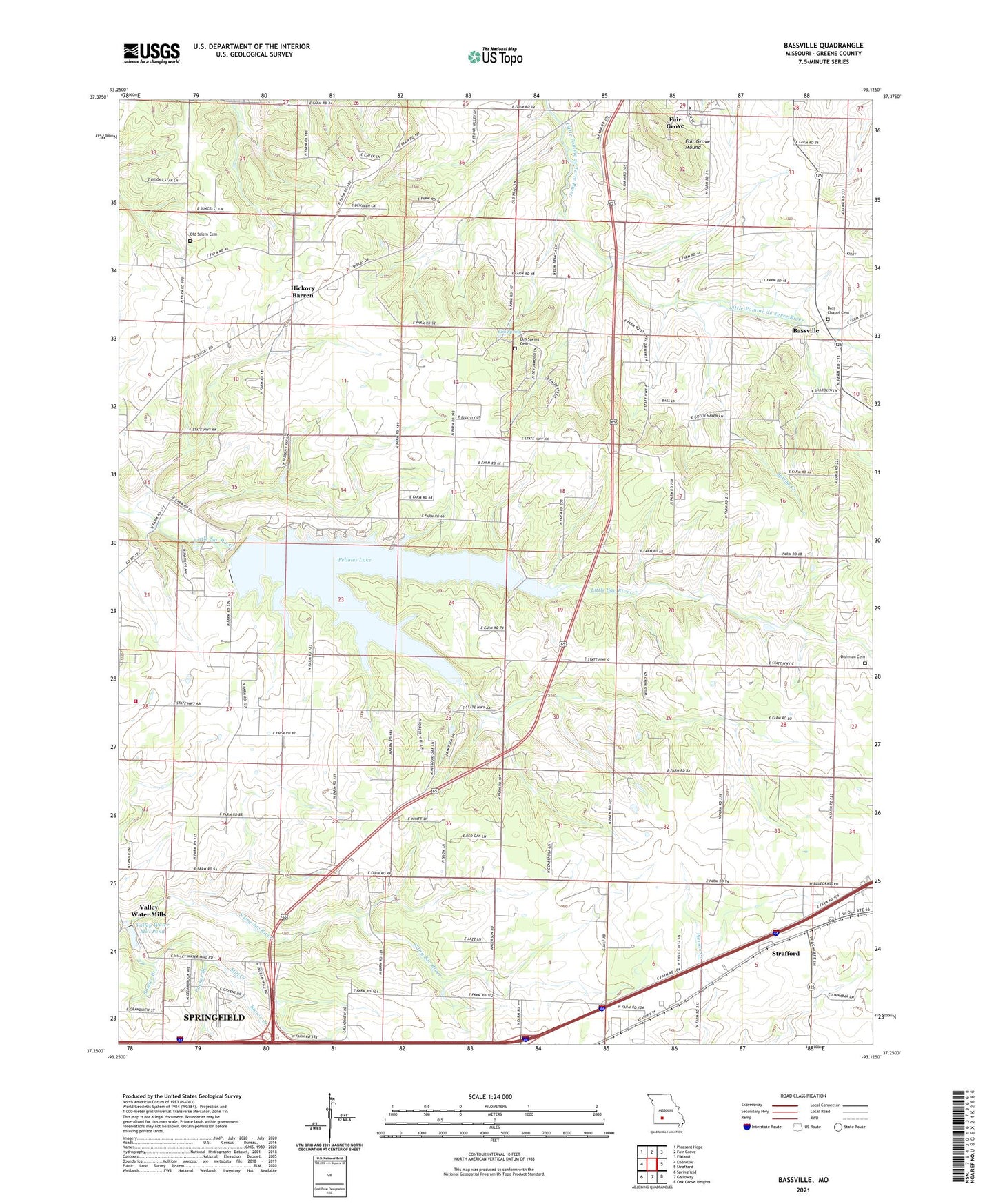
2021 topographic map quadrangle Bassville in the state of Missouri. Scale: 1:24000. Based on the newly updated USGS 7.5' US Topo map series, this map is in the following counties: Greene. The map contains contour data, water features, and other items you are used to seeing on USGS maps, but also has updated roads and other features. This is the next generation of topographic maps. Printed on high-quality waterproof paper with UV fade-resistant inks.
Quads adjacent to this one:
West: Ebenezer
Northwest: Pleasant Hope
North: Fair Grove
Northeast: Elkland
East: Strafford
Southeast: Oak Grove Heights
South: Galloway
Southwest: Springfield
This map covers the same area as the classic USGS quad with code o37093c2.
Contains the following named places: Bassville, Brown Branch, D and R Pipeline Construction Company Lake Dam, Dishman Cemetery, Elm Spring, Elm Spring Cemetery, Elm Spring Church, Fair Grove Mound, Fellows Lake, Fellows Lake Dam, Grandview Branch, Headlee Woods, Hickory Barren, Hickory Barren School, Ingram School, Liberty Church, Liberty School, Mill Creek, Mount Comfort Church, Nogo, Packer Branch, Peace Chapel, Pleasant Home Church, Pleasant View Fire Protection District, Pleasant View School, Potter Church, Salem Cemetery, Sander Branch, Spring Creek, Township of Franklin Number 1, Township of Jackson Number 1, Valley Water Mill Pond, Valley Water Mills, Valley Water Mills Dam, Whitlock School