MyTopo
Harwood Missouri US Topo Map
Couldn't load pickup availability
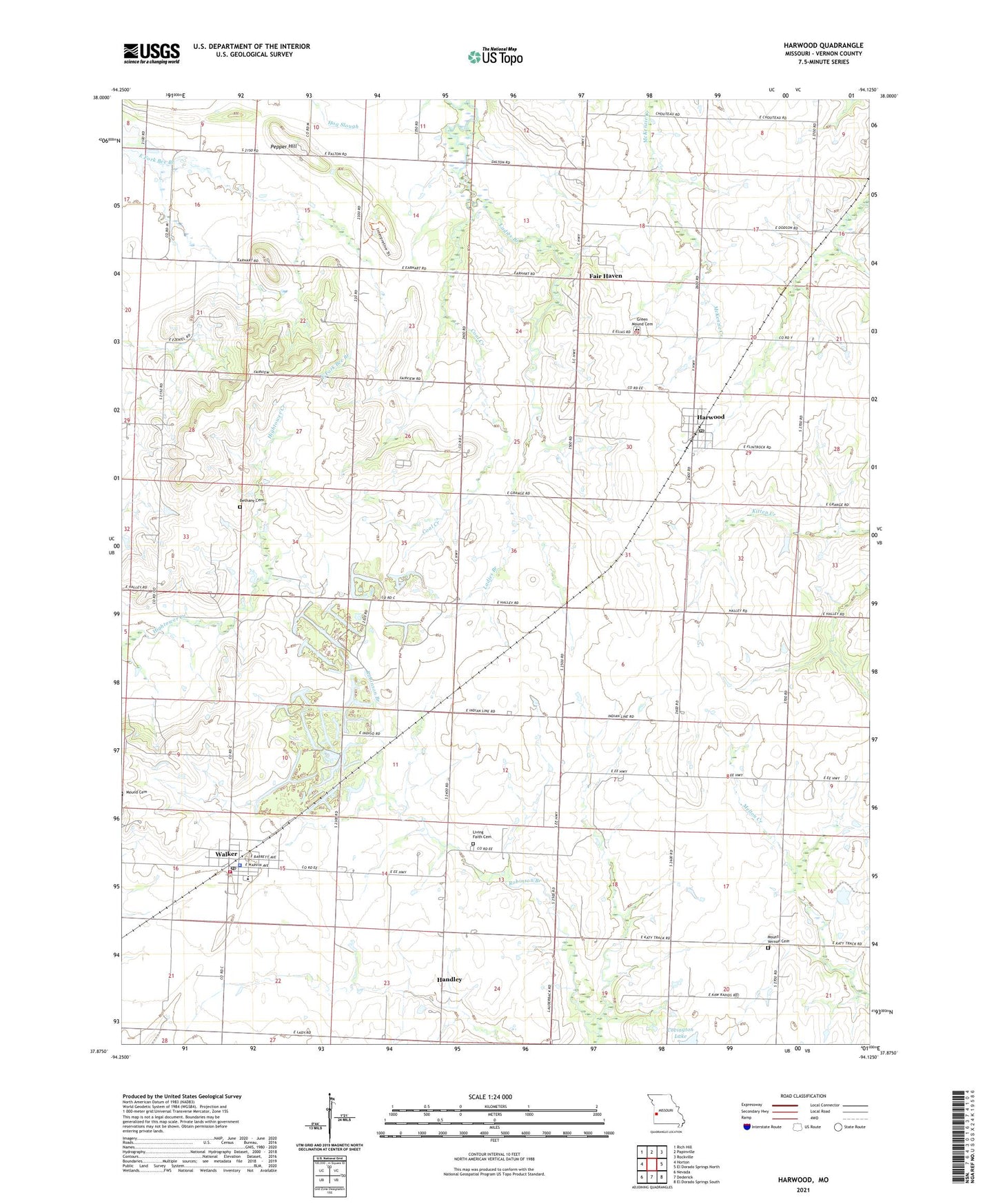
2021 topographic map quadrangle Harwood in the state of Missouri. Scale: 1:24000. Based on the newly updated USGS 7.5' US Topo map series, this map is in the following counties: Vernon. The map contains contour data, water features, and other items you are used to seeing on USGS maps, but also has updated roads and other features. This is the next generation of topographic maps. Printed on high-quality waterproof paper with UV fade-resistant inks.
Quads adjacent to this one:
West: Horton
Northwest: Rich Hill
North: Papinville
Northeast: Rockville
East: El Dorado Springs North
Southeast: El Dorado Springs South
South: Dederick
Southwest: Nevada
Contains the following named places: Bethany Cemetery, Blue Mound School, City of Walker, Coal Creek, Coal Creek School, Covington Dam, Covington Lake, Fair Haven, Fair Haven City Park, Fair Haven School, Green Mound Cemetery, Handley, Harwood, Harwood Post Office, Harwood School, Howard School, Living Faith Cemetery, Living Faith Church, Living Faith Mennonite School, Lowe School, Moss School, Mount Vernon Cemetery, Mount Vernon Church, Northeast Vernon County R-1 High School, Pepper Hill, Robinson School, Township of Blue Mound, Township of Walker, Village of Harwood, Walker, Walker Police Department, Walker Post Office, Walker Rural Fire Department, ZIP Code: 64790