MyTopo
Horton Missouri US Topo Map
Couldn't load pickup availability
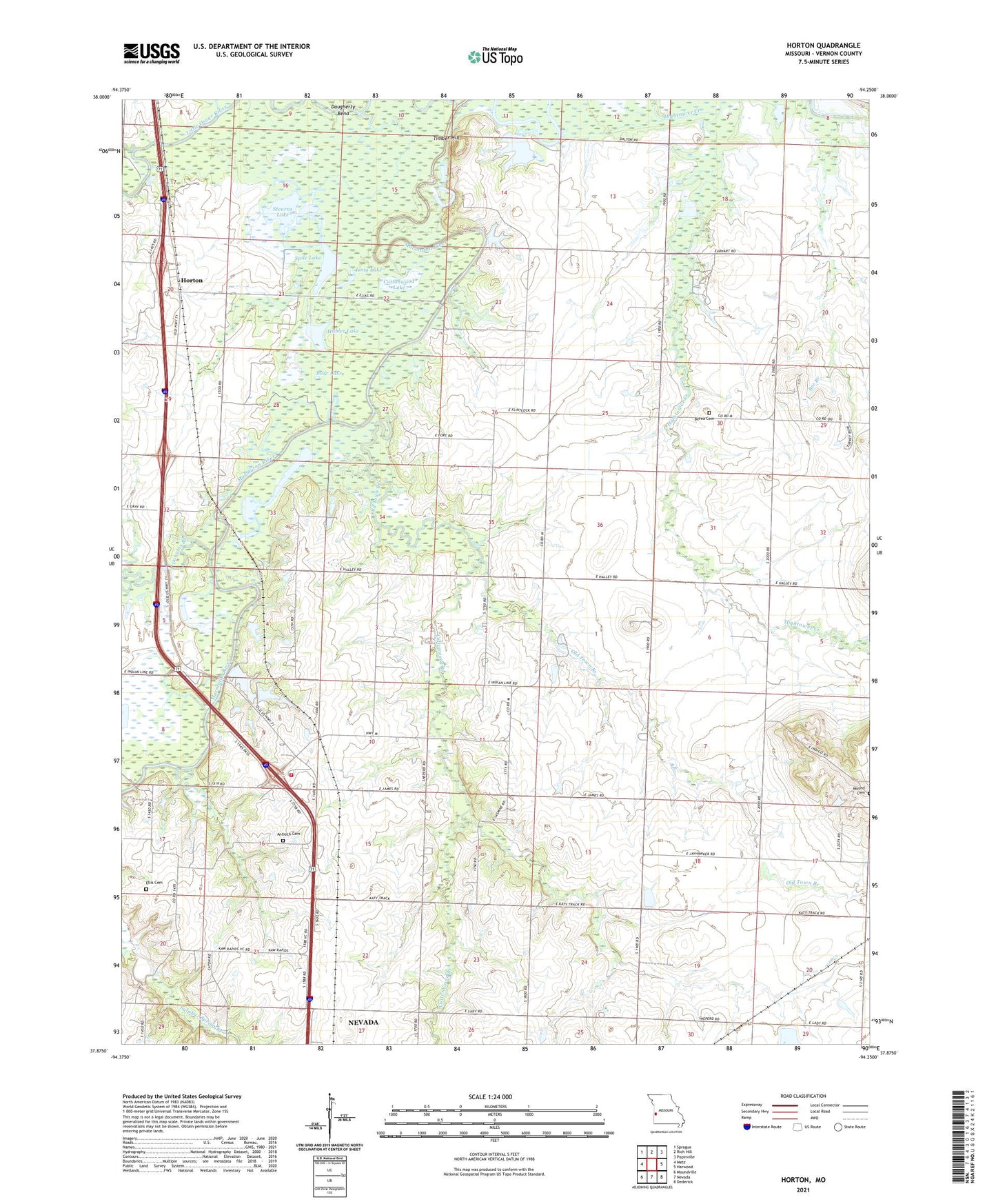
2021 topographic map quadrangle Horton in the state of Missouri. Scale: 1:24000. Based on the newly updated USGS 7.5' US Topo map series, this map is in the following counties: Vernon. The map contains contour data, water features, and other items you are used to seeing on USGS maps, but also has updated roads and other features. This is the next generation of topographic maps. Printed on high-quality waterproof paper with UV fade-resistant inks.
Quads adjacent to this one:
West: Metz
Northwest: Sprague
North: Rich Hill
Northeast: Papinville
East: Harwood
Southeast: Dederick
South: Nevada
Southwest: Moundville
This map covers the same area as the classic USGS quad with code o37094h3.
Contains the following named places: Antioch Cemetery, Antioch Church, Berea Cemetery, Berea Church, Burr Lake, Cephas Ford Public Access, Compton Junction, Compton Junction Fire Department, Cottonwood Branch, Cottonwood Lake, Douglas Branch, East Fork Bee Branch, East Washington School, Elks Lake, Ellis Cemetery, Green Valley School, Horseshoe Lake, Horton, Horton School, Hubler Lake, Humble School, Irrigation Lake, Ketterman, Lone Star School, Long Lake, Long Lower Lake Dam, Long Upper Lake Dam, Marmaton River, Marshall Cummins Pond, McDowell Lake, Mound Cemetery, New Pence Lake, Old Pence Lake, Old Town Branch, Spile Lake, Stearns Lake, Timber Hill, Timber Hill Church, Timber Hill River Bend Incorporated Dam, Timber Hill School, Township of Osage, Township of Washington, Wales Siding, West Point School