MyTopo
Nevada Missouri US Topo Map
Couldn't load pickup availability
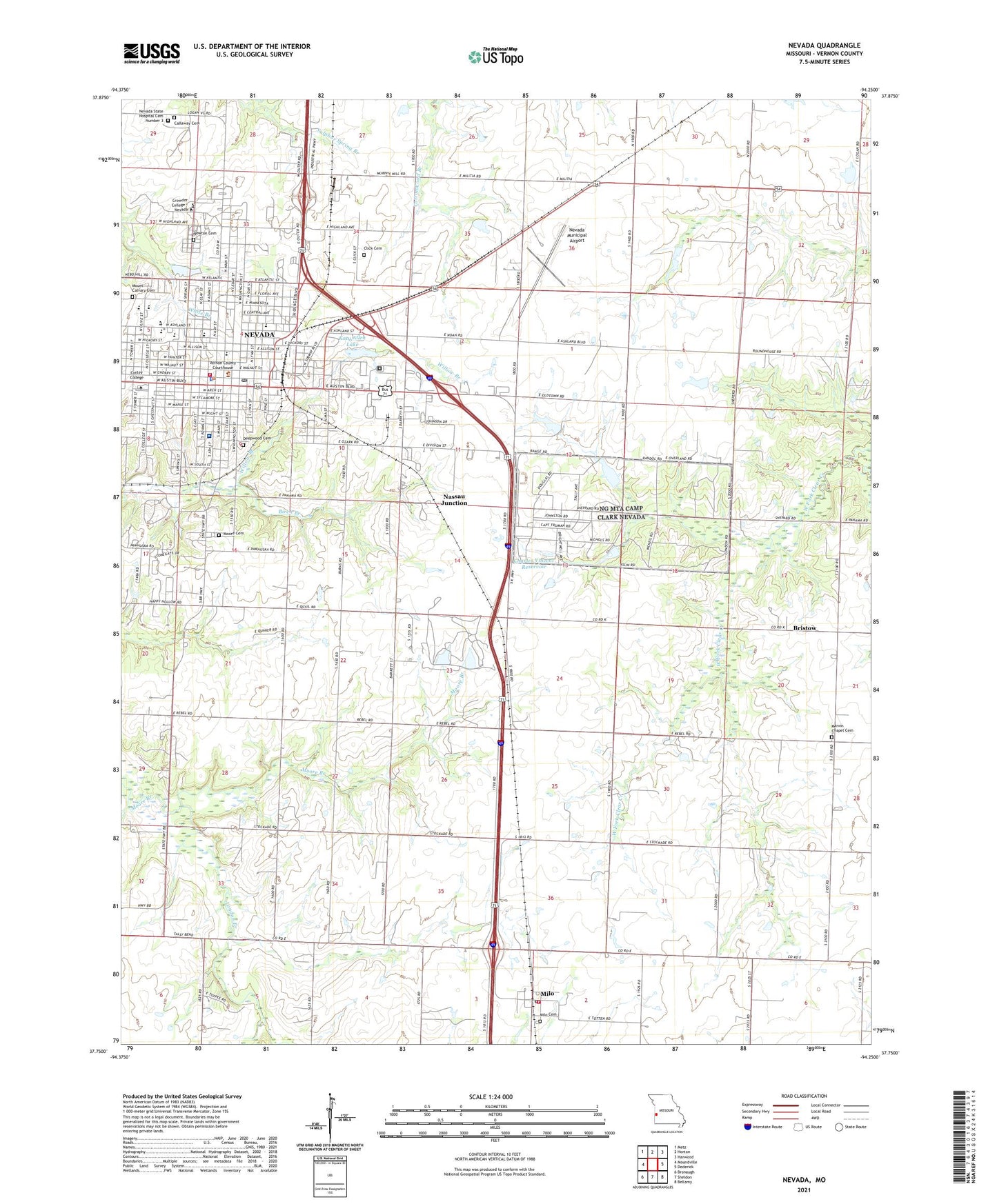
2021 topographic map quadrangle Nevada in the state of Missouri. Scale: 1:24000. Based on the newly updated USGS 7.5' US Topo map series, this map is in the following counties: Vernon. The map contains contour data, water features, and other items you are used to seeing on USGS maps, but also has updated roads and other features. This is the next generation of topographic maps. Printed on high-quality waterproof paper with UV fade-resistant inks.
Quads adjacent to this one:
West: Moundville
Northwest: Metz
North: Horton
Northeast: Harwood
East: Dederick
Southeast: Bellamy
South: Sheldon
Southwest: Bronaugh
This map covers the same area as the classic USGS quad with code o37094g3.
Contains the following named places: Benton Elementary School, Bethel Chapel, Bethel School, Board School, Bristow, Bryan Elementary School, Callaway Cemetery, Camp Clark, Camp Clark Army Heliport, Centennial Park, Charles Vincent Dam, Charles Vincent Reservoir, City of Nevada, Click Cemetery, Cottey College, Countryside Assembly of God Church, Deepwood Cemetery, Fern School, First Baptist Church, First Christian Church, Franklin School, George Lyons Park, Heritage Baptist Church, Highway School, Izaak Walton Lake, Izaak Walton Lake Dam, John L Cunningham Dam, John L Cunningham Reservoir, Katy Allen Lake, Katy Allen Lake Dam, KNEM-AM (Nevada), Landon Branch, Mapledale School, Marmaduke Park, Marquardt Dam, Marquardt Lake, Marvin Chapel, Marvin Chapel Cemetery, Milo, Milo Cemetery, Milo Post Office, Milo Rural Fire Department, Milo School, Moore Cemetery, Mount Calvary Cemetery, Nassau Junction, Nevada, Nevada Country Club, Nevada Fire Department, Nevada High School, Nevada Middle School, Nevada Municipal Airport, Nevada Police Department, Nevada Post Office, Nevada Regional Medical Center, Nevada Regional Technical Center, Nevada State Hospital Cemetery Number 3, Newton Cemetery, Oakdale School, Postlethwaite Park, Prairie Valley School, Radio Springs Park, Radio Springs Park Dam, Spring Street Park, Stanton School, Township of Center, Truman Elementary School, Twin Lakes Park, Union School, United Methodist Church, Vernon County, Vernon County Jail, Village of Milo, Walton Park, West Fairview Church, Willow Branch, Wilson Lake Dam, Woods School, ZIP Code: 64772