MyTopo
Samburg Tennessee US Topo Map
Couldn't load pickup availability
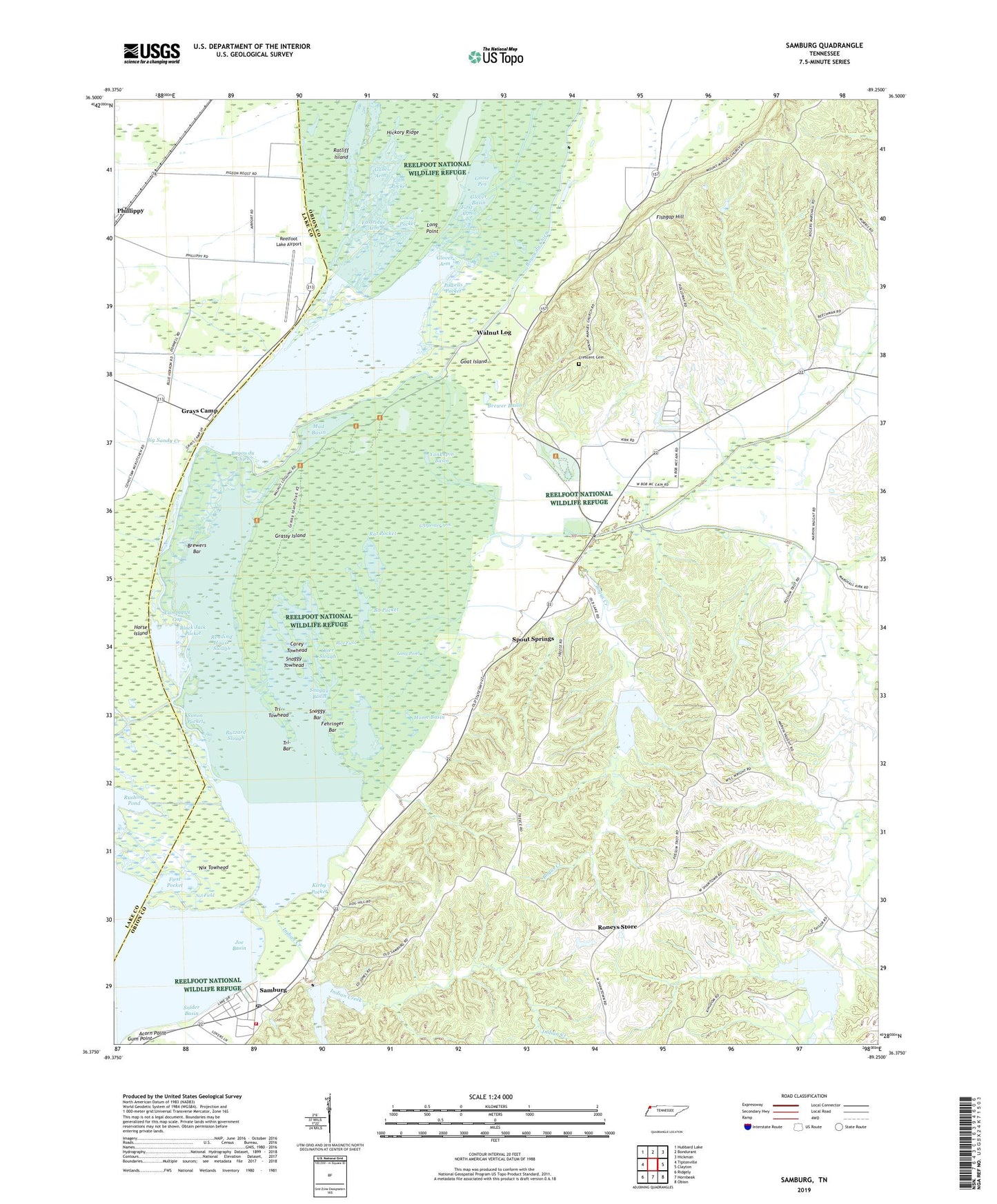
2022 topographic map quadrangle Samburg in the state of Tennessee. Scale: 1:24000. Based on the newly updated USGS 7.5' US Topo map series, this map is in the following counties: Obion, Lake. The map contains contour data, water features, and other items you are used to seeing on USGS maps, but also has updated roads and other features. This is the next generation of topographic maps. Printed on high-quality waterproof paper with UV fade-resistant inks.
Quads adjacent to this one:
West: Tiptonville
Northwest: Hubbard Lake
North: Bondurant
Northeast: Hickman
East: Clayton
Southeast: Obion
South: Hornbeak
Southwest: Ridgely
This map covers the same area as the classic USGS quad with code o36089d3.
Contains the following named places: Acorn Point, Bayou du Chien, Big Sandy Creek, Black Jack Pocket, Black Slough, Bo Pocket, Bogus Creek, Brewer Basin, Brewers Bar, Bryants Camp, Buck Basin, Burnt Woods, Buzzard Slough, Campbells Gap, Carey Basin, Carey Towhead, CArpenter Arm, Chigger Ridge School, Crescent Cemetery, Crescent School, Devils Race Track, Eastridge Arm, Eastridge Arm Ditch, Fehringer Bar, First Arm, First Pocket, Fishgap Hill, Glory Hole, Glover Arm, Glover Basin, Goat Island, Goose Pen, Goose Pocket, Grassy Island, Grays Camp, Gum Arm, Gum Arm Ditch, Gum Pocket, Gum Point, Hickman Gun Club, Hickman Hunting Club, Hickory Ridge, Home Basin, Horse Island, Horse Island Ditch, Indian Creek, Joe Basin, Jones School, Kilham Creek, Kirby Pocket, Kirby Pocket Day Use Area, Liberty Church, Little Starve Island, Long Arm Ditch, Long Point, Long Pond, Midway Church, Millers Boat Dock, Mount Manuel Church, Mount Zion Church, Mud Basin, Nations Ditch, Nix Field, Nix Towhead, North Reelfoot Creek, Opossum Branch, Otter Slough, Owens School, Possum Trot Church, Powells Pocket, Rag Point Ditch, Rat Pocket, Ratliff Island, Reelfoot Creek, Reelfoot Lake Airport, Reelfoot Lake Biological Station, Reelfoot National Wildlife Refuge, Rice Field, Rodgers School, Rogers Creek, Roneys Store, Rushing Pond, Samburg, Samburg - Reelfoot Volunteer Fire Department, Samburg Ditch, Samburg Post Office, Simon Pocket, Snaggy Bar, Snaggy Basin, Snaggy Opening, Snaggy Towhead, Snider Basin, South Fork Indian Creek, South Reelfoot Creek, Spout Springs, Star of Bethlehem Church, Straders Boat Dock, Sugar Creek, Town of Samburg, Tri-Bar, Tri-Towhead, Upper Blue Basin, Walnut Log, Walnut Log Baptist Church, Walnut Log Ditch, Yankapin Basin