MyTopo
Wachita Mountain Missouri US Topo Map
Couldn't load pickup availability
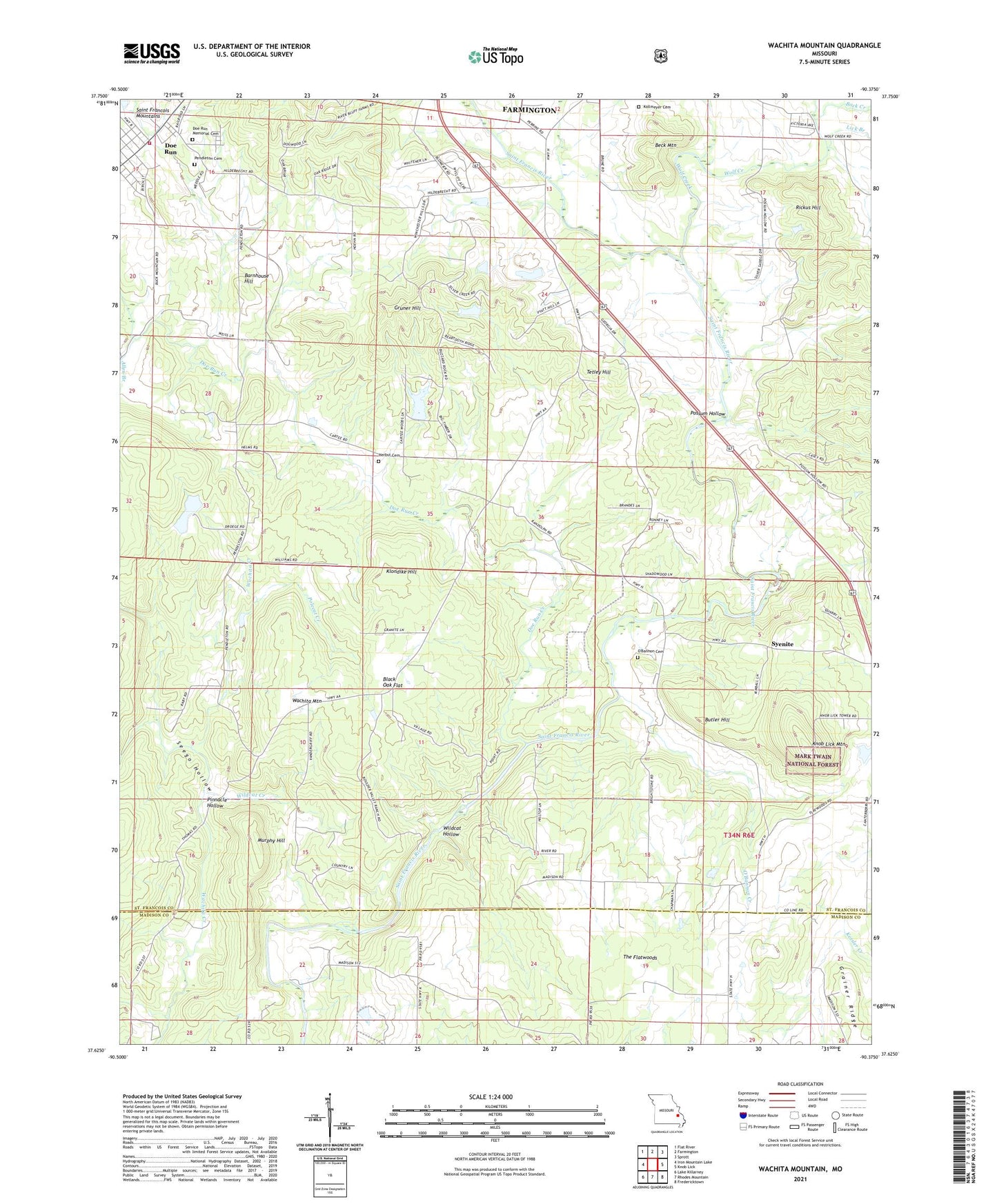
2021 topographic map quadrangle Wachita Mountain in the state of Missouri. Scale: 1:24000. Based on the newly updated USGS 7.5' US Topo map series, this map is in the following counties: St. Francois, Madison. The map contains contour data, water features, and other items you are used to seeing on USGS maps, but also has updated roads and other features. This is the next generation of topographic maps. Printed on high-quality waterproof paper with UV fade-resistant inks.
Quads adjacent to this one:
West: Iron Mountain Lake
Northwest: Flat River
North: Farmington
Northeast: Sprott
East: Knob Lick
Southeast: Fredericktown
South: Rhodes Mountain
Southwest: Lake Killarney
This map covers the same area as the classic USGS quad with code o37090f4.
Contains the following named places: Alexander and Burks Granite Quarry, Allen Branch, Asplof Granite Quarry, Back Creek, Barnhouse Hill, Beck Mountain, Black Oak Flat, Brewer Creek School, Brewers Creek, Brightstone Community Church, Brightstone School, Butler Hill, Cartee School, Doe Run, Doe Run Census Designated Place, Doe Run Creek, Doe Run Fire Protection District, Doe Run Memorial Cemetery, Fredericktown Ranger District, Gruner Hill, Hamilton Town, Herbst Cemetery, Hildebright School, Hill-O'Mera Construction Company Granite Quarry, Klondike Hill, Knob Lick Lookout, Knob Lick Mountain, Kollmeyer Cemetery, Lick Branch, Limel Lake, Masda School, Milne and Gordon Granite Quarry, Missouri Granite Construction Company Quarry, Mononame 662 Dam, Mononame 826 Dam, Murphy Hill, O'Bannon Cemetery, O'Bannon Creek, Pendleton Church, Pinnacle Hollow, Polecat Creek, Possum Hollow, Possum Hollow School, Rickus Hill, Seego Hollow, Shannon Dam, Syenite, Tetley Hill, The Flatwoods, Township of Pendleton, Wachita Church, Wachita Mountain, Wildcat Creek, Wildcat Hollow, Wolf Creek, Zeran Gregory Granite Company Quarry