MyTopo
Helena Missouri US Topo Map
Couldn't load pickup availability
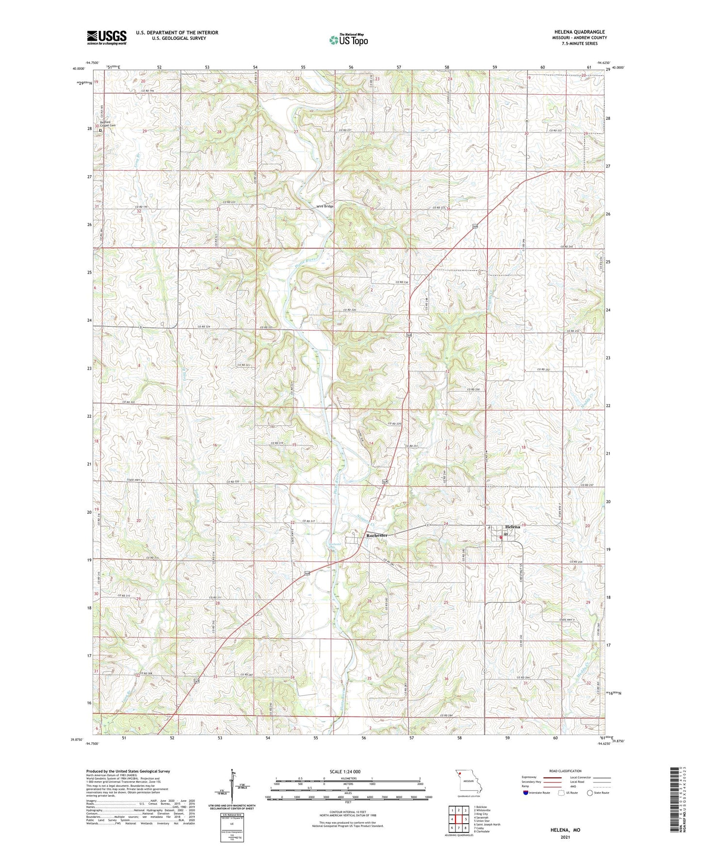
2021 topographic map quadrangle Helena in the state of Missouri. Scale: 1:24000. Based on the newly updated USGS 7.5' US Topo map series, this map is in the following counties: Andrew. The map contains contour data, water features, and other items you are used to seeing on USGS maps, but also has updated roads and other features. This is the next generation of topographic maps. Printed on high-quality waterproof paper with UV fade-resistant inks.
Quads adjacent to this one:
West: Savannah
Northwest: Bolckow
North: Whitesville
Northeast: King City
East: Union Star
Southeast: Clarksdale
South: Cosby
Southwest: Saint Joseph North
This map covers the same area as the classic USGS quad with code o39094h6.
Contains the following named places: Bedford Chapel, Bedford Chapel Cemetery, Black Oak School, Cherry Grove School, Chestnut Grove School, Clanton School, Cosby - Helena Fire District, Dale School, Elm Grove School, Fountain Blue School, Fountainbleau, Helena, Helena Elementary School, Helena Post Office, Liberty School, Lillabridge Lake, Long Branch Church, Middle Lake, New Hope School, Niagara Creek, Platte Chapel, Pleasant Prairie School, Rochester, Rochester Falls, Rochester School, Taylor Lake, Township of Rochester, Van Meter Bridge, Wire Bridge, ZIP Code: 64459