MyTopo
La Grange Missouri US Topo Map
Couldn't load pickup availability
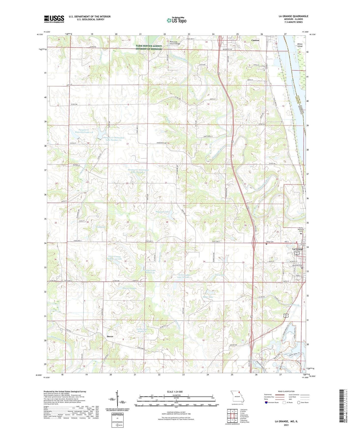
2021 topographic map quadrangle La Grange in the state of Missouri. Scale: 1:24000. Based on the newly updated USGS 7.5' US Topo map series, this map is in the following counties: Lewis, Adams. The map contains contour data, water features, and other items you are used to seeing on USGS maps, but also has updated roads and other features. This is the next generation of topographic maps. Printed on high-quality waterproof paper with UV fade-resistant inks.
Quads adjacent to this one:
West: Monticello
Northwest: Benjamin
North: Canton
Northeast: Lima
East: Long Island
Southeast: Quincy West
South: Maywood
Southwest: Durham
This map covers the same area as the classic USGS quad with code o40091a5.
Contains the following named places: Bozarth School, Central School, City of La Grange, Dover, Dover Baptist Church, Dover School, Durgans' Landing, Durgens Creek Watershed Dam Number 1 A, Durgens Creek Watershed Dam Number 24, Durgens Creek Watershed Dam Number 32, Durgens Creek Watershed Dam Number 4, Durgens Creek Watershed Dam Number 5, Durgens Creek Watershed Dam Number 7, Durgens Creek Watershed Lake 1 B, Durgens Creek Watershed Lake 1 B Dam, Durgens Creek Watershed Lake Number 1 A, Durgens Creek Watershed Lake Number 4, Durgens Creek Watershed Number 23 Dam, Durgens Creek Watershed Number 33 Dam, Durgens Creek Watershed Number 34 Dam, Durgens Creek Watershed Number 37 Dam, Garkie Lake Section 32, Garkie Lake Section 8, Gordon Ford, High Hill School, La Grange Fire Department, Lake O'Vaughn, Lewis County Number 33 Lake, Lewis County Number 38 Dam, Lindale School, Linn Branch, Marks Memorial Cemetery, Midway School, Pink Prairie School, Pleasant Ridge School, Porter School, Riverview Cemetery, Salter Cemetery, Scott Shaffer Lake Number 7, Solter Lake, Solter Lake Dam, Sugar Creek, Sunnyside School, Todd Lake, Township of Union, Tracy Lake, Waganer Lake, Wakonda State Park, Weber, Windy Hill Airport, Wyaconda Church, Wyaconda Church Bridge, ZIP Code: 63448